

Arrival at Tribhuwan International Airport. Our Staff member meets you and transfers you to the hotel.
Overnight at the hotel.
Everest Region

Trek Starting Point
Lukla

Trek Ending Point
Lukla

Departure From
Ramechhap

Transportation
Domestic flight

Style
High-altitude Trekking & Climbing

Meal
Breakfast, Lunch, Dinner

Accommodation
Tea house / Tourist standard hotel in Kathmandu
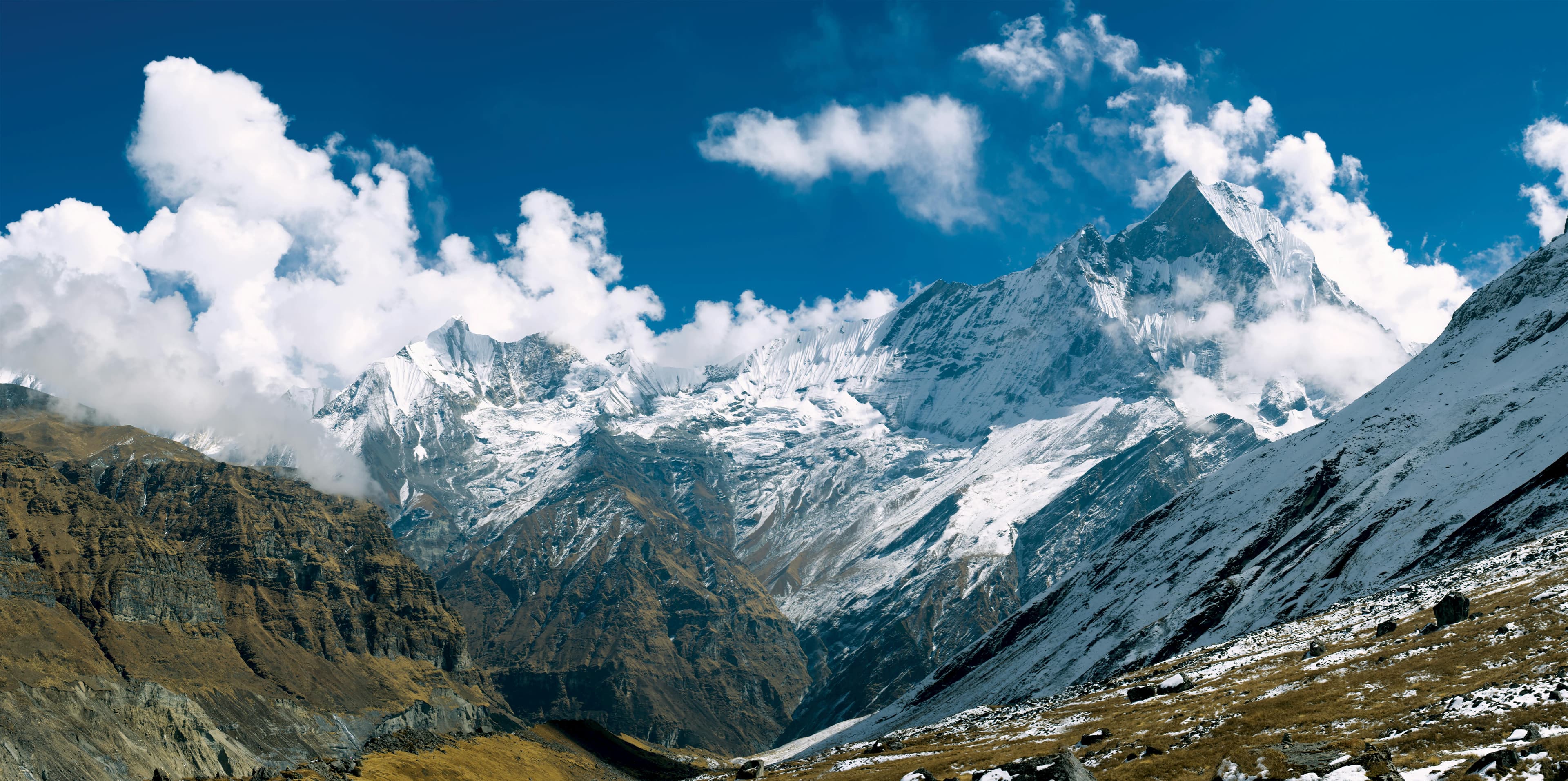
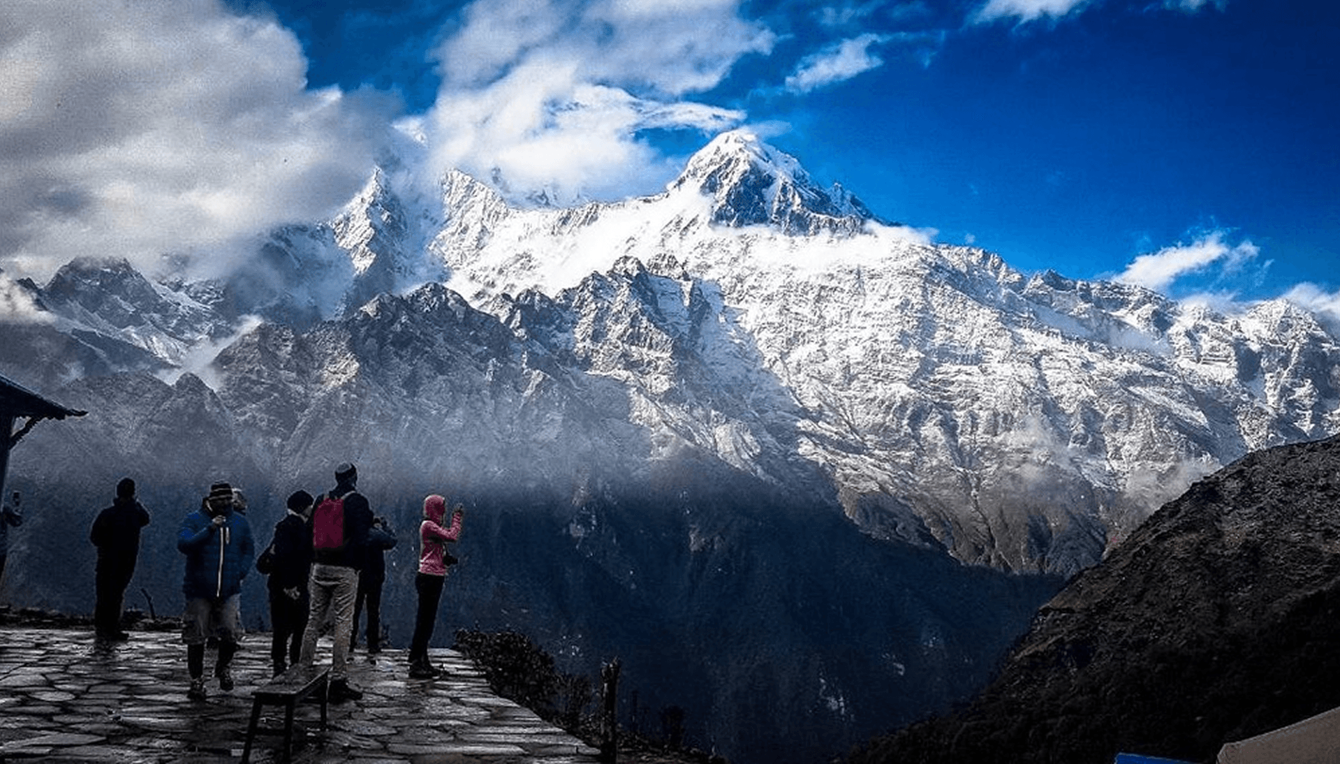
Mt. Abi (6,043 m / 19,826 ft) is a remote Himalayan peak located in Nepal’s Khumbu region, within the wider Everest landscape. Known for its remote alpine setting, glaciated terrain, and impressive position within the Everest region, the peak offers a unique combination of high-altitude trekking and technical Himalayan climbing away from the busier routes of the Khumbu.
The expedition follows a scenic approach through the Khumbu Valley, passing through traditional Sherpa settlements and the renowned Gokyo region while allowing gradual acclimatization before entering the remote alpine terrain surrounding Mt. Abi. The route provides spectacular views of some of the Himalaya’s most iconic peaks while gradually transitioning from trekking landscapes into a high-altitude climbing environment.
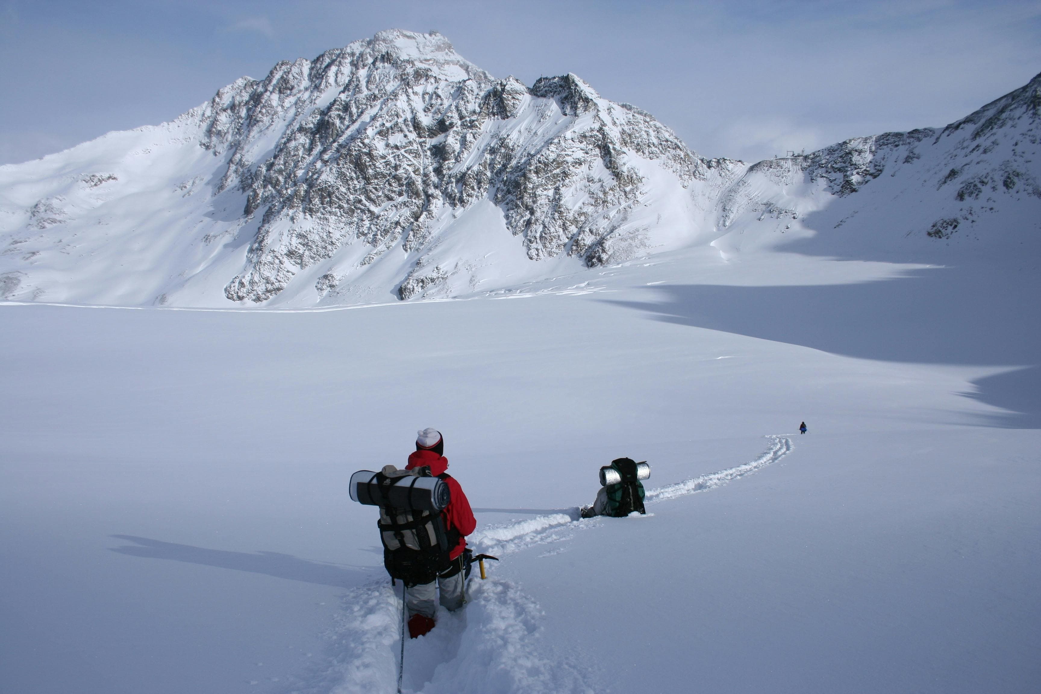
From Base Camp, the expedition progresses into more technical terrain involving glacier travel, snow slopes, and mixed alpine sections leading toward the summit. The climb requires careful preparation, strong physical fitness, previous high-altitude experience, and basic alpine climbing skills. Weather conditions, snow stability, and acclimatization play an important role in determining the success of the summit attempt.
Following the summit, the descent continues through the dramatic Cho La Pass, adding another classic Himalayan crossing to the overall expedition experience. The combination of technical climbing, remote alpine landscapes, and high-altitude trekking makes Mt. Abi a complete Himalayan adventure in the heart of the Khumbu region.
The summit of Mt. Abi rewards climbers with impressive views of Everest, Lhotse, Makalu, Cho Oyu, and the surrounding Himalayan ranges. With its beautiful approach, technical challenge, and unique route through the Khumbu, Mt. Abi is an excellent objective for experienced climbers seeking a less-crowded 6,000-meter Himalayan ascent.
Arrival at Tribhuwan International Airport. Our Staff member meets you and transfers you to the hotel.
Overnight at the hotel.
After breakfast at the hotel, our guide will meet you for a detailed trip briefing covering the itinerary, route conditions, safety procedures, altitude considerations, and important preparations for the journey ahead. For peak climbing expeditions, the climbing guide will also check the required mountaineering equipment and provide guidance on any necessary gear adjustments before departure.
During the briefing, we will complete the required trekking and climbing formalities, including necessary permits and documentation. Afterward, we will explore some of Kathmandu Valley's cultural highlights, including UNESCO World Heritage Sites such as Boudhanath Stupa, one of the largest Buddhist stupas in the world, and Swayambhunath Stupa, also known as the Monkey Temple.
The rest of the day is free for final preparations, including organizing trekking equipment, purchasing any last-minute essentials, and making final arrangements before heading into the Himalaya. Overnight at the hotel.
After an early breakfast, we will fly from Kathmandu (1,400 m / 4,600 ft) to Lukla (2,840 m / 9,317 ft). The short 35-minute flight offers spectacular views of the Himalayas, and landing on the hillside airstrip is an adventure in itself, with mountains towering on all sides and a steep drop at the end of the runway. The crisp mountain air and dramatic landscapes make it clear that we have entered the heart of the Everest region.
From Lukla, we will start our trek along a gentle trail towards Cheplung Village, enjoying the striking views of Mount Khumbila. The path then gradually descends through the Dudh Koshi River valley as we make our way to Phakding (2,610 m / 8,563 ft). Surrounded by lush hills and offering panoramic views of Kusum Kanguru, Phakding is a charming village with comfortable lodges that serve trekkers. The trek from Lukla to Phakding is approximately 8 km (5 miles) and takes around 3–4 hours, providing a relaxed start to acclimatize and soak in the Himalayan scenery. Overnight at a guesthouse in Phakding.
Note: The weather in Lukla is highly unpredictable. Occasionally, flights may be delayed or canceled due to adverse weather conditions. If a flight is canceled, you will need to return to your hotel in Kathmandu. Please note that transportation back to the hotel and accommodation for this night are not included. If the weather clears the next day, you will be accommodated on either the 3rd or 4th flight to Lukla. If conditions remain unfavorable, there is also an option to take a helicopter flight. The cost of a helicopter flight is not fixed and will be quoted by the airline on the same day. You should expect to pay an additional approx. 250 USD for the helicopter transfer from Kathmandu to Lukla. Although such situations are rare, we believe it is important to inform you in advance.
We will start our trek from Phakding (2,610 m / 8,563 ft) and follow the trail along the Dudh Koshi River, passing through traditional Sherpa villages and suspension bridges. The trail gradually ascends through pine and rhododendron forests, offering beautiful views of the surrounding hills and mountains. We will cross several small settlements before reaching Monjo (2,835 m / 9,301 ft), where we may stop for a short break.Continuing uphill, we will climb steeply to Namche Bazaar (3,440 m / 11,286 ft), the main trading hub of the Khumbu region.
The trek covers approximately 10 -12km and takes around 5–7 hours, making it a moderate to challenging day that helps with acclimatization. Along the way, we will enjoy panoramic views of Thamserku and Kongde Ri, and take in the lively atmosphere of Namche Bazaar, surrounded by dramatic Himalayan peaks. Overnight at a guesthouse in Namche Bazaar.
This day is set aside for acclimatization in Namche Bazaar (3,440 m / 11,286 ft), allowing our bodies to adjust to the higher altitude while remaining gently active. Rather than staying idle, we will take a short hike above the village to support acclimatization and enjoy expansive Himalayan views.
A recommended ascent is toward Tengboche Hill (approximately 3,870 m / 12,697 ft), rising above Namche. The climb is gradual but noticeably more demanding due to the altitude, rewarding us with sweeping panoramas of Ama Dablam, Thamserku, and the surrounding Himalayan peaks. After spending time at the viewpoint, we descend back to the village.
The excursion takes around 3 – 4 hours round trip, covering approximately 3 – 4 km (1.8–2.5 miles). The remainder of the day is free for rest, exploration of Namche Bazaar’s shops and monasteries, and preparation for higher elevations. Overnight at a guesthouse in Namche Bazaar.
As we begin the trek from Namche Bazaar to Dole (4,040 m / 13,255 ft), the trail gradually leaves the lively Sherpa hub behind and enters quieter alpine landscapes. The path climbs steadily through pine and rhododendron forests, crossing small streams and yak pastures, with occasional views of Ama Dablam, Thamserku, and Kangtega.
The trail is moderately steep, gaining about 600 m in elevation over the day. Along the way, trekkers cross suspension bridges over the roaring Dudh Koshi River and navigate ridges that provide excellent perspectives of the surrounding valleys. The environment becomes noticeably more tranquil as the number of trekkers diminishes, and the high Himalaya begins to feel closer with each step.
After approximately 5 – 6 hours of trekking, covering around 9 – 10 km (5.5–6.2 miles), we arrive at Dole, a small high-altitude settlement perched beneath dramatic cliffs and alpine slopes. Dole is a key acclimatization stop, offering crisp air, quiet mountain surroundings, and stunning views, preparing trekkers for the next stage toward Machhermo and higher elevations.
Overnight at a teahouse in Dole.
Setting off from Dole, the trail gradually leads us higher into the serene alpine valleys of the Khumbu region. The landscape opens up to sweeping views of Ama Dablam, Thamserku, and Cho Oyu, with the quiet of the high mountains surrounding the path.
The trail climbs steadily, gaining approximately 430 m in elevation over 7 – 8 km, passing scattered teahouses and yak grazing areas. The terrain becomes rockier and more exposed as we approach Machhermo, highlighting the transition into higher Himalayan wilderness.
After approximately 4 – 5 hours of trekking, we arrive at Machhermo (4,470 m / 14,665 ft), a small settlement of lodges nestled beneath dramatic cliffs and glaciers. Machhermo serves as an important acclimatization point before continuing toward Gokyo or higher passes, offering crisp air, quiet surroundings, and breathtaking mountain vistas.
Overnight at a teahouse in Machhermo.
We will begin our trek from Machhermo (4,470 m / 14,665 ft), gradually ascending along glacial valleys toward the renowned Gokyo Lake region. The trail winds past moraine ridges, scattered teahouses, and yak grazing areas, with panoramic views of towering Himalayan peaks, including Cho Oyu, Everest, and Makalu, unfolding along the way.
The trek covers approximately 7 – 8 km (4.3 – 5 miles) with an elevation gain of around 280 m (920 ft), taking roughly 4 – 5 hours. The trail is mostly moderate, becoming slightly rockier closer to Gokyo, while offering increasingly expansive vistas of turquoise glacial lakes and snow-capped mountains.
We arrive at Gokyo (4,750 m / 15,584 ft), a serene settlement beside the largest of the Gokyo lakes. This high-altitude village is ideal for rest, acclimatization, and photography, with the calm waters reflecting the surrounding peaks.
Overnight at a teahouse in Gokyo, enjoying the peaceful alpine setting.
Today we will begin our hike from Gokyo (4,750 m / 15,584 ft), ascending toward Gokyo Ri (5,357 m / 17,572 ft), one of the most spectacular viewpoints in the Khumbu region. The trail climbs steadily along a rocky ridge, passing scattered teahouses and glacial moraines, with the turquoise Gokyo Lakes growing smaller in the valley below. The ascent covers approximately 3–3.5 km (1.9–2.2 miles) with an elevation gain of 607 m (1,988 ft), taking around 3–4 hours.
From the summit of Gokyo Ri, trekkers are rewarded with breathtaking 360° Himalayan panoramas. Looking around, you can see Mount Everest rising majestically above the surrounding peaks, Lhotse just nearby, Makalu and Cho Oyu on the horizon, and the striking pyramid-shaped Ama Dablam, along with numerous other snow-capped ridges and peaks of the Khumbu region.
We will then descend the same trail back to Gokyo, taking about 2–3 hours, making the total round-trip distance approximately 6–7 km (3.7–4.3 miles) and total time around 5–7 hours, depending on pace and time spent at the summit. Overnight at a teahouse in Gokyo, enjoying the calm alpine environment and reflections of the surrounding peaks in the glacial lakes.
Today we will begin our trek from Gokyo toward Mt. Abi Base Camp (5,300 m / 17,388 ft). The trail follows the Ngozumpa Glacier, the largest glacier in Nepal, winding across moraines and glacial streams while offering increasingly dramatic views of the Khumbu peaks. The landscape transitions from high alpine valleys to a rugged glacial environment as we gain altitude.
The trek covers roughly 10 – 12 km (6–7.5 miles) with an elevation gain of about 550 m (1,804 ft), taking approximately 5 – 6 hours, depending on pace and acclimatization. Along the way, trekkers are rewarded with spectacular views of Cho Oyu, Everest, Lhotse, Makalu, Baruntse, and surrounding snow-capped ridges.
We arrive at Mt. Abi Base Camp (5,300 m / 17,388 ft), a remote high-altitude site at the foot of the peak, where climbers prepare for the next stage: the climb to High Camp at around 5,800 m / 19,029 ft. Base Camp provides a safe spot for acclimatization, rest, and enjoying the pristine alpine scenery with dramatic glaciers and towering mountains in all directions.
Overnight at Base Camp in tents, as this is a true expedition environment with no permanent lodges.
We will begin our trek from Mt. Abi Base Camp toward High Camp (approx. 5,800 m / 19,029 ft), the staging point for the summit attempt. The trail becomes steeper and more rugged, traversing glacial moraines, icy ridges, and snow-covered slopes. The environment is stark and alpine, with dramatic views of the surrounding Khumbu Himalaya and the expansive Ngozumpa Glacier below.
The trek covers approximately 4 – 5 km (2.5–3.1 miles) with an elevation gain of around 500 m (1,641 ft). Trekking time is typically 4 – 5 hours, depending on pace, weather, and acclimatization. The climb is gradual but demanding at this altitude, requiring careful pacing and frequent rest stops.
Along the way, trekkers are rewarded with magnificent views of Mt. Abi rising above the glaciers, Cho Oyu, Makalu, Lhotse, and Everest, as well as the smaller peaks and rugged glaciers of the Khumbu region. Reaching High Camp, the surrounding peaks form a dramatic, snow-draped amphitheater a perfect spot for pre-summit preparation, acclimatization, and photographs.
Overnight at High Camp in tents, where climbers rest and prepare for the summit push the following day.
Today is the pinnacle of the expedition. We will begin our ascent from High Camp (5,800 m / 19,029 ft) in the early hours, moving carefully along a combination of rocky ridges, snow slopes, and glacial terrain. The climb to the summit of Mt. Abi (6,043 m / 19,836 ft) involves an elevation gain of approximately 243 m (797 ft) over 2 – 3 km (1.2–1.9 miles). Every step requires focus and measured breathing, as the high altitude demands steady pacing.
Reaching the summit, the landscape unfolds in a breathtaking panorama: the snow-draped ridges of Everest, Lhotse, Makalu, Cho Oyu, and the surrounding Khumbu peaks stretch as far as the eye can see. The immense scale of the glaciers and alpine valleys below creates a profound sense of awe, as the sheer majesty of the Himalayas becomes palpable. Time at the summit allows for quiet reflection, photographs, and the deep satisfaction of standing atop a 6,043 m peak.
The descent retraces the ascent route back to High Camp (5,800 m / 19,029 ft), taking about 2 – 3 hours. From there, we continue descending to Mt. Abi Base Camp (5,300 m / 17,388 ft) over 4 – 5 km (2.5–3.1 miles), losing 500 m (1,641 ft) of elevation across glacial moraines and alpine terrain, which typically takes 3 – 4 hours. Overnight at Base Camp in tents.
Today is kept as a contingency and summit buffer day at Mt. Abi Base Camp (5,300 m / 17,388 ft). In high-altitude expeditions, weather, wind, or acclimatization needs can affect summit timing, and this day provides flexibility for a safe and well-planned climb.
If required, it serves as an additional opportunity to attempt the summit of Mt. Abi (6,043 m) via High Camp (5,800 m), following the same established route depending on conditions and guide assessment.
If the summit has already been completed, the day is used for rest, recovery, and light movement around Base Camp, with short walks of about 1–2 km (0.6–1.2 miles) on moraine terrain and minimal elevation gain.
The day also allows time for equipment checks, weather updates, and preparation for descent, while remaining at Base Camp overnight.
We will begin the trek early from Mt. Abi Base Camp (5,300 m / 17,388 ft), setting out while the alpine world remains still and cold. The trail gradually leaves the base camp terrain and moves into moraine fields and glacial sections as we make our way toward Cho La Pass (5,420 m / 17,782 ft). Although the net elevation gain is modest, the constantly shifting terrain of rock, ice, and glacier makes this a physically demanding ascent.
The approach to the pass covers approximately 7 – 9 km (4.3–5.6 miles) and takes around 5 – 7 hours, depending on snow conditions and pace. At the top of Cho La Pass, the landscape opens into a dramatic high-altitude basin surrounded by ice walls and distant Himalayan ridges, marking one of the most striking crossings in the region.
From the pass, we descend steadily toward Dzonglha (4,830 m / 15,846 ft) over 6 – 7 km (3.7 – 4.3 miles), dropping approximately 590 m through rocky and glacial terrain. This section typically takes 3 – 4 hours, with the landscape gradually softening as we approach the valley settlement.
The full journey from Base Camp to Dzonglha via Cho La Pass covers approximately 13 – 16 km (8 – 10 miles) and takes around 8 – 11 hours, depending on conditions and pace. Overnight at a teahouse in Dzonglha.
We will begin the descent from Dzonglha (4,830 m / 15,846 ft), gradually leaving behind the dramatic alpine setting beneath Cholatse and Taboche. The trail initially follows a gentle downhill path through open high-altitude terrain, where the landscape feels wide and exposed, with uninterrupted views of the surrounding Himalayan ridgelines.
As we continue, the route descends steadily toward Dughla (Thukla), where the terrain briefly narrows before a short uphill section leads to the ridge of memorials dedicated to climbers who lost their lives in the Khumbu. From here, the trail drops again into the broad valley system leading toward Pheriche.
The final stretch follows a well-defined path alongside the river valley, gradually descending into Pheriche (4,240 m / 13,911 ft), a sheltered settlement known for its wide valley floor and strong expedition support facilities.
The trek covers approximately 9 – 11 km (5.6–6.8 miles) with an elevation loss of about 590 m (1,936 ft). The journey typically takes around 4.5 – 6 hours, depending on pace and trail conditions.
We arrive at Pheriche by afternoon for rest and recovery in a more comfortable altitude setting. Overnight at a teahouse in Pheriche.
We will begin the trek from Pheriche as the morning light settles over the wide alpine valley. The trail initially follows a gentle descent through open terrain, gradually rejoining the main Khumbu route as the landscape begins to narrow into river-carved valleys.
As we continue, the path passes through Dughla and Orsho, where the scenery transitions from stark high-altitude plains into greener, more sheltered terrain. The trail then leads through Pangboche, one of the oldest Sherpa settlements in the region, with traditional stone houses and expansive views of Ama Dablam dominating the skyline.
From Pangboche, the route descends further into forested sections before a final steady climb brings us to Tengboche (3,860 m / 12,664 ft), home to the iconic monastery set against one of the most dramatic mountain backdrops in the Khumbu.
The trek covers approximately 10 – 11 km (6.2 – 6.8 miles) with an elevation loss of about 380 m (1,247 ft). The journey typically takes around 4 – 6 hours, depending on pace and conditions.
We arrive at Tengboche by afternoon, where the Himalayan panorama opens widely once again, framed by peaks such as Ama Dablam, Everest, and Lhotse. Overnight at a teahouse in Tengboche.
We will begin the trek from Tengboche (3,860 m / 12,664 ft), descending gently through the open alpine slopes that surround the monastery. The morning light often reveals sweeping views of Ama Dablam, Everest, and Lhotse, as the trail gradually drops into forested terrain.
The path leads down through Debuche, entering dense rhododendron and pine forests before reaching the river at Phunki Tenga, where the terrain shifts noticeably. After crossing the suspension bridge, the trail begins a steady and sustained climb through shaded forest sections, gradually regaining elevation toward Namche.
As we continue upward, the familiar ridgelines of the Khumbu reappear, and the bustling amphitheater of Namche Bazaar (3,440 m / 11,286 ft) comes into view, marking our return to the region’s main trading hub.
The trek covers approximately 9 – 10 km (5.6 – 6.2 miles) with an elevation change of about 420 m descent followed by a significant final ascent section. The journey typically takes around 4–5 hours, depending on pace and trail conditions.
We arrive at Namche Bazaar by afternoon, returning to its lively atmosphere and mountain views. Overnight at a teahouse in Namche Bazaar.
We will begin the trek from Namche Bazaar (3,440 m / 11,286 ft), gradually descending out of the main trading hub of the Khumbu. The trail initially follows familiar ridgelines before dropping steadily toward Monjo, where the landscape transitions into forested river valleys and lower Himalayan terrain.
As we continue, the route follows the Dudh Koshi River, passing through settlements such as Benkar and Phakding, with a series of suspension bridges and gradual elevation loss defining the journey. The environment steadily becomes warmer and greener as we move away from the high alpine zone.
From Phakding, the final section continues along the river before a gradual approach brings us back to Lukla (2,860 m / 9,383 ft), the gateway town of the Everest region.
The trek covers approximately 18 – 19 km (11.2–11.8 miles) with an elevation loss of about 580 m (1,903 ft). The journey typically takes around 6 – 7 hours, depending on pace, stops, and trail conditions.
We arrive in Lukla by late afternoon, marking the completion of the trekking route. Overnight at a teahouse in Lukla.
We will begin the day with an early morning transfer to Tenzing-Hillary Airport, Lukla (2,860 m / 9,383 ft), where the short but scenic mountain flight back to Kathmandu awaits. Weather conditions in Lukla can change quickly, so departures are typically scheduled in the morning for better visibility and safer flying conditions.
The flight offers a final aerial perspective of the Khumbu region, with views of deep valleys, winding rivers, and the distant Himalayan peaks gradually fading into the horizon. As the aircraft descends toward the capital, the rugged alpine landscape transitions into the green hills and urban expanse of the Kathmandu Valley.
After approximately 30 – 35 minutes of flight time, we arrive at Tribhuvan International Airport, Kathmandu (1,400 m / 4,593 ft). From here, a short transfer takes us to the hotel, marking the return from the high Himalayas to the capital city.
Today marks the end of your Mt. Abi Expedition (6,043 m / 19,836 ft). Depending on your flight schedule, you will be transferred from your hotel in Kathmandu (1,400 m / 4,593 ft) to Tribhuvan International Airport for your onward journey.
This is a meaningful moment to reflect on the journey that led from the lower valleys of the Khumbu region to the high alpine wilderness, including the trek through remote villages, glacial valleys, High Camp, and the successful summit of Mt. Abi (6,043 m). The expedition has offered a powerful blend of Himalayan scenery, challenging terrain, and cultural encounters along the way.
As you depart from Nepal, the memories of towering peaks, quiet mountain landscapes, and the spirit of the Himalayas remain with you, marking the completion of an unforgettable adventure. Safe travels onward.