

Arrival at Tribhuwan International Airport. Our Staff member meets you and transfers you to the hotel.
Overnight at the hotel.
Rolwaling Region

Trek Starting Point
Shigati

Trek Ending Point
Shigati

Departure From
Kathmandu

Transportation
Tourist Coach, Local Jeep, Private Vehicle

Style
High-altitude Trekking & Climbing

Meal
Breakfast, Lunch, Dinner

Accommodation
Tea house / Tourist standard hotel in Kathmandu
Chekigo Peak (6,257 m / 20,528 ft) is a remote and rarely climbed Himalayan peak located in Nepal’s Rolwaling region. Situated in one of the most secluded valleys of the Himalayas near the Tibetan border, it offers a true high-altitude mountaineering experience away from the more frequently climbed routes of Nepal.
The expedition combines a challenging approach through the Rolwaling Valley with technical alpine climbing above base camp. The route passes through traditional Sherpa villages, forests, alpine pastures, and glacial terrain before reaching the high camps beneath the peak. From Base Camp, climbers follow an acclimatization schedule, gradually moving through higher camps to prepare for the summit attempt.
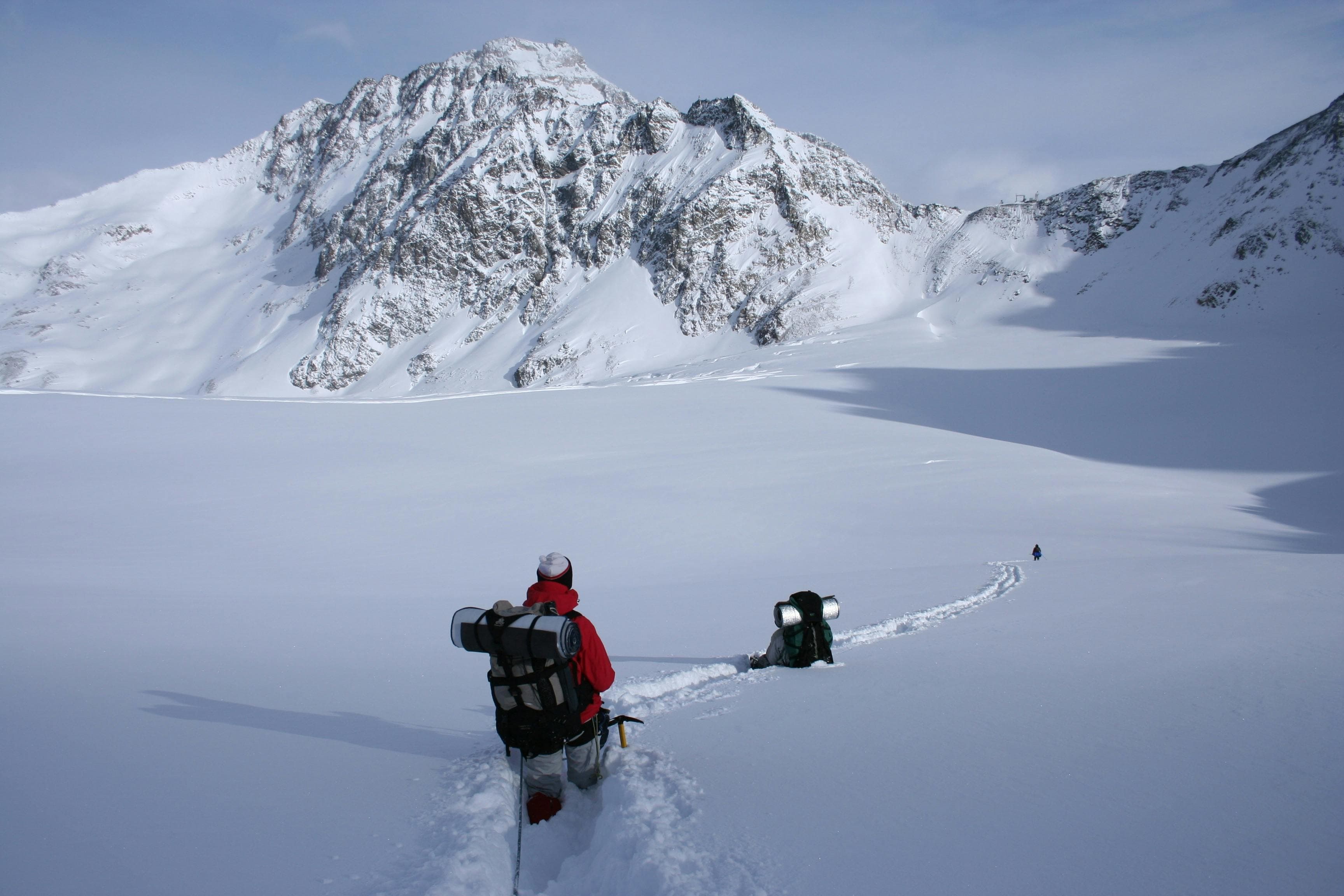
The climbing section involves glacier travel, snow slopes, and possible fixed-rope sections depending on seasonal conditions. Due to its altitude, remote location, and alpine environment, Chekigo Peak requires strong physical preparation, previous mountaineering experience, and proper technical equipment. Weather, snow conditions, and acclimatization play an important role throughout the expedition.
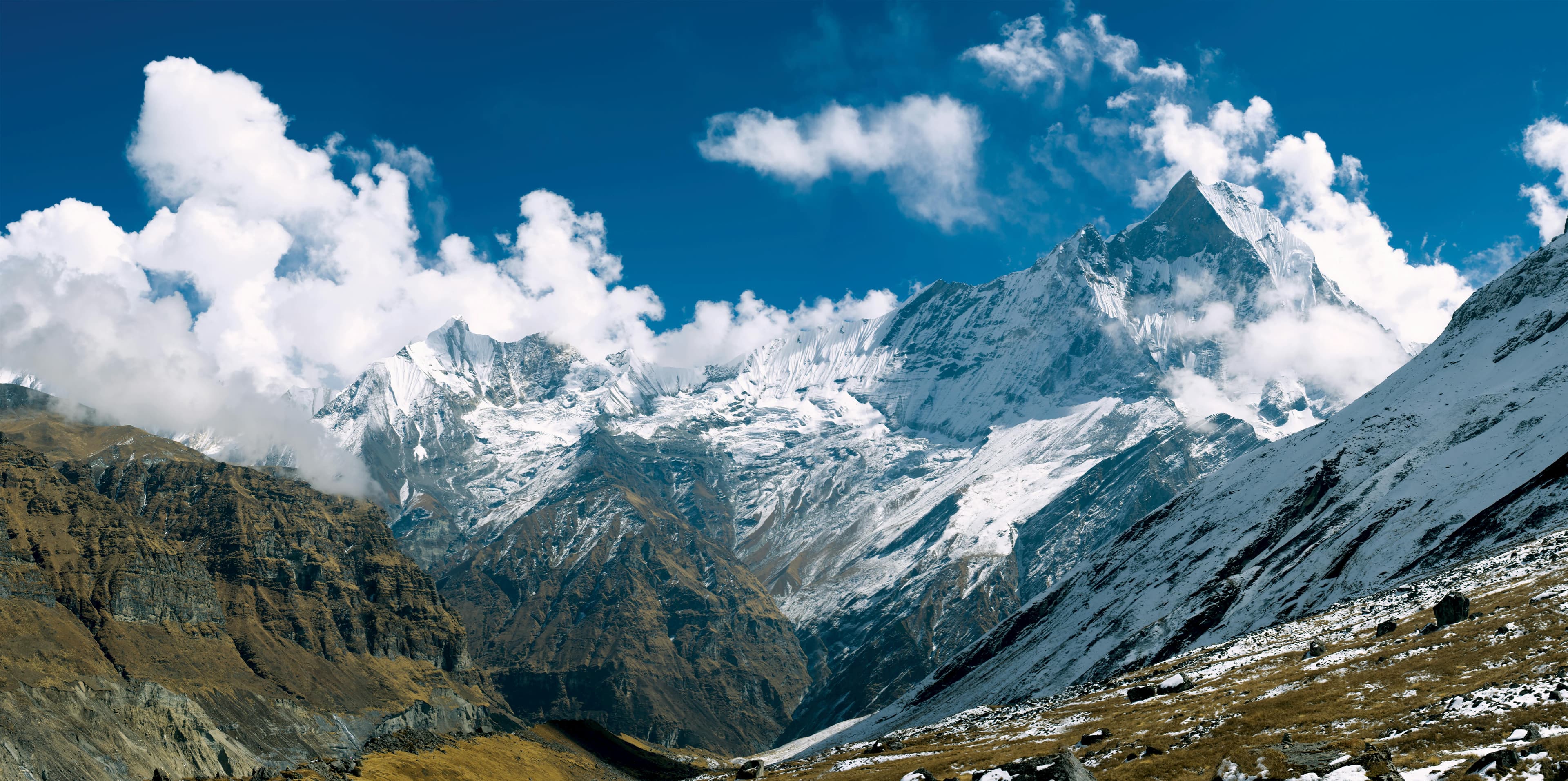
The summit provides impressive views of the Rolwaling Himal, Gaurishankar range, and surrounding Himalayan peaks. With its remote setting, technical climbing demands, and limited number of ascents, Chekigo Peak is an excellent objective for experienced climbers seeking a remote and technically engaging 6,000-meter Himalayan ascent in one of Nepal’s most isolated mountain regions.
Arrival at Tribhuwan International Airport. Our Staff member meets you and transfers you to the hotel.
Overnight at the hotel.
After breakfast at the hotel, our guide will meet you for a detailed trip briefing covering the itinerary, route conditions, safety procedures, altitude considerations, and important preparations for the journey ahead. For peak climbing expeditions, the climbing guide will also check the required mountaineering equipment and provide guidance on any necessary gear adjustments before departure.
During the briefing, we will complete the required trekking and climbing formalities, including necessary permits and documentation. Afterward, we will explore some of Kathmandu Valley's cultural highlights, including UNESCO World Heritage Sites such as Boudhanath Stupa, one of the largest Buddhist stupas in the world, and Swayambhunath Stupa, also known as the Monkey Temple.
The rest of the day is free for final preparations, including organizing trekking equipment, purchasing any last-minute essentials, and making final arrangements before heading into the Himalaya. Overnight at the hotel.
Today, we begin our journey with breakfast in Kathmandu before driving toward Shigati, a small riverside trading town and an important gateway to the eastern Himalayan trekking regions of Nepal. The drive covers approximately 170 – 185 km and takes around 7 – 9 hours, depending on road and weather conditions.
Leaving the busy capital behind, we follow the scenic Arniko Highway eastward through rolling green hills, terraced farmland, traditional villages, and lively roadside towns. As we continue beyond Charikot and Dolakha Bazaar, the road becomes narrower and more rugged, winding alongside the Tama Koshi River through remote mountain terrain.
Along the way, travelers can enjoy beautiful views of waterfalls, suspension bridges, forested hillsides, deep river gorges, and occasional glimpses of distant snow-capped Himalayan peaks. By evening, we arrive at Shigati, surrounded by peaceful mountain scenery and natural beauty. The town serves as a starting point for trekking routes toward the Rolwaling Valley and nearby Himalayan regions. Overnight stay at a local guesthouse or teahouse in Shigati.
From Shigati, we begin our trek toward Jagat (1,150 m), entering the lower Himalayan foothills of the Rolwaling region. The trek covers approximately 7 – 9 km and takes around 4 – 6 hours, depending on trail conditions and walking pace. The route initially follows the Tama Koshi River, gradually winding through terraced farmland, small settlements, and lush forested hillsides.
As the trail progresses, it alternates between gentle ascents and riverside sections, crossing several suspension bridges that connect remote hillside communities. The path is well-defined but steadily undulating, offering a comfortable yet engaging trekking experience through a diverse landscape of waterfalls, green valleys, and surrounding ridgelines.
By late afternoon, we arrive at Jagat, a quiet riverside settlement and an important stop along the trekking route toward the deeper Rolwaling Valley. Overnight stay at a local teahouse in Jagat.
From Jagat, we begin our ascent toward Simigaon (2,000m), entering a steeper and more demanding section of the Rolwaling trekking route. The trek covers approximately 7 – 9 km and takes around 4 – 6 hours, depending on trail conditions, weather, and walking pace.
The trail immediately leaves the lower valley and climbs steadily through stone staircases, forest paths, and terraced hillsides. This section is known for its continuous ascent, with limited flat stretches, requiring a steady rhythm. Trekkers pass through dense rhododendron and pine forests, small farming settlements, and occasional resting points along the hillside.
As the altitude increases, the environment becomes noticeably cooler and more alpine. The trail opens at intervals to wide valley views and glimpses of distant Himalayan ridges, offering a rewarding contrast to the steep climb. The final approach to Simigaon gradually levels out as the village comes into view, surrounded by forested slopes and traditional stone houses.
Overnight stay at a local teahouse in Simigaon.
Setting out from Simigaon, we begin our steady ascent toward Daldung La (2,850 m), entering a quieter and more remote section of the Rolwaling trekking route. The trek covers approximately 8 – 10 km and takes around 5 – 6 hours, depending on trail conditions, pace, and weather.
The trail climbs consistently through dense rhododendron and mixed forests, following stone staircases, narrow ridgelines, and well-defined mountain paths. This is a steady uphill day with limited flat sections, gradually gaining elevation as the landscape becomes cooler and more alpine in character.
Along the way, occasional clearings open up to wide views of the Rolwaling Valley and surrounding forested ridges. The higher sections feel more remote and peaceful, with the forest thinning as we approach the upper slopes of the pass.
We finally reach Daldung La, a forested ridge pass offering sweeping Himalayan views and marking an important crossing point on the route toward the upper Rolwaling Valley. Overnight stay at a basic teahouse or camping site near Daldung La.
Descending from Daldung La, we make our way toward Beding (3,690 m), entering the dramatic upper section of the Rolwaling Valley. The trek covers approximately 9 – 11 km and takes around 4 – 6 hours, depending on pace, trail conditions, and weather.
The trail begins with a descent through forested ridges and alpine slopes before gradually following the Rolwaling River valley. This section involves a mix of descending paths and gentle undulations, with occasional rocky and exposed stretches along the valley walls. The landscape becomes increasingly vast and alpine as we progress deeper into the region.
As the valley opens up, trekkers are rewarded with striking views of glacial-fed rivers, moraine formations, and towering Himalayan peaks. The air becomes noticeably thinner, and the terrain shifts into a high-mountain environment characterized by rugged beauty and wide alpine expanses.
We finally arrive at Beding, a traditional Sherpa village nestled beneath dramatic peaks, serving as one of the main acclimatization stops in the upper Rolwaling Valley. Overnight stay at a local teahouse in Beding.
Acclimatization day at Beding is an important pause in the journey, allowing the body to adjust to the higher altitude of the upper Rolwaling Valley. Surrounded by towering Himalayan peaks and a vast alpine landscape, Beding offers a peaceful setting for rest and gradual adaptation.
Today is typically kept relaxed, with optional short hikes around the village and nearby ridgelines for better acclimatization. These gentle walks help improve oxygen efficiency while offering stunning views of glaciers, surrounding mountains, and the Rolwaling River valley below. The village itself reflects traditional Sherpa mountain life, with stone houses, prayer flags, and a strong cultural atmosphere.
As the day progresses, trekkers rest, hydrate, and prepare for the next stage of the journey toward higher elevations. This acclimatization stop plays a key role in ensuring a safer and more comfortable ascent.
Overnight stay at a local teahouse in Beding, before continuing the trek toward Chekigo Base Camp the following day.
Setting out from Beding (3,690 m), we begin our challenging ascent toward Chekigo Base Camp (approx. 4,700–4,800 m), entering one of the most remote and high-altitude sections of the Rolwaling Valley. The trek covers approximately 10 – 12 km (6 – 7.5 miles) and takes around 6 – 7 hours, depending on pace, weather, and acclimatization.
The trail gradually leaves the village behind and follows the upper Rolwaling Valley, where vegetation becomes increasingly sparse and the terrain turns rocky and glacial in character. The route involves steady uphill walking along moraine paths, river crossings, and exposed sections carved into the valley landscape.
As altitude increases, the surroundings become stark and dramatic, with sweeping views of surrounding peaks, hanging glaciers, and rugged ice formations. The air is noticeably thinner, requiring a slow and steady pace throughout the ascent.
We finally arrive at Chekigo Base Camp, a remote high-altitude campsite situated beneath the towering peaks of the upper Rolwaling region, serving as a base for exploration and acclimatization. Overnight stay at a tented camp or basic alpine shelter.
This period is dedicated to the gradual ascent, acclimatization, and summit attempt of Chekigo Peak. Over these days, the expedition moves between base camp and higher camps, allowing climbers to properly adapt to extreme altitude while carrying loads, fixing routes, and preparing for the final summit push under the guidance of the climbing team.
The schedule is flexible and depends heavily on weather conditions, snow stability, and acclimatization progress. Climbers may spend time at higher camps for rotation and rest before making the summit attempt when a suitable weather window opens. The ascent involves high-altitude glacier and snow terrain, requiring steady pacing, technical support, and careful coordination throughout.
Upon reaching the summit, the team descends carefully back through the established camps to Base Camp. This phase marks the most challenging and rewarding section of the expedition, offering panoramic Himalayan views from one of the highest points in the Rolwaling region.
This day is reserved as a contingency buffer within the climbing schedule, allowing flexibility for weather delays, acclimatization needs, or recovery before the summit attempt. In high-altitude expeditions such as this, conditions can change rapidly, and an additional day plays a crucial role in ensuring safety and improving summit success chances.
Depending on the situation, the team may use this day for rest at base camp, short acclimatization hikes, equipment checks, or waiting for an improved weather window. It also provides essential recovery time after rotation climbs or previous high-camp stays.
This flexible planning approach is an important part of Himalayan expedition strategy, ensuring that the summit attempt of Chekigo Peak is made under the safest and most favorable conditions possible.
Leaving Chekigo Base Camp, we begin our descent back toward Beding (3,690 m), retracing our path through the upper Rolwaling Valley. The trek covers approximately 9 – 11 km and takes around 4 – 6 hours, depending on trail conditions and pace.
The route initially descends through alpine moraine landscapes and rugged high-altitude terrain, gradually following the Rolwaling River valley. As we lose elevation, the surroundings slowly soften from stark glacial scenery into wider valleys with scattered vegetation and grazing areas. The trail includes a mix of rocky paths, gentle downhill sections, and river-side walking.
As we continue, the valley opens up with increasingly green landscapes and clearer air, offering sweeping views of surrounding peaks and glacier-fed streams. The descent provides a more relaxed pace compared to the ascent, allowing time to absorb the vast Himalayan scenery one last time.
We finally arrive at Beding, a traditional Sherpa village and key settlement in the Rolwaling Valley. Overnight stay at a teahouse in Beding.
Retracing our steps from Beding, we set out toward Daldung La (2,850 m), descending from the upper Rolwaling Valley into its mid-hill forested section. The trek covers approximately 9 – 11 km and takes around 4 – 6 hours, depending on pace, trail conditions, and weather.
The trail initially leaves the high alpine environment of Beding and follows a gradual descent along the valley before re-entering dense rhododendron and mixed forests. The route includes a combination of downhill sections, gentle undulations, stone steps, and narrow forest paths carved into the hillside.
As we continue downward, the scenery transitions from open mountain landscapes to lush, green woodland, with occasional viewpoints offering glimpses back into the upper Rolwaling Valley. The atmosphere becomes warmer and more sheltered as the altitude drops steadily.
We finally arrive at Daldung La, a quiet forest ridge area that serves as a resting point along the route back toward lower settlements. Overnight stay at a basic teahouse or campsite near Daldung La.
Retracing our steps from Beding, we set out toward Daldung La (2,850 m), descending from the upper Rolwaling Valley into its mid-hill forested section. The trek covers approximately 9 – 11 km and takes around 4 – 6 hours, depending on pace, trail conditions, and weather.
The trail initially leaves the high alpine environment of Beding and follows a gradual descent along the valley before re-entering dense rhododendron and mixed forests. The route includes a combination of downhill sections, gentle undulations, stone steps, and narrow forest paths carved into the hillside.
As we continue downward, the scenery transitions from open mountain landscapes to lush, green woodland, with occasional viewpoints offering glimpses back into the upper Rolwaling Valley. The atmosphere becomes warmer and more sheltered as the altitude drops steadily.
We finally arrive at Daldung La, a quiet forest ridge area that serves as a resting point along the route back toward lower settlements. Overnight stay at a basic teahouse or campsite near Daldung La.
Descending from Daldung La, we make our way back toward Simigaon (2,000 m), leaving the forested ridge line and re-entering the mid-hill landscapes of the Rolwaling region. The trek covers approximately 8 – 10 km (5 – 6.2 miles) and takes around 4 – 5 hours, depending on trail conditions and pace.
The trail descends steadily through rhododendron and mixed forests, following stone staircases and winding hillside paths. The route is mostly downhill with a few short undulating sections, offering a comfortable yet scenic descent through changing vegetation zones.
As elevation decreases, the landscape becomes warmer and more open, with occasional viewpoints overlooking the Rolwaling Valley and surrounding green hills. The forest gradually gives way to cultivated land and village approaches.
We finally arrive at Simigaon, a traditional hillside settlement known for its monastery and panoramic mountain views. Overnight stay at a teahouse in Simigaon.
Departing from Simigaon (2,000 m), we begin our descent back toward Jagat (1,150 m), leaving the forested hills of the Rolwaling mid-section and gradually returning to the lower river valley. The trek covers approximately 7 – 9 km and takes around 3 – 5 hours, depending on trail conditions and walking pace.
The trail descends steadily through terraced farmland, small settlements, and mixed forest sections, with stone steps and winding hillside paths forming much of the route. As we lose elevation, the landscape becomes increasingly warm and cultivated, with more frequent village activity and river valley views.
Further along, the path follows the natural contours of the hills, eventually easing into gentler gradients as we approach the Tama Koshi River corridor. The scenery transitions from forested slopes to open farmland and scattered rural homes, reflecting the lower Himalayan environment.
We finally arrive at Jagat, a quiet riverside settlement and an important stop along the Rolwaling trekking route. Overnight stay at a teahouse in Jagat.
Setting out from Jagat, we begin our descent toward Shigati (1,000 m), following the lower Rolwaling valley corridor along the Tama Koshi River. The trek covers approximately 7 – 9 km and takes around 3.5 – 5 hours, depending on pace and trail conditions.
The trail gradually winds downhill through terraced farmland, small rural settlements, and forested hillside sections. A mix of stone steps, narrow paths, and suspension bridges connects the route, offering a varied but steady descent through the valley landscape.
As we continue, the surroundings become increasingly warm and open, with more frequent village activity and clearer views of the river below. The descent remains comfortable, with occasional gentle undulations typical of Himalayan river valley trails.
We finally arrive at Shigati, a small riverside trading settlement and key access point for the Rolwaling trekking region. Overnight stay at a teahouse in Shigati.
Leaving Shigati, we begin our return drive to Kathmandu, covering approximately 170 – 185 km through the scenic mid-hills of eastern Nepal. The journey takes around 7 – 9 hours, depending on road and traffic conditions.
The route follows winding mountain highways, passing through river valleys, terraced hillsides, and rural settlements before gradually merging into more developed road networks closer to the capital. As we descend, the landscape transitions from remote mountain scenery to bustling towns and urban outskirts.
By evening, we arrive in Kathmandu, marking the conclusion of the trekking journey. Overnight stay at a hotel.
After completing the expedition to Chekigo Peak, this day is reserved for your final departure from Kathmandu. Depending on your flight schedule, you will be transferred from your hotel to Tribhuvan International Airport for your onward journey, ensuring smooth coordination and assistance with check-in procedures.
This marks the successful conclusion of your Chekigo Peak climbing adventure, following an unforgettable journey through the Rolwaling Valley, high alpine terrain, and challenging Himalayan climbing sections. From remote villages to high camps and the summit of Chekigo Peak, this expedition offers a complete Himalayan mountaineering experience.
Our team will assist you with all necessary departure arrangements, wishing you safe travels and hoping to welcome you again for another adventure in the Himalayas.