

Arrival at Tribhuwan International Airport. Our Staff member meets you and transfers you to the hotel.
Overnight at the hotel.
Annapurna Region

Trek Starting Point
Jagat

Trek Ending Point
Jomsom

Departure From
Kathmandu

Transportation
Tourist Coach, Local Jeep, Private Vehicle

Style
Hiking, Trekking and Climbing

Meal
Breakfast, Lunch, Dinner

Accommodation
Tourist standard hotel in Kathmandu, Teahouse during trek
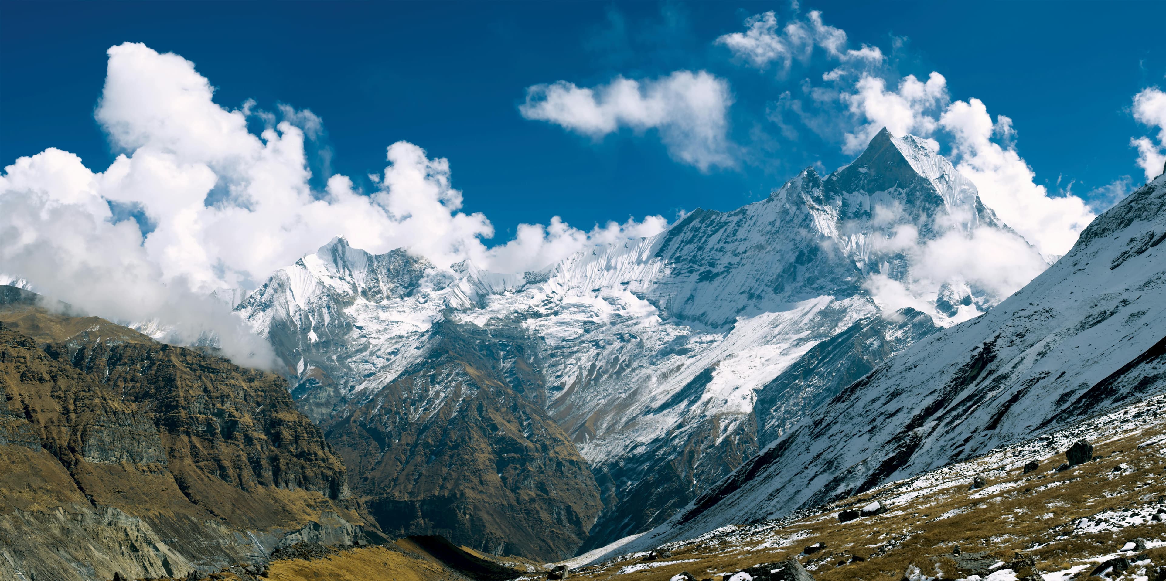
Chulu West (6,419 m / 21,059 ft) is a demanding trekking peak in the Annapurna region, offering a natural progression from high-altitude trekking to glacier and snow climbing. Rising above the Manang Valley along the Annapurna Circuit, the peak is surrounded by rugged ridges, glaciers, and some of the most impressive high mountain landscapes in the region.
The expedition follows the Annapurna Circuit through traditional mountain villages and the changing landscapes of the Manang Valley. As the trail gains altitude, the surroundings gradually shift from cultivated hillsides and pine forests to dry, open valleys, yak pastures, and barren alpine terrain. Beyond Manang, the route becomes increasingly remote as the team moves toward the climbing area, with rocky moraines, glaciers, and snow-covered slopes replacing the lower trekking trails.
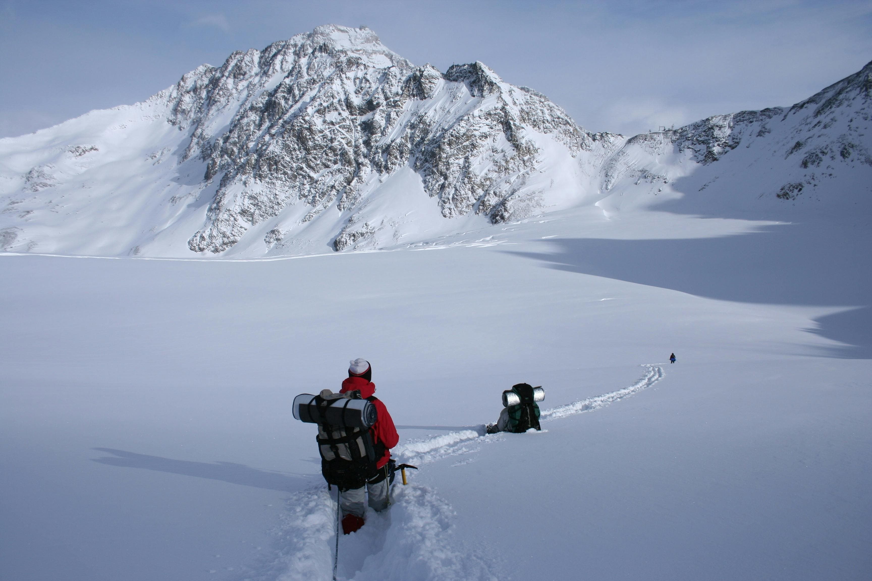
Chulu West is a demanding trekking peak and should not be approached as a straightforward high-altitude trek. Good physical fitness, previous high-altitude trekking experience, and basic mountaineering skills are important. The climbing section involves glacier travel, snow slopes, and steeper sections where crampons, an ice axe, rope techniques, and fixed ropes may be required depending on the route and mountain conditions. Careful acclimatization is also essential, particularly as the expedition moves above High Camp and toward the summit.
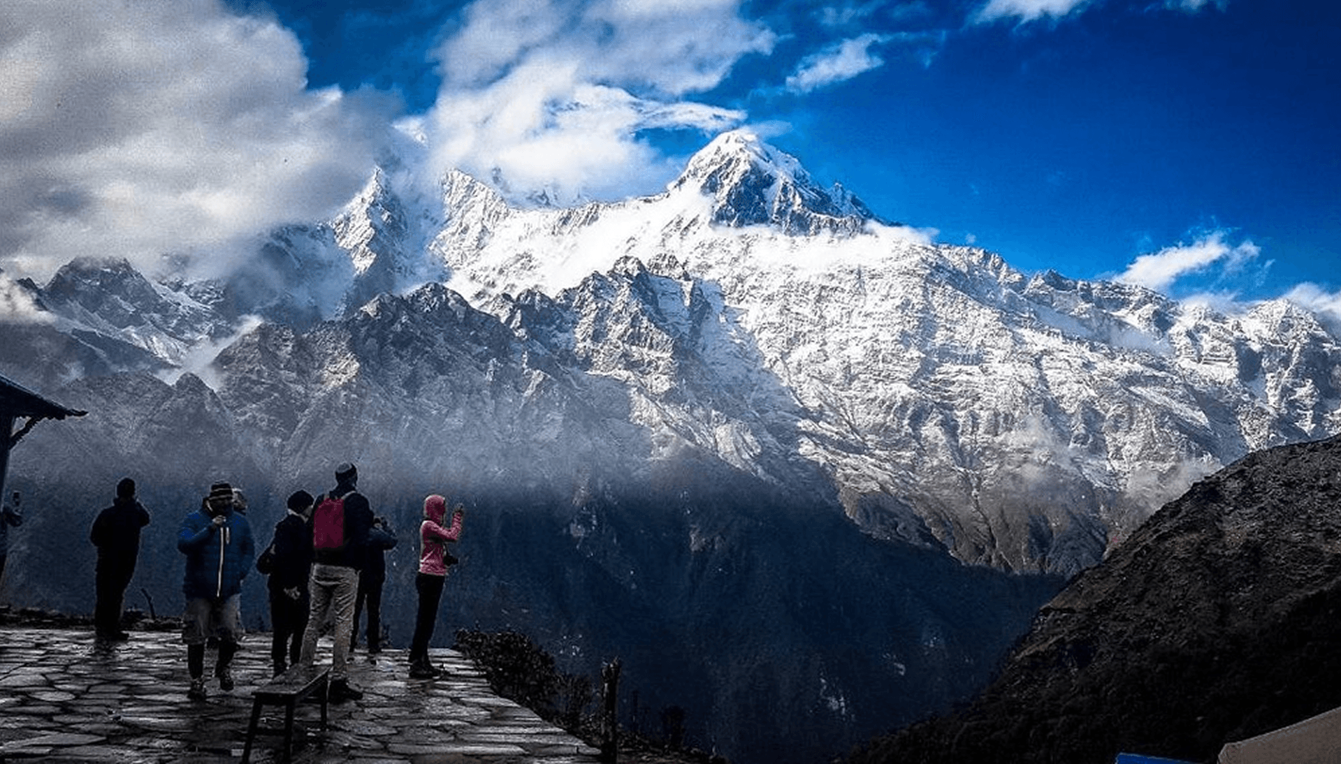
One of the highlights of the climb is the changing mountain scenery as the route gains elevation. From the higher camps and summit, the views extend across the surrounding Annapurna Himal, including Annapurna II, Annapurna III, Annapurna IV, Gangapurna, Tilicho Peak, Chulu East, and other peaks along the Himalayan horizon. The combination of high mountain views and the changing terrain makes the ascent as much about the journey to the summit as the summit itself.
Chulu West Peak Climbing brings together the best elements of a Himalayan expedition: a gradual approach through the Annapurna Circuit, time spent in the mountain communities of the Manang region, acclimatization at altitude, and a genuine alpine climbing objective. It is well suited to experienced trekkers who are prepared to move beyond trekking and take on the additional demands of snow, ice, altitude, and technical mountain terrain.
Arrival at Tribhuwan International Airport. Our Staff member meets you and transfers you to the hotel.
Overnight at the hotel.
After breakfast at the hotel, our guide will meet you for a detailed trip briefing covering the itinerary, route conditions, safety procedures, altitude considerations, and important preparations for the journey ahead. For peak climbing expeditions, the climbing guide will also check the required mountaineering equipment and provide guidance on any necessary gear adjustments before departure.
During the briefing, we will complete the required trekking and climbing formalities, including necessary permits and documentation. Afterward, we will explore some of Kathmandu Valley's cultural highlights, including UNESCO World Heritage Sites such as Boudhanath Stupa, one of the largest Buddhist stupas in the world, and Swayambhunath Stupa, also known as the Monkey Temple.
The rest of the day is free for final preparations, including organizing trekking equipment, purchasing any last-minute essentials, and making final arrangements before heading into the Himalaya. Overnight at the hotel.
After an early breakfast in Kathmandu, we begin our journey toward Jagat (1,340 m) in a private vehicle, marking the start of our transition into the Himalayas.
The drive covers approximately 200 – 210 km and takes around 8–10 hours, depending on road and weather conditions. We leave the Kathmandu Valley via the Prithvi Highway, where city traffic gradually gives way to river valleys, winding roads, and hillside settlements along the Trishuli River.
As we continue toward Dumre and Besisahar, the landscape becomes quieter and more rural. From Besisahar onward, the road turns into a rough mountain track following the Marsyangdi River, where a private vehicle offers more comfort and flexibility on the uneven terrain.
Approaching Jagat, the valley narrows and the scenery becomes distinctly Himalayan, with steep cliffs, small villages, and suspension bridges marking the entrance to the trekking region. It is a full-day journey that slowly carries us from the city into the remote mountains of the Annapurna region. Overnight stay at guesthouse or lodge in Jagat.
The trek from Jagat to Dharapani (1,860 m) is a steady and scenic ascent deeper into the Marsyangdi Valley, marking our entry into the heart of the Annapurna region.
This section covers about 12 – 15 km and takes roughly 5 – 7 hours, depending on pace and trail conditions. We follow stone steps, forest paths, and river trails, passing small villages, terraced fields, and suspension bridges over the Marsyangdi River.
As we move higher, the valley narrows and the landscape becomes more dramatic, with waterfalls, cliffside sections, and gradual elevation gain throughout the day.
Approaching Dharapani, the terrain opens slightly and the village appears as an important junction on the Annapurna Circuit, marking a clear transition into higher Himalayan terrain.
Overnight stay at a guesthouse in Dharapani.
The trek from Dharapani to Chame (2,670 m) is a beautiful and gradual ascent deeper into the upper Marsyangdi Valley, where the Himalayan landscape becomes more dramatic and remote.
This section covers approximately 15 – 17 km and takes around 6 – 7 hours, depending on pace and trail conditions. We begin by following the river trail through forested paths, stone steps, and suspension bridges, passing small settlements and entering increasingly alpine terrain.
As we gain elevation, the valley tightens and the scenery becomes more striking, with dense pine forests, waterfalls, and occasional views of snow-capped peaks appearing above the ridgelines. The air feels noticeably cooler, and the surroundings become quieter and more rugged.
Approaching Chame, the administrative center of the Manang district, the trail levels slightly before reaching the village, where mountain culture and Buddhist influence become more prominent. Overall, it is a rewarding trekking day that marks a clear transition into higher-altitude Himalayan terrain. Overnight stay at a lodge in Chame.
Departing from Chame, the trail enters a serene alpine landscape, following the course of the Marshyangdi River as we move through dense pine forests and scattered settlements. The sound of the river continues below, guiding the rhythm of the journey along the valley.
As we progress further, the forest gradually thins and the valley begins to open. We are greeted with dramatic views of Annapurna II rising sharply above the landscape. The route includes suspension bridges and rocky sections, with the terrain becoming more rugged and expansive.
As we near Pisang, the valley widens into a broad high-altitude basin surrounded by towering peaks and open skies. After approximately 5 – 6 hours of trekking, covering around 13 – 15 km (8 – 9 miles), arrival at Pisang offers a peaceful mountain setting with sweeping Himalayan views.
Overnight at a guesthouse in Pisang.
The trek from Pisang to Manang (3,540 m) is one of the most visually striking sections of the journey, as we move deeper into the rain-shadow region of the Annapurna Himal.
Covering approximately 18 – 20 km in around 6 – 8 hours, the trail offers two distinct route options. The upper trail climbs through traditional villages like Ghyaru and Ngawal, rewarding us with sweeping panoramic views of snow-capped peaks and dramatic valley landscapes, while the lower route follows the river, offering a gentler path through rocky terrain and scattered settlements.
As we progress, the landscape gradually transforms into a high-altitude alpine environment. The air becomes noticeably drier, vegetation thins out, and vast cliffs and mountain walls dominate the horizon, creating a powerful sense of scale and remoteness.
Arriving in Manang, we settle into one of the key acclimatization villages of the region. Surrounded by towering Himalayan peaks, Manang offers a striking balance of raw mountain beauty and traditional Himalayan culture, making it an ideal place to rest and prepare for the higher sections ahead. Overnight stay at a lodge in Manang.
The acclimatization day in Manang is an important pause in our journey, allowing the body to adjust to higher altitude while we explore one of the most scenic valleys in the Annapurna Himal.
After a relaxed morning in the village, we take short hikes to gain elevation and support proper acclimatization. One of the most popular options is a visit to Gangapurna Lake, a stunning turquoise glacial lake set beneath dramatic ice-covered peaks. Another rewarding hike leads toward Bhraka Village and the centuries-old monastery, offering insight into local Himalayan culture and traditions.
For those feeling energetic, a gradual uphill walk toward viewpoints above Manang provides sweeping panoramas of the surrounding snow peaks, glaciers, and the vast arid valley landscape. Throughout the day, we maintain a slow and steady pace, focusing on both rest and light activity.
By evening, we return to Manang for an overnight stay, surrounded by towering mountains and crisp alpine air, preparing for the higher elevations ahead on our Himalayan journey.
The trek from Manang (approx. 3,540 m) to Ledar (approx. 4,200 m) is a steady ascent into the high alpine zone of the Annapurna Himal, where the landscape becomes more raw, open, and remote.
Covering about 10–12 km in 4–5 hours, the trail passes through Bhraka and Yak Kharka, following a wide glacial valley with scattered yak pastures and stone shelters along the way. As we climb higher, vegetation fades and the terrain turns into dry, rocky slopes and moraine fields.
Throughout the route, we enjoy clear views of Gangapurna, Annapurna III, and Tilicho Peak, which dominate the skyline and shift as we move deeper into the valley.
Arriving in Ledar, we settle into a simple mountain lodge for an overnight stay, surrounded by stark alpine scenery as we prepare for our approach toward Chulu West Base Camp.
The trek from Ledar to Chulu West Base Camp (4,950 m) is a demanding but rewarding ascent into a true high-mountain wilderness within the Annapurna Himal.
Covering approximately 6 – 8 km in around 4 – 6 hours, the trail climbs steadily above the main trekking route, leaving behind the established lodges and entering a more remote alpine zone. The path leads through high yak pastures, rocky moraine terrain, and open slopes where the landscape feels increasingly stark and exposed.
As we gain elevation, the air becomes noticeably thinner and the surroundings more dramatic, with wide views opening across the Manang Valley and surrounding peaks such as Chulu West, Chulu East, Gangapurna, and Annapurna IIIforming a powerful Himalayan backdrop.
The final approach to base camp is quiet and isolated, with only basic camping conditions and no permanent settlements. Arriving at Chulu West Base Camp, we settle into our campsite surrounded by towering ridgelines and glaciated terrain, fully immersed in the high-altitude environment in preparation for the climb ahead.
The acclimatization and preparation day at Chulu West Base Camp (4,950 m) is an important phase of the expedition, allowing us to properly adjust to the high altitude within the dramatic setting of the Annapurna Himal.
The day is kept deliberately relaxed, focusing on rest, hydration, and gradual movement around the surrounding terrain. Short acclimatization hikes are carried out on nearby slopes to aid adaptation, giving us time to gain comfort on steeper snow and mixed ground while enjoying expansive views of Chulu West, Chulu East, Gangapurna, and Annapurna III.
Our guides use this day for final preparations, including gear checks, rope practice, and route planning for the ascent ahead. Weather and snow conditions are carefully reviewed to ensure a safe and well-timed summit push.
As the day progresses, we return to base camp to rest, with the quiet of the high Himalayas all around us. The stark alpine environment, glaciated terrain, and towering peaks create a powerful sense of isolation and focus as we prepare for the climb ahead.
The ascent from Chulu West Base Camp (approximately 4,900 m) to High Camp (typically 5,300–5,400 m) is a short but demanding climb into the upper alpine zone of the Annapurna Himal, bringing us closer to the 6,419 m summit of Chulu West. The climb takes approximately 3–4 hours, with the route ascending steadily over rocky moraine and mixed snow slopes. As the air becomes thinner, a slow and controlled pace is important.
High Camp is typically established at 5,300–5,400 m in a suitable location above Base Camp. The exact camp position depends on weather, snow conditions, and the safety of the terrain on the day. As we gain elevation, the views open across the surrounding Himalayan peaks, with Chulu West, Chulu East, Gangapurna, and Annapurna III dominating the skyline. The landscape becomes increasingly stark and remote, characterized by rock, ice, snow, and high-altitude wilderness.
After reaching High Camp, the team settles in and prepares for the summit push. The remainder of the day is dedicated to rest, hydration, and final equipment checks, with an early start planned for the ascent of Chulu West (6,419 m). The evening is kept quiet and focused, allowing the team to conserve energy for the demanding summit attempt ahead.
The summit push of Chulu West (6,419 m) begins early in the morning from High Camp. We start before sunrise and ascend gradually over snow-covered slopes and glaciated terrain toward the higher sections of the mountain. The summit day is demanding and usually takes around 8–12 hours round trip, depending on weather, snow conditions, route conditions, and the pace of the team. Fixed ropes may be used on steeper or more exposed sections where required, with the climbing team moving carefully and maintaining a steady pace throughout the ascent.
As we gain elevation, the views open across the Annapurna Himal, with Gangapurna, Annapurna III, Chulu East, and numerous surrounding peaks visible from the higher slopes. Reaching the 6,419 m summit of Chulu West marks the highest point of the expedition and provides extensive views across the surrounding mountain range. After a short break at the summit, we begin the descent, taking particular care on steep sections and adjusting our pace to the prevailing snow and weather conditions.
We descend back to High Camp before continuing to Chulu West Base Camp at approximately 4,900 m. Although the descent is generally faster than the climb, fatigue and changing snow conditions require careful movement all the way down. We expect to reach Base Camp by late afternoon or evening, where we can rest and recover after the long summit day. Overnight at tented camp.
Today is kept as a contingency and summit buffer day at Chulu West Base Camp (approximately 4,900 m / 16,076 ft). In high-altitude expeditions, weather conditions, wind, and snow stability can significantly influence summit timing, so this day provides important flexibility for a safe and well-planned climb of Chulu West (6,419 m / 21,257 ft).
If required, this day serves as an additional opportunity to attempt the summit via High Camp (5,300–5,400 m / 17,390–17,717 ft), following the established technical route depending on weather, snow conditions, and guide assessment.
If the summit has already been achieved, the day is used for rest, recovery, and light activity around Base Camp, including short walks on moraine terrain with minimal elevation gain to aid acclimatization and recovery.
The day also allows time for equipment checks, weather monitoring, and final planning for the descent, while we remain overnight at Base Camp in the high-altitude Himalayan environment.
The trek from Chulu West Base Camp to Thorong Phedi (approx. 4,540 m) is a gradual descent back toward the main Thorong La route within the Annapurna Himal.
Covering approximately 6 – 8 km in around 3 – 5 hours, the trail follows a mix of rocky moraine and alpine paths before rejoining the established trekking route. As we descend, the terrain becomes less exposed, with increasing signs of yak grazing areas and regular trail infrastructure.
Throughout the journey, we continue to enjoy views of surrounding Himalayan peaks including Chulu West, Chulu East, Gangapurna, and Annapurna III, before gradually entering the main Thorong La approach corridor.
Arriving in Thorong Phedi, we settle into a mountain lodge at the base of the pass, preparing for the challenging ascent toward Thorong La ahead.
Before sunrise, we begin one of the most challenging and rewarding days of the journey, trekking from Thorong Phedi across Thorong La Pass (5,416 m) and descending toward Muktinath Temple (3,800 m).
Covering approximately 14–16 km in around 8–10 hours, the trail climbs steadily through rocky switchbacks and high-altitude slopes under cold alpine conditions. As we gain elevation, the surrounding landscape opens into vast Himalayan panoramas before finally reaching the prayer-flag-covered summit of Thorong La, the highest point of the trek.
From the pass, we are rewarded with sweeping views across the Annapurna and Dhaulagiri ranges, with endless ridgelines stretching into the distance. The route then descends steeply into the Mustang region, where the terrain changes dramatically into dry, wind-shaped landscapes characteristic of the trans-Himalayan zone.
Continuing downward through barren hillsides and scattered settlements, we eventually arrive at Muktinath Temple, one of Nepal’s most important pilgrimage sites for both Hindus and Buddhists. Upon arrival, we settle into a lodge for an overnight stay after completing one of the most iconic Himalayan crossings in the region.
We will begin our descent from Muktinath (3,800 m / 12,467 ft), leaving behind the sacred temple complex and the high-altitude serenity of the Thorong La region. The morning carries a sense of completion as the trail turns downward into the vast, dry landscapes of Mustang.
The route gradually descends through wind-swept hills and traditional settlements, where stone-built villages and scattered chortens reflect the deep cultural character of the region. As we move lower, the terrain becomes increasingly arid, with dramatic views opening across the Kali Gandaki Valley, framed by the towering peaks of the Annapurna and Dhaulagiri ranges.
We continue the steady descent along the valley corridor toward Jomsom (2,720 m / 8,923 ft), where the landscape broadens into a windswept basin beside the Kali Gandaki River. The air grows warmer and denser as altitude drops, marking a clear transition from high alpine terrain to the trans-Himalayan valley.
After approximately 5 – 6 hours of trekking, covering around 18 – 20 km (11 – 12.5 miles), arrival in Jomsom brings the journey into the heart of Mustang’s main trading town.
Overnight stay at a guesthouse in Jomsom.
Setting off from Jomsom (2,720 m / 8,923 ft), the drive follows the dramatic corridor of the Kali Gandaki Valley, where the road runs between towering cliffs and the rushing waters of the Kali Gandaki River. The early stretch is rugged and exposed, reflecting the raw trans-Himalayan landscape of Mustang.
As the journey continues south, the scenery gradually transforms. The dry, wind-swept hills begin to soften into greener slopes, terraced farmland, and scattered hillside villages. The road winds through narrow gorges and open river valleys, offering shifting views of waterfalls and distant Himalayan peaks.
Passing through towns such as Beni, the route reconnects with more developed road networks as the landscape transitions fully into the lower hill region.
After approximately 8 – 10 hours of driving, covering around 160 – 170 km (100 – 105 miles) depending on road and weather conditions, arrival at Pokhara brings the journey back to the calm lakeside atmosphere of the city.
Overnight at a hotel in Pokhara.
The drive begins in Pokhara, gradually moving away from the tranquil lakeside setting and joining the Prithvi Highway. The road soon winds into the mid-hills, where terraced fields, scattered villages, and forested slopes define the landscape.
Much of the journey follows the course of the Trishuli River, with deep gorges, suspension bridges, and fast-flowing water shaping a constantly shifting backdrop. The route alternates between quiet rural stretches and increasingly busy roadside towns.
As the Kathmandu Valley approaches, the terrain gradually flattens and traffic becomes heavier, signaling the transition back into the urban environment.
After approximately 6 – 8 hours of driving, covering around 200 – 210 km (125 – 130 miles) depending on road and traffic conditions, arrival at Kathmandu marks the end of the overland journey. Overnight at a hotel in Kathmandu.
Alternative: You can also take a domestic flight from Jomsom to Pokhara and Pokhara to Kathmandu. The duration of the flight is about 30 Minutes. One-way flight costs around 125 USD per Person. We can make a flight reservation for you. Please let us know.
After completing the Chulu West expedition, today is the final day of the journey in Nepal. The morning is free to rest at the hotel, enjoy breakfast, or spend some time in Kathmandu before the onward flight.
At the appropriate time, we arrange a transfer from the hotel to Tribhuvan International Airport for your departure. The drive to the airport generally takes around 30–45 minutes, depending on traffic conditions.
With the expedition completed, you depart Nepal with memories of the mountains, villages, trails, and people encountered along the journey. Farewell and safe travels!