

Arrival at Tribhuwan International Airport. Our Staff member meets you and transfers you to the hotel.
Overnight at the hotel.
Annapurna Region

Trek Starting Point
Phedi

Trek Ending Point
New Bridge

Departure From
Kathmandu

Transportation
Tourist Coach, Local Jeep

Style
Hiking, Trekking and Climbing

Meal
Breakfast, Lunch, Dinner

Accommodation
Tea house / Tourist standard hotel in Kathmandu, Camping
Hiunchuli Peak Climbing is a challenging Himalayan adventure that combines the classic Annapurna trekking experience with the opportunity to climb a 6,000-metre peak. Rising to 6,441 metres, Hiunchuli lies within the Annapurna massif and offers a natural progression from lower mountain villages and forested trails to the high-altitude snow and ice of the upper Annapurna Sanctuary.
The journey begins with a scenic drive from Kathmandu to Pokhara, followed by a gradual trek through terraced hillsides, traditional villages, forests, and river valleys. The route passes through Dhampus and Tolka before reaching Chhomrong, with the landscape and vegetation changing steadily as the trail gains altitude. The gradual approach allows the team to adapt to the increasing elevation before moving deeper into the Annapurna mountains.
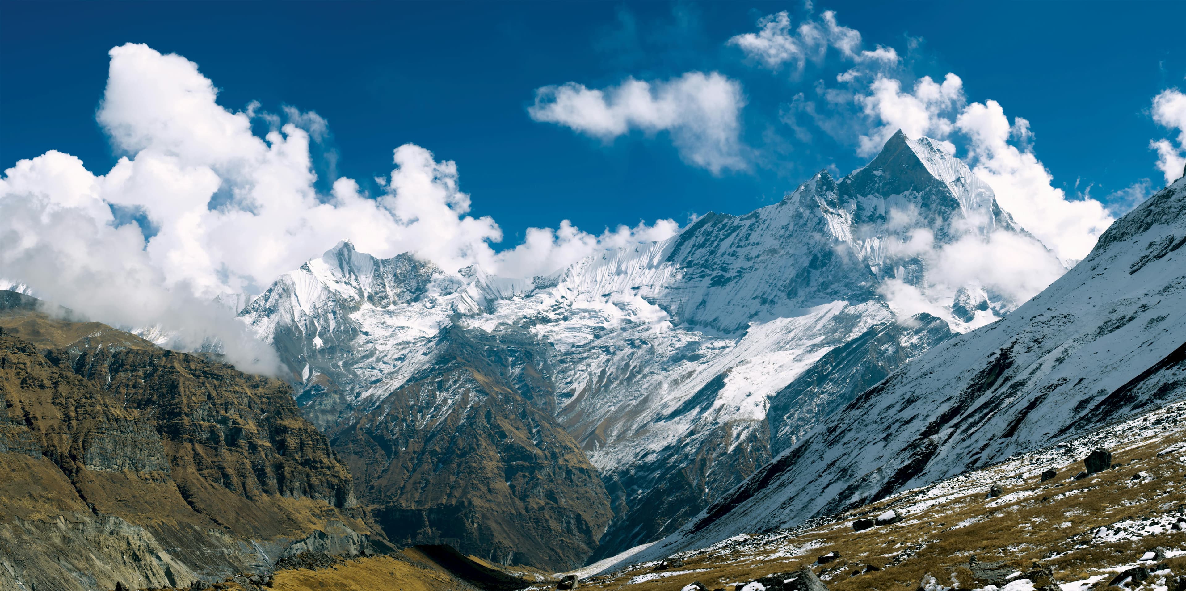
From Chhomrong, the trail follows the Modi Khola valley through Bamboo and Deurali to Annapurna Base Camp at 4,130 metres. Surrounded by Annapurna I (8,091 m), Annapurna South (7,219 m), and Machapuchare (6,993 m), the sanctuary provides a spectacular high-mountain setting and marks the transition from the trekking section of the journey to the climbing phase of the Hiunchuli expedition.
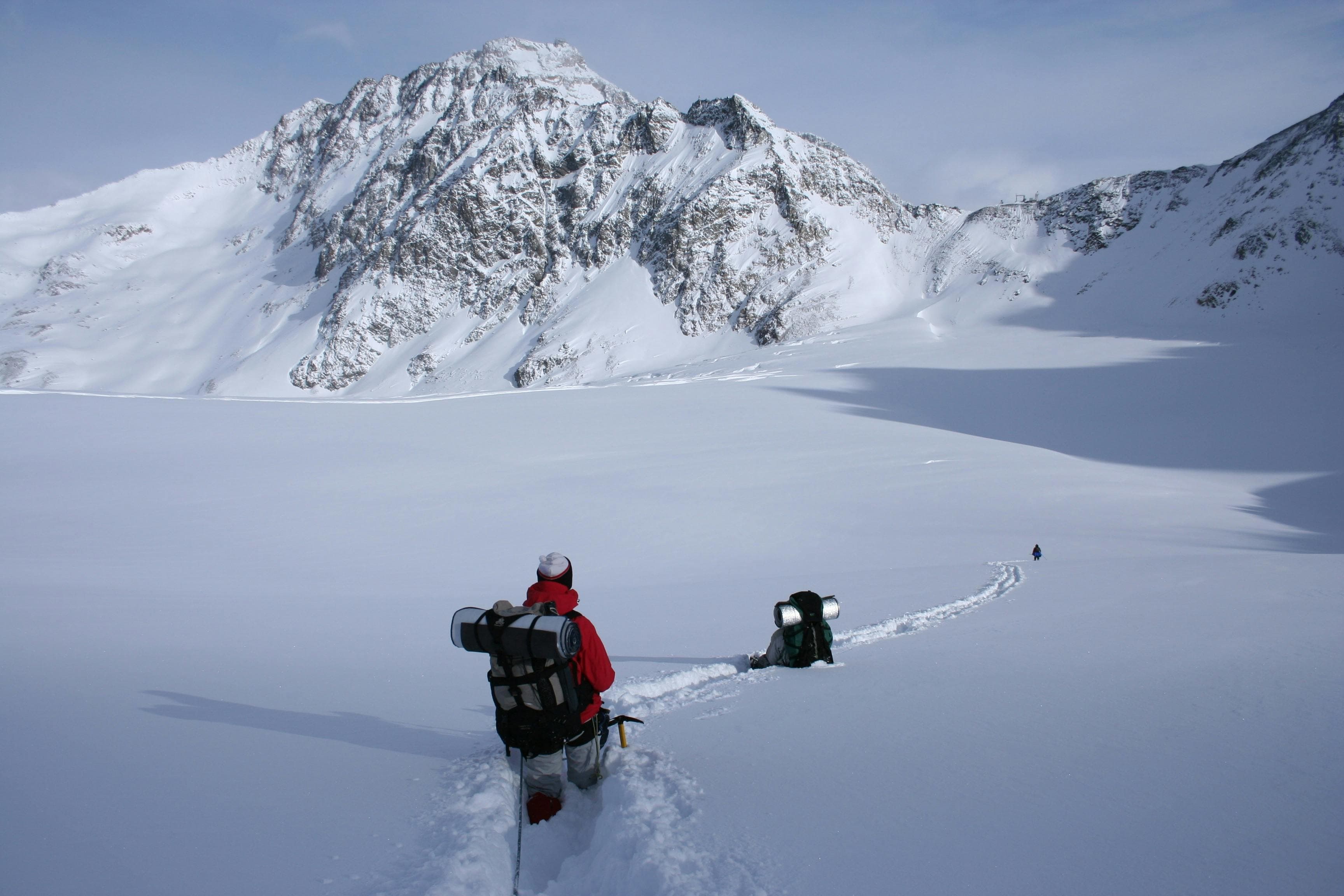
From the Annapurna Sanctuary, the expedition continues toward Hiunchuli Base Camp, where the character of the journey changes. The trails become steeper and more demanding as the team moves into higher alpine terrain. Depending on the route and prevailing mountain conditions, the ascent involves snow and ice, with crampons, an ice axe, rope techniques, and careful movement becoming important. Good physical conditioning, previous high-altitude trekking experience, and basic mountaineering skills are essential for the climb.
The summit attempt is the most demanding stage of the expedition and requires an early start, steady pacing, and close attention to weather and snow conditions. Reaching the 6,411 m summit of Hiunchuli is a rewarding achievement, with impressive views across the Annapurna range. As with any Himalayan peak, summit success depends not only on preparation and fitness but also on the conditions encountered on the mountain.
After the summit attempt, the team descends through the Annapurna trekking route, gradually leaving the snow-covered high country behind and returning to the greener hills and mountain villages below. The journey concludes in Pokhara, completing an expedition that combines the cultural and natural diversity of the Annapurna region with the challenge of climbing a Himalayan 6,000-metre peak.
Hiunchuli Peak Climbing is best suited to experienced trekkers who want to progress beyond high-altitude trekking and gain experience in a more demanding alpine environment while following one of Nepal's most established and scenic trekking routes.
Arrival at Tribhuwan International Airport. Our Staff member meets you and transfers you to the hotel.
Overnight at the hotel.
After breakfast at the hotel, our guide will meet you for a detailed trip briefing covering the itinerary, route conditions, safety procedures, altitude considerations, and important preparations for the journey ahead. For peak climbing expeditions, the climbing guide will also check the required mountaineering equipment and provide guidance on any necessary gear adjustments before departure.
During the briefing, we will complete the required trekking and climbing formalities, including necessary permits and documentation. Afterward, we will explore some of Kathmandu Valley's cultural highlights, including UNESCO World Heritage Sites such as Boudhanath Stupa, one of the largest Buddhist stupas in the world, and Swayambhunath Stupa, also known as the Monkey Temple.
The rest of the day is free for final preparations, including organizing trekking equipment, purchasing any last-minute essentials, and making final arrangements before heading into the Himalaya. Overnight at the hotel.
The drive from Kathmandu to Pokhara begins with an early departure from the bustling valley, gradually giving way to rolling hills and terraced farmland. As the city fades, the journey settles into a scenic rhythm along the Prithvi Highway.
Following the highway westward, the road traces the Trishuli River, where rushing waters and steep gorges create a dramatic backdrop. Small towns and rural landscapes pass by, with occasional glimpses of the Annapurna Range on clear days.
After approximately 6–8 hours of driving, covering around 200 km (124 miles), we arrive in Pokhara, a serene lakeside city known for its natural beauty. The rest of the day is free to relax, perhaps by Phewa Lake.
Overnight at a hotel in Pokhara.
The day begins with a short drive from Pokhara (822 m) to Phedi (1,130 m), the starting point of the trek. Leaving the lakeside behind, the road winds through small settlements and cultivated fields before the journey continues on foot.
From Phedi, the trail ascends steadily via stone steps and forested paths toward Dhampus (1,650 m). This initial climb is the most demanding section, rewarded with wide views over the valley and glimpses of the Annapurna Range on clear days. Beyond Dhampus, the trail becomes more gradual, traversing ridgelines, terraced farmland, and patches of rhododendron forest.
After approximately 4 – 6 hours of trekking, we reach Tolka (1,790 m), a peaceful village surrounded by rolling hills and offering beautiful mountain scenery. The rest of the day is free to relax and enjoy the surroundings.
Overnight at a teahouse in Tolka.
The trail from Tolka to Chhomrong (2,170 m) begins quietly, leaving Tolka behind as the path gently descends through terraced fields and shaded forest sections. The morning feels calm, with wide hillside views gradually opening toward the valley below.
We pass through Landruk (1,565 m), a traditional hillside settlement where stone houses and farmland blend naturally into the landscape. From here, the trail drops further to the Modi Khola, where a suspension bridge marks the transition into a steady uphill climb.
The ascent toward Chhomrong is the most demanding part of the day, yet also the most rewarding. Step by step, elevation is gained through forested slopes and open ridgelines, and the scenery slowly begins to shift. The peaks of Annapurna South and Machapuchare gradually come into view, rising sharply above the valley as we move higher.
Covering roughly 10 – 12 km and taking around 6 –7 hours, the walk feels steady and immersive, shaped more by the landscape than by urgency.
By late afternoon, Chhomrong appears ahead a hillside village set against a dramatic mountain backdrop, offering a natural place to pause and settle in.
Overnight at a teahouse in Chhomrong.
The trek from Chhomrong to Himalaya (2,920 m) begins with a long descent on stone steps toward the Chhomrong Khola. The morning starts with a steady drop through the village and surrounding terraced slopes before the trail reaches the river valley below.
From the suspension bridge, the path climbs sharply toward Sinuwa, gaining elevation through dense forest and shaded sections where the air feels noticeably cooler. The rhythm of the day is defined by ascent and descent, as the trail continues through Bamboo (2,310 m), a quiet forest stop surrounded by thick bamboo and rhododendron growth.
Beyond Bamboo, the route gradually enters a deeper, more remote section of the valley. The forest becomes denser, the trail quieter, and the landscape increasingly enclosed by steep hillsides. As we move higher, glimpses of the surrounding peaks begin to appear through breaks in the trees, hinting at the proximity of the higher Himalaya.
After approximately 6 – 7 hours of trekking, covering around 12 – 14 km (7.5–8.5 miles), we arrive at Himalaya, a small, secluded stop nestled in the valley.
The evening is calm and still, with the sense of entering a more remote mountain world.
Overnight at a teahouse in Himalaya.
We begin the trek from Himalaya, gradually ascending through the upper Modi Khola valley as the landscape opens into a rugged alpine environment. The trail climbs steadily above the last patches of forest, with steep cliffs and glacial streams shaping the route ahead.
Passing through Deurali (3,230 m), a quiet resting point beneath dramatic rock faces, the valley becomes noticeably wider and more exposed. From here, the tree line disappears completely, and the trail continues into a stark glacial corridor surrounded by towering peaks.
The climb remains steady and well-paced, with increasingly clear views of Machhapuchre dominating the skyline as we approach the sanctuary.
After approximately 3 – 4 hours of trekking, covering around 5 – 6 km (3.1 – 3.7 miles), we arrive at Machhapuchhre Base Camp (3,700 m), set within a vast amphitheater of Himalayan peaks. Time is taken to rest and absorb the high-altitude surroundings.
Overnight at a teahouse in Machhapuchhre Base Camp.
The ascent from Machapuchare Base Camp (3,700 m) to Annapurna Base Camp (4,130 m) is part of the continued progression into the Annapurna Sanctuary, as the route gradually opens into a vast glacial basin surrounded by towering Himalayan peaks.
The trail rises gently over moraine terrain, with the landscape becoming increasingly exposed and dramatic. As we move higher, the full scale of the sanctuary reveals itself, with Annapurna South dominating one side of the valley and the surrounding ice walls and ridgelines enclosing the route.
The walk is steady and relatively short, taking around 1 – 2 hours and covering approximately 2 –3 km (1.2 – 1.8 miles). Upon reaching ABC, the sense of scale is immediate, with a complete amphitheater of peaks surrounding the campsite.
This stop is part of the ongoing acclimatisation and preparation phase for the expedition toward Huin Chuli, rather than a final summit approach. Time is spent resting, adjusting to altitude, and preparing for the next stage of the journey.
Overnight at a teahouse in Annapurna Base Camp.
A full acclimatisation day is spent at Annapurna Base Camp (4,130 m), surrounded by the towering walls of the Annapurna Sanctuary. The morning begins in crisp, thin air, with the first light slowly revealing Annapurna South (7,219 m), Machapuchare (6,993 m), and the distant presence of Annapurna I (8,091 m), the highest peak in the massif, rising deep within the range.
The panorama from base camp stretches far beyond a single peak, forming a complete amphitheater of the Annapurna Range, including surrounding summits such as Hiunchuli and Gangapurna, all standing above the glacier basin in layered walls of rock and ice.
The day is intentionally relaxed, allowing the body to adapt to altitude ahead of the move toward Huin Chuli. Short, easy walks around the base camp help with acclimatisation, offering shifting perspectives of ice fields, moraines, and the surrounding Himalayan giants. The rest of the time is spent resting at camp, hydrating, and preparing gear for the expedition phase ahead.
As the day progresses, the changing light over the amphitheater creates a slow, dramatic shift across the mountains from sharp morning clarity to warm alpine tones by late afternoon.
Overnight at a teahouse in Annapurna Base Camp.
We leave Annapurna Base Camp (4,130 m) early in the morning, as the first light spreads across the Annapurna Sanctuary. Behind us, the great wall of peaks Annapurna South (7,219 m), Machapuchare (6,993 m), and the distant mass of Annapurna I (8,091 m) slowly recede as the valley opens into quieter, less-travelled terrain.
The route toward Huin Chuli Base Camp feels noticeably more remote. The well-defined trekking path fades into glacial moraine and broken alpine ground, where movement becomes slower and more deliberate. The landscape is stark and powerful, shaped entirely by ice, rock, and wind.
After around 4 – 6 hours of steady progression, depending on conditions, we arrive at Huin Chuli Base Camp, set beneath the mountain’s steep and imposing faces in a raw, high-altitude environment.
The rest of the day is spent settling in, organizing expedition equipment, and preparing for the climbing phase ahead.
Overnight at Base Camp in a tented camp.
From Huin Chuli Base Camp (approx. 4,700 m), we set out early in the morning while the glacier is still firm and cold under the first light. The terrain feels untouched and raw no defined trail, only shifting moraine ridges, broken ice, and the quiet presence of towering Himalayan walls around us.
The route to High Camp rises steadily through mixed alpine ground, where snow, rock, and glacier blend into one continuous climb. Progress is slow and measured, shaped entirely by conditions rather than distance, as the mountain feels increasingly close and more demanding with every step.
As elevation builds, the views begin to open back across the Annapurna Sanctuary, while the upper slopes of Huin Chuli grow steeper and more dominant ahead. The sense of isolation deepens, with only wind and crunching ice marking the passage upward.
After approximately 4–5 hours of steady climbing, covering around 2–3 km (1.2–1.8 miles), we reach Huin Chuli High Camp (approx. 5,200–5,300 m), set on a narrow, windswept alpine platform beneath the upper mountain. Time is spent settling into camp, resting, hydrating, and carefully preparing gear for the summit phase ahead.
Overnight at High Camp in a tented camp.
From Huin Chuli High Camp (approx. 5,200–5,300 m), the summit push begins before dawn, when the mountain is still wrapped in darkness and the cold sits heavy in the air. Headlamps trace a quiet line up steep snow and ice slopes, as the route steadily gains height toward the 6,411 m summit.
The ascent is slow and technical, shaped entirely by terrain and altitude rather than distance. With the first light, the surrounding Himalayan world slowly reveals itself the vast Annapurna Range stretching across the horizon, with peaks such as Annapurna I (8,091 m), Annapurna South (7,219 m), and Machapuchare (6,993 m) rising above the cloud-filled valleys below.
After approximately 8–10 hours of climbing, the summit of Huin Chuli (6,411 m) is reached. The moment is brief but powerful, set within a sweeping Himalayan panorama in every direction.
After a short time at the summit, the descent begins, carefully retracing the same route back down to High Camp. The return is steady and controlled, as fatigue and altitude make the terrain equally demanding on the way down.
By late afternoon or evening, High Camp is reached once again, marking the completion of the summit rotation. Overnight at High Camp in a tented camp.
From Huin Chuli High Camp (approx. 5,200 – 5,300 m), we begin the long descent early in the day as the upper slopes slowly release the grip of altitude. The first section retraces the alpine terrain carefully, moving down through snow and ice where every step requires steady control after the summit push.
As elevation drops, the stark high-altitude environment gradually softens, and the route returns toward the glacial basin around Annapurna Base Camp (4,130 m). The surrounding peaks of the Annapurna Range slowly shift perspective, feeling less towering as we descend back into the sanctuary floor.
From ABC, the trail continues its long descent through the Modi Khola valley, passing familiar terrain such as Machapuchare Base Camp (3,700 m) and Deurali (3,230 m). The landscape becomes greener and more enclosed as we re-enter the forest zone.
After approximately 7 – 9 hours of descent, covering around 10 – 14 km (6–8.5 miles), we reach Bamboo (2,310 m), a quiet forest stop surrounded by bamboo and rhododendron. Time is spent resting and recovering after the long descent from the high mountains.
Overnight at a teahouse in Bamboo.
From Bamboo (2,310 m), the trail begins its long descent through the lush forested slopes of the Modi Khola valley. The morning feels quieter here, with the air growing warmer and thicker as we leave the high alpine zone behind and re-enter dense bamboo and rhododendron forest.
The route passes through familiar villages such as Sinuwa and continues down a mix of stone steps and natural forest trails, following the river valley deeper into greener, more tropical surroundings. The sound of the Modi Khola becomes a constant companion as the landscape gradually opens.
After crossing suspension bridges and passing through scattered settlements along the valley floor, the trail makes a final gentle ascent toward Jhinu Danda (1,780 m), a hillside village known for its natural hot springs located near the river.
After approximately 5 – 6 hours of trekking, covering around 10 – 12 km (6–7.5 miles), we arrive at Jhinu Danda.
Later in the day, there is time to relax and unwind at the natural hot springs by the river, a well-earned recovery after the descent from the higher Himalaya.
Overnight at a teahouse in Jhinu Danda.
The journey from Jhinu Danda to Pokhara begins with a gentle downhill trek of approximately 45 minutes to 1 hour, descending through stone steps and forested trails to reach Siwai or New Bridge, the nearest road-access points.
From here, a jeep or 4WD vehicle is typically used to continue the drive toward Nayapul. This section of road is rough and uneven, passing through small rural settlements and terraced hillsides as we gradually reconnect with the main transport route. At Nayapul, the journey joins the paved highway, where the drive becomes smoother and more comfortable.
The final stretch follows the main road through towns such as Lumle and the surrounding mid-hill landscapes, with increasingly open views as we approach the valley. The scenery gradually shifts from rural hills to the more urban surroundings of Pokhara.
The total drive from Siwai/Nayapul to Pokhara typically takes around 4 to 6 hours, depending on road conditions and traffic. Starting early in the morning is recommended for a smoother journey and to avoid delays along the rough sections.
Arrival in Pokhara is usually by afternoon or early evening, marking a comfortable return from the trekking region back to the lakeside city.
Overnight at a hotel in Pokhara.
The drive begins in Pokhara, gradually moving away from the tranquil lakeside setting and joining the Prithvi Highway. The road soon winds into the mid-hills, where terraced fields, scattered villages, and forested slopes define the landscape.
Much of the journey follows the course of the Trishuli River, with deep gorges, suspension bridges, and fast-flowing water shaping a constantly shifting backdrop. The route alternates between quiet rural stretches and increasingly busy roadside towns.
As the Kathmandu Valley approaches, the terrain gradually flattens and traffic becomes heavier, signaling the transition back into the urban environment.
After approximately 6 – 8 hours of driving, covering around 200 – 210 km (125 – 130 miles) depending on road and traffic conditions, arrival at Kathmandu marks the end of the overland journey.
Overnight at a hotel in Kathmandu.
Alternative: You can also take a domestic flight from Pokhara to Kathmandu. The duration of the flight is about 30 Minutes. One-way flight costs around 125 USD per Person. We can make a flight reservation for you. Please let us know.
Today marks the final day of the Himalayan journey after completing the expedition through the high mountains, remote valleys, and high passes of Nepal. After days spent in alpine wilderness and Himalayan landscapes, this day offers a calm transition back to everyday life.
The morning is spent in Kathmandu (1,400 m / 4,593 ft), with time to rest at the hotel or enjoy a final breakfast in the city. After the stillness of the mountains, Kathmandu feels both familiar and distant.
Later, a transfer is arranged to Tribhuvan International Airport for the onward flight. The drive takes approximately 30–45 minutes, depending on traffic conditions.
As the journey comes to an end, departure from Nepal carries lasting memories of the Himalayas, where every trail, pass, and peak has shaped the experience.