

Arrival at Tribhuwan International Airport. Our Staff member meets you and transfers you to the hotel.
Overnight stay at a hotel
Langtang Region

Trek Starting Point
Syabrubesi

Trek Ending Point
Syabrubesi

Departure From
Kathmandu

Transportation
Private Vehicle, Local Jeep

Style
High-altitude trekking & peak climbing

Meal
Breakfast, Lunch, Dinner

Accommodation
Tourist standard hotel in Kathmandu, Teahouse during trek
Paldor Peak Climbing is a remote and rewarding Himalayan expedition that leads into the untouched landscapes of the Ganesh Himal region. Standing at 5,896 meters (19,344 feet), Paldor Peak offers an exceptional combination of alpine adventure, breathtaking mountain scenery, and authentic Himalayan culture. Away from the more crowded trekking routes of Nepal, this expedition provides a true wilderness experience for climbers seeking a less-explored Himalayan summit.
Situated between the Langtang Valley and Ganesh Himal range, the journey to Paldor Peak passes through traditional Tamang villages, terraced hillsides, dense forests, alpine meadows, and remote mountain valleys. The trail offers an opportunity to experience the rich culture and traditions of local Himalayan communities while surrounded by spectacular views of Nepal's lesser-known mountain landscapes.
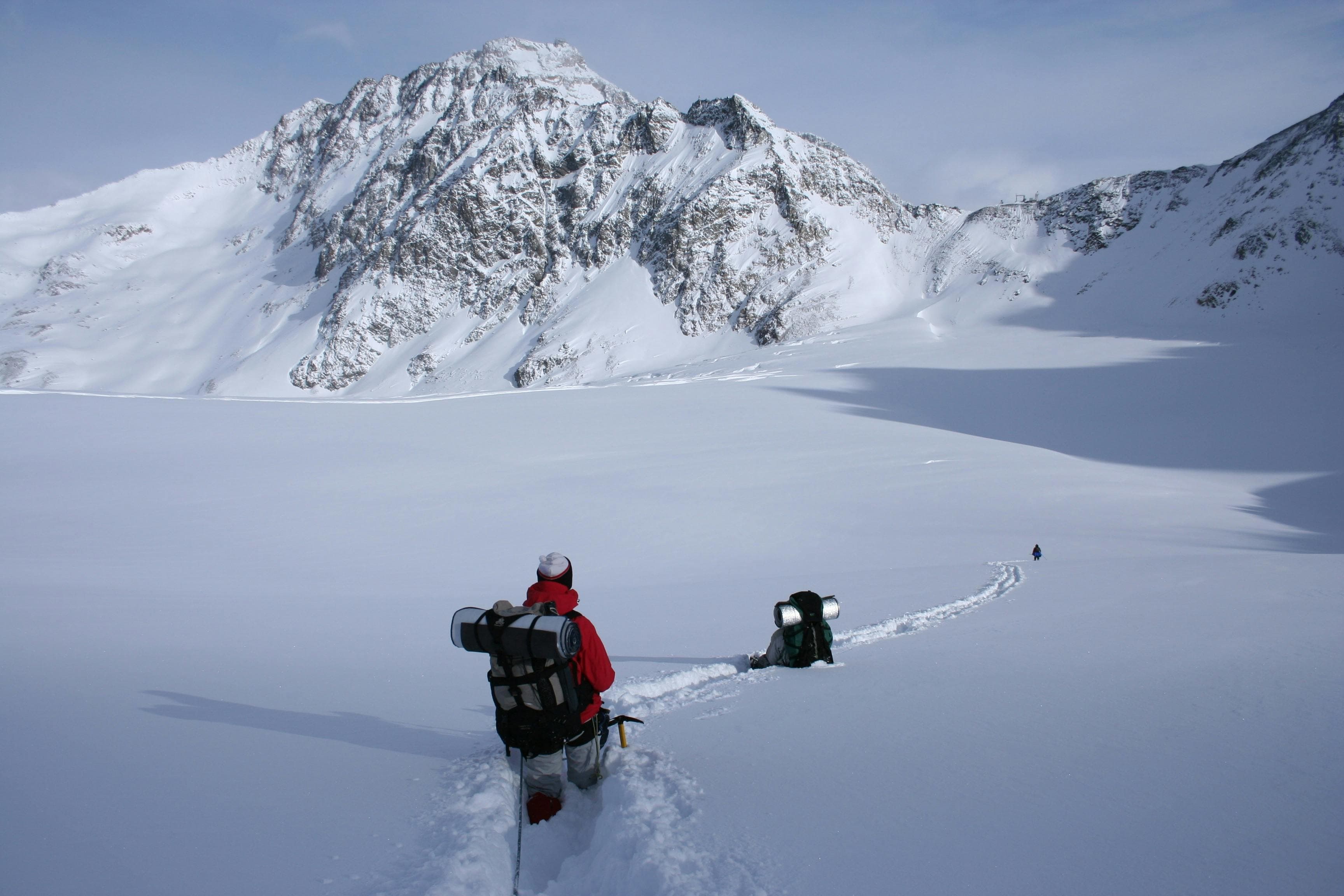
The ascent of Paldor Peak is an exciting mountaineering challenge that involves glacier travel, snow slopes, and the use of essential climbing equipment. While considered achievable for climbers with proper preparation, the expedition requires good physical fitness, acclimatization, and basic technical climbing skills. The combination of trekking through remote terrain and climbing in a high-altitude environment makes Paldor Peak a rewarding experience for those looking to progress in Himalayan mountaineering.
From the summit, climbers are rewarded with magnificent views of the surrounding Himalayan ranges, including Ganesh Himal, Langtang Lirung, Shishapangma, Manaslu, and numerous snow-covered peaks stretching across the horizon. The summit experience reflects the true spirit of Himalayan adventure, where dedication, endurance, and exploration come together.
Unlike many of Nepal's popular trekking peaks, Paldor Peak offers a quieter and more authentic expedition experience. The remote trails, untouched landscapes, and cultural encounters make this climb a unique journey through one of Nepal's hidden mountain regions. With careful planning, proper acclimatization, and professional support, Paldor Peak Climbing delivers a memorable Himalayan adventure filled with challenge, discovery, and achievement.
Arrival at Tribhuwan International Airport. Our Staff member meets you and transfers you to the hotel.
Overnight stay at a hotel
After breakfast at the hotel, our guide will meet you at the hotel and provide a briefing about the upcoming trek, including the itinerary, safety information, and important preparations. He will also assist you with all the necessary trekking formalities and paperwork.
After the briefing, we will go on a sightseeing tour around the Kathmandu Valley, visiting famous UNESCO World Heritage Sites such as Boudhanath Stupa, one of the largest Buddhist stupas in the world, and Swayambhunath Stupa, also known as the Monkey Temple. On this day, we will also arrange the TIMS card and other required permits for the trek.In the evening, you will have time to prepare your trekking gear and make the final arrangements for the journey ahead. Overnight stay at a hotel.
Today, we begin our journey with a drive from Kathmandu to Syabrubesi (1,460 m / 4,790 ft), the gateway to the Langtang region and the starting point of the Yubra Himal expedition.
The drive takes approximately 7 – 9 hours and covers about 120–130 km (75–81 miles), depending on road and traffic conditions.
Leaving Kathmandu, we follow winding mountain roads northwest through scenic hills, terraced farmland, and traditional rural settlements. The route passes alongside rivers, forested ridges, and small roadside towns, gradually transitioning from the busy capital into the quieter Himalayan foothills.
As we approach the Langtang region, the road becomes narrower and more rugged, offering dramatic views of deep valleys, waterfalls, and distant snow-capped peaks. The final section descends into the river valley leading to Syabrubesi.
Finally, we arrive at Syabrubesi, a small mountain town situated along the Bhote Koshi River. It serves as the main trailhead for treks and expeditions into Langtang National Park. Overnight stay at a guesthouse in Syabrubesi.
Today, we begin our trek from Syabrubesi (1,460 m / 4,790 ft) to Gatlang Village (around 2,238 m / 7,343 ft), entering the culturally rich Tamang heritage region north of Langtang.
The trek takes approximately 5 – 7 hours and covers about 10 – 12 km (6–7.5 miles) as we steadily ascend through forested hillsides and traditional mountain settlements.
Leaving Syabrubesi, the trail crosses the Bhote Koshi River before climbing through terraced farmland, pine forests, and small Tamang villages. As we gain elevation, the scenery gradually opens with views of surrounding hills and distant Himalayan peaks.
The route passes through quiet rural landscapes where traditional stone houses, prayer flags, and Buddhist chortens reflect the strong Tibetan Buddhist influence of the region. Some sections are steep and physically demanding, but the cultural atmosphere and mountain scenery make the climb rewarding.
Finally, we arrive at Gatlang Village, a traditional Tamang settlement known for its stone-built homes, rich culture, and panoramic mountain views. Overnight stay at a guesthouse in Gatlang.
Today, we continue our trek from Gatlang Village to Somdang (3,270 m / 10,728 ft), gradually ascending into the more remote alpine landscapes of the Langtang and Ganesh Himal region.
The trek takes approximately 6 – 8 hours and covers about 12 – 14 km (7.5–8.5 miles) as we steadily gain elevation through forests, ridgelines, and isolated mountain terrain.
Leaving Gatlang, the trail climbs through terraced hillsides, pine forests, and rhododendron woodland before reaching the sacred Parvati Kunda area. As we continue higher, the landscape becomes more rugged and open, offering expanding views of the surrounding Himalayan ridges and deep valleys below.
The route passes through quiet grazing areas and remote mountain paths with fewer settlements, creating a peaceful wilderness atmosphere. Long uphill sections and increasing altitude make the day physically demanding but highly rewarding.
Finally, we arrive at Somdang, a remote alpine settlement known for its old mining area and dramatic mountain surroundings. Overnight stay at a guesthouse or basic lodge in Somdang.
Continuing our journey from Somdang (3,270 m / 10,728 ft), we trek toward Lari (4,868 m / 15,971 ft), ascending into the high alpine terrain of the Ganesh Himal region.
The trek takes approximately 5–7 hours and covers about 6 – 8 km (3.7 – 5 miles) as we gain significant elevation through rugged mountain landscapes and remote grazing areas.
Leaving Somdang, the trail climbs steadily through rhododendron forests, rocky hillsides, and open alpine terrain with increasingly dramatic views of Ganesh Himal, Manaslu, and surrounding Himalayan ranges. Vegetation gradually becomes sparse as the environment transitions into a colder and more exposed high-altitude landscape.
The route is physically demanding due to the steep elevation gain and thinner air, but the surrounding mountain scenery and remote wilderness atmosphere make the ascent highly rewarding.
Finally, we arrive at Lari, a remote high-altitude campsite surrounded by rugged Himalayan terrain and close views of nearby glacier systems and peaks. Overnight stay at camp in Lari.
An acclimatization day at Lari (4,868 m / 15,971 ft) is an important rest and preparation stop in the high-altitude section of the expedition, allowing the body to adjust before moving toward higher camps and passes.
This day is kept flexible for rest, hydration, and short exploratory hikes around the surrounding alpine terrain. A common option is a gradual hike to nearby ridges or viewpoints above camp, gaining and losing elevation to support proper acclimatization while staying within safe limits.
The surroundings of Lari offer dramatic high-mountain scenery, with views of Ganesh Himal, surrounding ridgelines, and distant Himalayan peaks. The landscape is fully alpine, with rocky terrain, glacial influences, and sparse vegetation, reflecting the high altitude environment.
Throughout the day, trekkers focus on recovery, slow movement, and preparation for the next ascent phase of the journey. This acclimatization stop plays a key role in improving safety and performance for the higher sections ahead. Overnight stay at camp in Lari.
From Lari, we continue our ascent to Paldor Base Camp (5,000 m / 16,404 ft), moving deeper into the high alpine and glacial terrain of the Ganesh Himal region.
The trek takes approximately 4 – 6 hours and covers about 5 – 7 km (3 – 4.5 miles), depending on snow conditions and the exact approach route.
We begin by gradually leaving Lari and traversing across rugged alpine slopes, moraine ridges, and glacially influenced terrain. The landscape becomes increasingly stark and exposed, with fewer signs of vegetation as we gain elevation.
As we ascend, we are rewarded with wide views of Ganesh Himal, Paldor Peak, and surrounding Himalayan ridgelines, creating a dramatic high-mountain atmosphere. The trail is remote and less defined, requiring careful movement across uneven and sometimes icy ground.
Finally, we arrive at Paldor Base Camp, a high-altitude campsite set beneath the towering slopes of Paldor Peak. The location offers a true expedition setting, surrounded by glaciers, rock faces, and vast Himalayan scenery. Overnight stay at base camp in tents.
From Paldor Base Camp, we continue our ascent to High Camp (5,500 m / 18,045 ft), moving deeper into the high alpine and glacial zone of the Ganesh Himal region.
The trek takes approximately 4 – 6 hours and covers about 3 – 5 km (2–3 miles), depending on snow conditions and the chosen line across moraine and glacier terrain.
We begin by gradually leaving Base Camp and ascending through rugged moraines, rocky slopes, and snow-covered sections. The terrain becomes increasingly steep and exposed, with fewer defined paths as we enter higher alpine ground.
As we gain altitude, the surroundings open up with dramatic views of Paldor Peak, Ganesh Himal, and surrounding Himalayan ridges, creating a true expedition atmosphere in a remote mountain environment.
Finally, we arrive at High Camp, a small, exposed campsite set in a high glacial basin. This serves as the final staging point before the summit push, surrounded by ice, rock, and towering Himalayan peaks. Overnight stay in tents at High Camp.
From High Camp (5,500 m / 18,045 ft), we begin the summit push to Paldor Peak (5,896 m / 19,344 ft) and descend back to Base Camp (5,000 m / 16,404 ft), completing a full high-altitude summit day in the Ganesh Himal region.
The total duration of this journey is approximately 9–14 hours, depending on weather, snow conditions, and team pace.
We start before dawn from High Camp, climbing steep snow slopes, mixed alpine terrain, and exposed ridgelines. As we gain altitude, the environment becomes increasingly technical, with sections that may require rope support depending on conditions. The final approach to the summit is steep and demanding, with thin air and challenging terrain.
From the summit of Paldor Peak (5,896 m), we are rewarded with panoramic views of Ganesh Himal, Langtang ranges, and distant Himalayan peaks, stretching across the horizon.
After a short stay at the summit, we carefully descend back through High Camp and continue down to Paldor Base Camp, retracing glacial and moraine sections. Although the descent is faster than the ascent, it remains technical and requires caution due to fatigue and terrain.
Overnight stay at base camp in tents
The Contingency Day in the Paldor Peak expedition is a flexible buffer day included to manage unpredictable mountain conditions and ensure a safe and successful summit of Paldor Peak (5,896 m / 19,344 ft).
This day may be used if weather, snow, or acclimatization conditions delay the summit attempt, providing an extra opportunity to choose the best and safest climbing window. If the summit has already been completed, it serves as a rest and recovery day at Base Camp.
Overall, the reserve day adds essential flexibility to the expedition, improving safety and increasing the chances of a successful ascent in the high Himalayas.
From Paldor Base Camp, we begin our descent back to Somdang (3,270 m / 10,728 ft), leaving the high alpine zone of the Ganesh Himal region.
The trek takes approximately 5 – 7 hours and covers about 7 – 9 km (4.3–5.6 miles) as we gradually descend through rugged mountain terrain.
We start by carefully descending across moraine ridges, rocky slopes, and glacial terrain. As we lose altitude, the landscape slowly transitions into alpine meadows and more defined trails.
Further down, vegetation increases and the surroundings become greener with pine forests and wider valley views. Although the descent is less technical than the ascent, some steep and loose sections still require careful footing.
Finally, we arrive at Somdang, a quiet mountain settlement known for its remote setting and historic mining background, where we rest after the high-altitude expedition section.
Overnight stay in Somdang.
From Somdang (3,270 m / 10,728 ft), we begin our descent to Gatlang Village (2,238 m / 7,343 ft), leaving the high alpine region of the Ganesh Himal and re-entering the lush lower hills of the Tamang settlements.
The trek takes approximately 5 – 7 hours and covers about 9 – 11 km (5.5–6.8 miles) as we descend through varied mountain terrain.
We start by leaving Somdang and following trails across rocky ridges, alpine slopes, and forested sections. As we lose elevation, the landscape gradually becomes greener with rhododendron and pine forests replacing the high-altitude terrain.
The route passes through quiet grazing areas and remote hillside paths, with occasional views of surrounding valleys and Himalayan ridges. Some steep sections require careful footing, especially on the descent.
Finally, we arrive at Gatlang Village, a traditional Tamang settlement known for its stone houses, cultural heritage, and peaceful mountain surroundings.
Overnight stay at a guesthouse in Gatlang.
From Gatlang Village, we descend to Tatopani (870 m / 2,854 ft), leaving the mid-hill Tamang settlements and moving toward the lower river valleys.
The trek takes approximately 5 – 7 hours and covers about 12 – 14 km (7.5–8.5 miles) as we steadily descend through varied terrain.
We begin by leaving Gatlang and following trails through terraced farmland, forested hillsides, and traditional rural paths. As we lose elevation, the landscape gradually transitions from cool alpine hills to warmer, subtropical valley environments.
Along the way, we pass small villages, suspension bridges, and agricultural land, with continuous descent that can be demanding on the knees in steeper sections but becomes gentler near the lower valley.
Finally, we arrive at Tatopani, a riverside settlement famous for its natural hot springs, offering a relaxing stop after the long descent.
From Tatopani (around 870–900 m / 2,854–2,953 ft), we set out on a full-day hike to Nagthali Ghyang (around 3,165 m / 10,384 ft) and return, exploring one of the most scenic ridge viewpoints in the Tamang Heritage region.
The trek takes approximately 6 – 8 hours round trip and covers about 10 – 12 km (6–7.5 miles) through varied terrain of forests, villages, and alpine ridges.
We begin with a steady climb from Tatopani, passing through traditional Tamang settlements, terraced farmland, and dense pine and rhododendron forests. The ascent is continuous and can be steep in sections, especially as we approach higher ridgelines.
As we gain elevation, the forest opens up to expansive mountain views, with increasing visibility of Langtang Lirung, Ganesh Himal, and surrounding Himalayan ranges. The air becomes cooler and the landscape shifts into a more alpine setting.
At Nagthali Ghyang, a peaceful ridge-top viewpoint and monastery area, we take time to rest and enjoy panoramic 360-degree Himalayan scenery, along with the tranquil spiritual atmosphere of the site.
After spending time at the viewpoint, we descend carefully back through the same forested and village trails to Tatopani.
Overnight stay in Tatopani.
From Tatopani (around 870 – 900 m / 2,854–2,953 ft), we begin our final trekking section back to Syabrubesi (1,460 m / 4,790 ft), descending through the lower hills of the Rasuwa region and gradually reconnecting with the main trailhead area.
The trek takes approximately 5 – 7 hours and covers about 10 – 12 km (6–7.5 miles) through forested hills, river valleys, and rural settlements.
We start by leaving Tatopani and following a mix of uphill and gradual trails through terraced fields, small Tamang villages, and forested sections. Although there is some ascent in the early part of the route, the overall journey gradually trends toward Syabrubesi.
As we continue, the trail passes through pine and mixed forests, with occasional suspension bridges and viewpoints overlooking deep valleys and surrounding hills. The landscape becomes more familiar as we re-enter the main trekking corridor of the Langtang region.
Finally, we arrive at Syabrubesi, the gateway town of the Langtang region, marking the completion of the trekking section of the journey. Overnight stay at a guesthouse in Syabrubesi
From Syabrubesi (1,460 m / 4,790 ft), we begin our drive back to Kathmandu (1,400 m / 4,593 ft), marking the final leg of the journey through the hills and river valleys of central Nepal.
The drive takes approximately 7 – 9 hours and covers about 120 – 130 km (75 – 81 miles), depending on road conditions and traffic.
We leave Syabrubesi and follow the winding mountain road along the Trishuli River, passing through forested hillsides, small towns, terraced farmland, and roadside settlements. The route offers a final glimpse of rural Nepal, with changing landscapes from deep valleys to rolling mid-hills.
As we approach Kathmandu Valley, the road becomes more developed and gradually transitions into urban surroundings. Traffic may slow the journey in the final stretch entering the city.
Finally, we arrive in Kathmandu, concluding the expedition and the return from the Langtang and Ganesh Himal region.
The departure day marks the conclusion of the expedition after completing the journey through the Langtang and Ganesh Himal region, including the approach to Paldor Peak (5,896 m / 19,344 ft) and the surrounding high-altitude trekking and climbing route.
After breakfast in Kathmandu (1,400 m / 4,593 ft), the morning is kept flexible for packing, final preparations, and reflecting on the completed adventure that included remote villages, alpine valleys, and the demanding ascent toward Paldor Peak.
At the scheduled time, a transfer is arranged to Tribhuvan International Airport for your onward flight. The drive provides a final glimpse of Kathmandu before departure.
This day officially concludes the expedition, leaving behind lasting memories of Paldor Peak, high mountain camps, glaciers, and the remote wilderness of the Ganesh Himal region.
Farewell and safe onward journey.