

Arrival at Tribhuwan International Airport. Our Staff member meets you and transfers you to the hotel.
Overnight at the hotel.
Manaslu Region

Trek Starting Point
Machhakhola

Trek Ending Point
Jagat

Departure From
Kathmandu

Transportation
Tourist Coach, Local Jeep

Style
High-altitude trekking & peak climbing

Meal
Breakfast, Lunch, Dinner

Accommodation
Tourist standard hotel in Kathmandu, Teahouse during trek
Larkya Peak (6,010 m / 19,720 ft) is a remote Himalayan summit located in Nepal's Manaslu region, offering a challenging alpine climbing experience away from the busier mountain routes. Rising above the high valleys surrounding the Manaslu Conservation Area, the peak combines remote trekking, glacier travel, and technical climbing in one of Nepal's most spectacular and remote mountain landscapes.
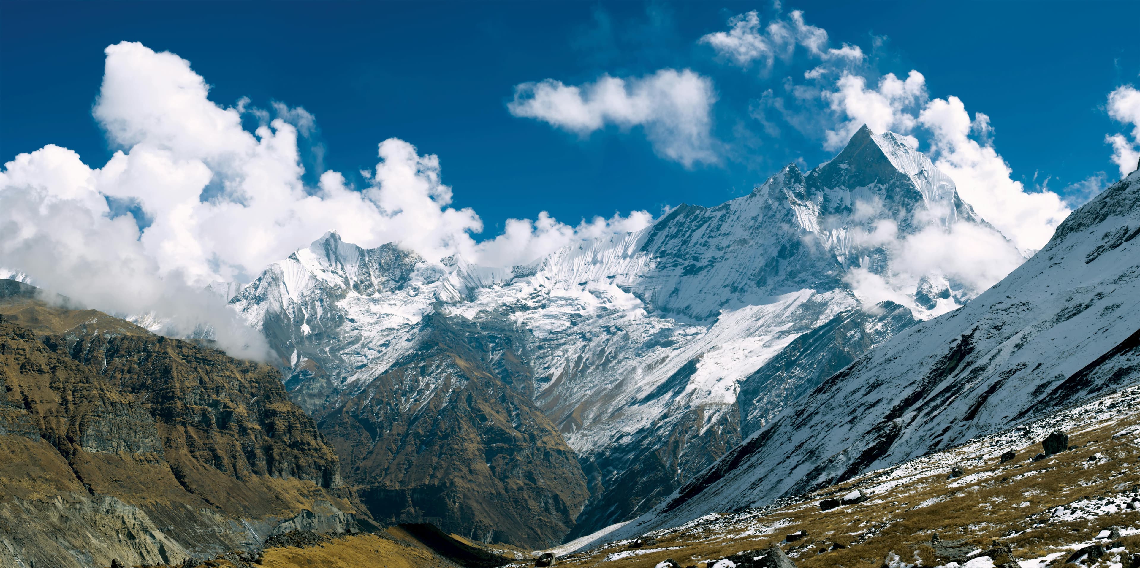
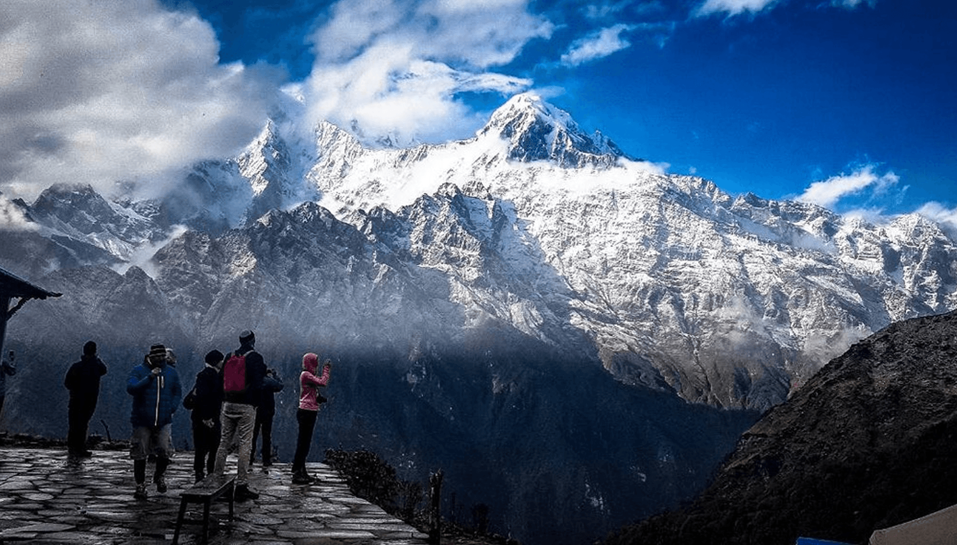
The expedition begins along the traditional Manaslu trekking route, passing through remote mountain villages, ancient settlements, forested valleys, and high alpine landscapes shaped by centuries of Himalayan culture. As the journey progresses beyond the lower valleys, the surroundings gradually transform into a rugged glacial environment, with snow-covered slopes, exposed ridgelines, and impressive views of Himalayan giants including Manaslu, Himlung Himal, and Cheo Himal.
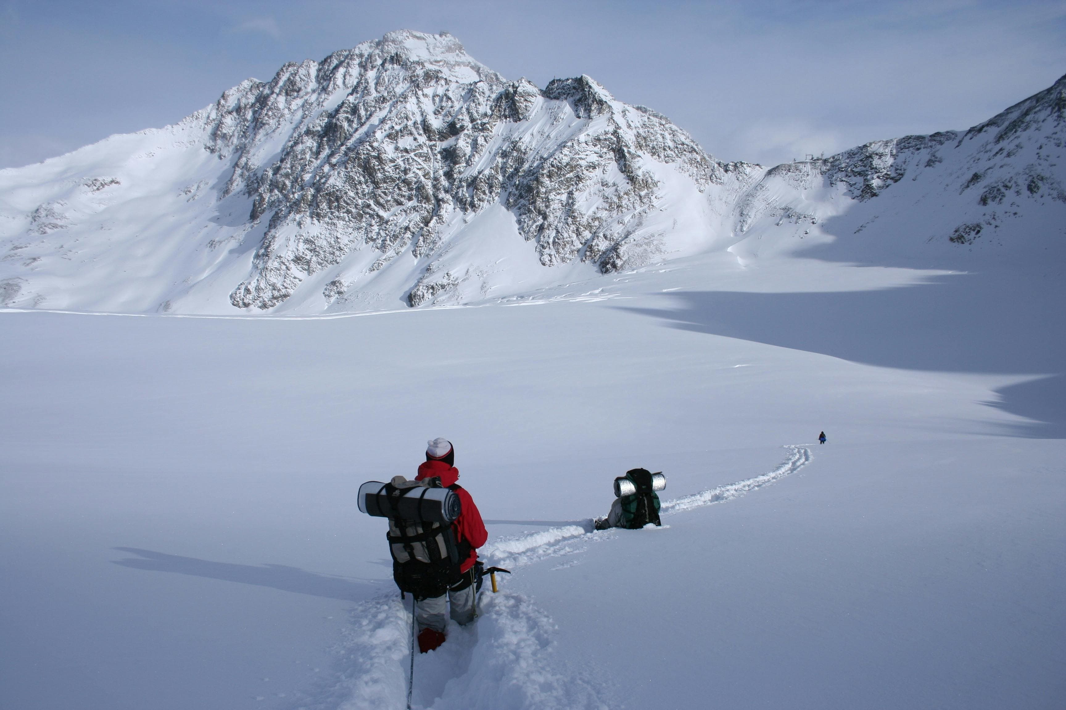
After reaching the higher alpine camps above 5,000 meters, the focus shifts toward the climbing phase. The ascent requires proper mountaineering skills, including crampon techniques, ice axe use, rope systems, and glacier travel. Climbers must be prepared for demanding high-altitude conditions, where careful movement, acclimatization, and teamwork are essential for a successful summit attempt.
The final push toward the summit involves challenging alpine terrain and the effects of extreme altitude. Reaching the top of Larkya Peak rewards climbers with panoramic views across the Manaslu region and the surrounding Himalayan ranges, including dramatic Himalayan landscapes extending toward the Tibetan plateau.
Less frequently climbed than many of Nepal's better-known trekking peaks, Larkya Peak provides a genuine sense of adventure and wilderness. Combining remote Himalayan exploration, technical climbing, and the beauty of the Manaslu region, this expedition is an ideal choice for experienced climbers seeking a serious and rewarding 6,000-meter mountain experience.
Arrival at Tribhuwan International Airport. Our Staff member meets you and transfers you to the hotel.
Overnight at the hotel.
After breakfast at the hotel, our guide will meet you for a detailed trip briefing covering the itinerary, route conditions, safety procedures, altitude considerations, and important preparations for the journey ahead. For peak climbing expeditions, the climbing guide will also check the required mountaineering equipment and provide guidance on any necessary gear adjustments before departure.
During the briefing, we will complete the required trekking and climbing formalities, including necessary permits and documentation. Afterward, we will explore some of Kathmandu Valley's cultural highlights, including UNESCO World Heritage Sites such as Boudhanath Stupa, one of the largest Buddhist stupas in the world, and Swayambhunath Stupa, also known as the Monkey Temple.
The rest of the day is free for final preparations, including organizing trekking equipment, purchasing any last-minute essentials, and making final arrangements before heading into the Himalaya. Overnight at the hotel.
After an early breakfast, we will begin our scenic drive from Kathmandu (1,400 m / 4,600 ft) toward Machhakhola(approximately 930 m / 3,051 ft), the gateway to the Manaslu region. The journey takes around 8 – 10 hours, depending on road and traffic conditions, and offers an exciting transition from the busy capital into the remote Himalayan foothills. Leaving Kathmandu Valley behind, the road follows the winding Trishuli River before continuing alongside the Budhi Gandaki River, passing through traditional villages, terraced farmland, waterfalls, and dense green hills.
As we travel deeper into the countryside, the scenery gradually changes from urban landscapes to rugged mountain terrain with occasional views of snow-capped peaks in the distance. The drive includes both paved highways and rough mountain roads, adding a sense of adventure to the journey. Along the way, we will pass through small roadside towns and local settlements where we can stop for tea breaks and lunch while experiencing rural Nepali life.
Upon reaching Machhakhola, a small riverside village nestled beside the Budhi Gandaki River, we can relax and prepare for the trekking days ahead. The peaceful surroundings, fresh mountain air, and sound of the rushing river create a perfect introduction to the Manaslu trekking region. Overnight at a guesthouse in Machhakhola.
After breakfast, we will begin our trek from Machhakhola to Jagat (1,340 m / 4,396 ft), following the scenic trail along the Budhi Gandaki River. The trek takes around 6 – 7 hours and covers approximately 14 – 15 km (9 miles), offering a rewarding introduction to the Manaslu region with its dramatic river valleys, suspension bridges, waterfalls, and traditional hillside villages.
The trail begins with gentle ascents and descents through lush forests and terraced farmland as we pass small settlements such as Khorlabesi and Tatopani, where natural hot springs can sometimes be seen nearby. Along the route, we will cross several suspension bridges over the roaring Budhi Gandaki River while enjoying impressive views of steep cliffs and cascading waterfalls. The path gradually climbs through narrow valleys and stone staircases, giving us our first real taste of trekking in the Himalayas.
As we approach Jagat, the landscape becomes more rugged and distinctly mountainous. Jagat is a charming stone-paved village that serves as an important checkpoint for trekkers entering the Manaslu Conservation Area. Surrounded by green hills and traditional houses, the village offers a peaceful atmosphere and beautiful mountain scenery. Overnight at a guesthouse in Jagat.
Today, we will continue our trek from Jagat (1,340 m / 4,396 ft) to Deng (1,860 m / 6,102 ft). The trek takes approximately 6 – 7 hours and covers around 18 – 20 km (11–12 miles), leading us deeper into the remote valleys of the Manaslu region. Along the way, we will experience changing landscapes, traditional villages, and increasingly impressive mountain scenery.
Leaving Jagat behind, the trail climbs gradually through terraced hillsides and forests before descending toward the Budhi Gandaki River. We will pass through the villages of Salleri and Sirdibas, where traditional stone houses and prayer flags reflect the region’s Tibetan cultural influence. The route continues through narrow gorges and dense pine forests, crossing several suspension bridges over the rushing river while offering dramatic views of cliffs and waterfalls.
Further along the trail, we will reach the village of Philim, a beautiful Gurung settlement known for its open landscapes and mountain views. From here, the path enters quieter and more remote terrain as we move through bamboo forests and riverside trails toward Deng. The atmosphere gradually changes as Tibetan-style culture becomes more noticeable in the architecture, mani walls, and prayer wheels along the route.
Nestled beside the Budhi Gandaki River, Deng is a peaceful mountain village surrounded by forested hills and rugged Himalayan scenery. The fresh mountain air and tranquil setting make it a perfect place to rest and prepare for the higher-altitude sections of the trek ahead. Overnight at a guesthouse in Deng.
Today, we will continue our trek from Deng (1,860 m / 6,102 ft) to Namrung (2,630 m / 8,628 ft). The trek takes approximately 6–7 hours and covers around 17 km (10.5 miles), leading us deeper into the upper Manaslu region where Tibetan culture and mountain scenery become increasingly prominent.
Leaving Deng behind, the trail crosses the Budhi Gandaki River several times on suspension bridges while passing through dense forests of pine and rhododendron. The route winds through small settlements such as Bihi Phedi and Ghap, where beautifully carved mani walls, chortens, and prayer flags reflect the strong Tibetan Buddhist influence of the region. Along the way, we will enjoy peaceful forest trails, cascading waterfalls, and impressive views of steep valleys and rugged cliffs.
As we gain elevation, the landscape gradually changes with cooler temperatures and more expansive mountain scenery. The trail continues through alpine forests and traditional stone villages before reaching Namrung, a charming village known for its Tibetan-style houses and stunning Himalayan panoramas. From here, magnificent views of peaks including Ganesh Himal and Siring Himal can often be seen on clear days.
Situated high above the Budhi Gandaki Valley, Namrung offers a tranquil atmosphere and marks an important transition into the high Himalayan section of the Manaslu Circuit. Overnight at a guesthouse in Namrung.
From Namrung (2,630 m / 8,628 ft), we will continue our trek to Samagaon (3,530 m / 11,581 ft). The trek takes approximately 6 – 7 hours and covers around 18 km, leading us deeper into the upper Himalayan valleys where the landscape opens dramatically and the views of Mount Manaslu become more striking.
The trail begins with a steady climb through beautiful alpine forests and traditional stone settlements. We pass through Lho, a scenic village known for its monastery and its first wide, close-up views of Manaslu, followed by Shyala, where the valley opens into vast panoramas surrounded by snow-covered peaks. Throughout this section, we are continuously accompanied by views of Manaslu, Himalchuli, and Ngadi Chuli rising above the surrounding ridges.
As the elevation increases, the vegetation becomes sparser and the terrain shifts into high-altitude yak grazing fields and broad, open landscapes. Prayer flags, mani walls, and chortens line the trail, reflecting the deep Tibetan Buddhist culture of the region. The air becomes noticeably thinner and cooler as we approach the higher Himalayas.
Finally, we arrive at Samagaon, a large and culturally rich village situated at the base of Mount Manaslu. Surrounded by glaciers, ancient monasteries, and expansive mountain scenery, it serves as one of the most important acclimatization stops on the Manaslu Circuit. Overnight at a guesthouse in Samagaon.
At Samagaon (3,530 m / 11,581 ft), we will spend a well-earned acclimatization day to allow the body to adjust to the increasing altitude before continuing further into the Manaslu region.
This rest day is important as it helps reduce the risk of altitude sickness while improving overall trekking comfort for the days ahead. Rather than complete rest, we will take short, gentle hikes around the village to support acclimatization.
One of the popular options is a hike to the ancient Pungyen Gompa, a serene monastery located above the valley with stunning views of the Manaslu Glacier and surrounding peaks. Another shorter option is a walk around the village itself, exploring traditional stone houses, yak pastures, and nearby viewpoints.
Samagaon is one of the most culturally rich settlements on the Manaslu Circuit, with strong Tibetan Buddhist influence visible in its monasteries, mani walls, and prayer flags. The village also offers impressive views of Mount Manaslu, especially during clear morning hours.
The remainder of the day can be used for rest, hydration, and preparation for the next stage of the trek toward higher altitudes. Overnight at a guesthouse in Samagaon.
From Samagaon (3,530 m / 11,581 ft), we will continue our trek to Samdo (3,875 m / 12,713 ft). The trek takes approximately 4 – 5 hours and covers around 7 – 9 km, making it a shorter but important ascent as we move closer to the Tibetan border region.
The trail begins with a gradual climb out of Samagaon, offering wide-open views of Mount Manaslu and the surrounding glaciers. As we leave the village behind, the landscape becomes more barren and alpine, with fewer trees and more rugged terrain. The path follows the Budhi Gandaki River valley, crossing gentle slopes, yak grazing pastures, and old mani walls that reflect the strong Tibetan influence of this region.
Along the way, we pass through Kermo Kharka, a seasonal herding area, where the scenery opens up dramatically with sweeping views of snow-covered peaks and windswept valleys. The air becomes noticeably thinner and colder as we gain elevation, marking our entry into a more remote high-altitude environment.
Eventually, we arrive at Samdo, a traditional Tibetan refugee village located very close to the Nepal–Tibet border. Surrounded by stark mountains and wide valleys, Samdo offers a peaceful yet dramatic Himalayan setting. The village is known for its unique culture, stone houses, and breathtaking mountain views, making it a memorable stop on the Manaslu Circuit. Overnight at a guesthouse in Samdo.
From Samdo (3,875 m / 12,713 ft), we will continue our trek to Dharamsala (Larkya Phedi) (4,460 m / 14,632 ft), the final stop before crossing the Larkya La Pass. The trek takes approximately 3 – 4 hours and covers around 6 – 7 km (3.7 – 4.3 miles), but the ascent is steady and noticeable due to the higher altitude and thinner air.
The trail begins with a gradual climb out of Samdo, crossing a wooden bridge and passing through wide, barren alpine landscapes shaped by strong winds and glacial activity. As we gain elevation, the vegetation disappears almost completely, and the scenery becomes stark yet incredibly dramatic, with expansive views of surrounding peaks and valleys near the Tibetan border.
Along the way, we may pass seasonal yak pastures and small rest points used by trekkers and herders. The trail is not technically difficult, but the altitude makes the pace slower and more deliberate, so steady walking and hydration are important.
Eventually, we reach Dharamsala (also known as Larkya Phedi), a basic high-altitude settlement located beneath the Larkya La Pass. Surrounded by rugged mountains and glacial terrain, it serves as the final acclimatization stop before the long pass crossing the following day. Overnight at a simple teahouse in Dharamsala.
From Dharamsala (Larkya Phedi) (4,460 m / 14,632 ft), we will make a short but important ascent to Larkya Base Camp, located near Larkya La Pass (approx. 5,100 m / 16,732 ft). This is a brief trekking section, taking around 1 – 2 hours and covering approximately 2 – 3 km, but it is a significant gain in altitude.
The trail climbs gradually over rocky and glacial moraine terrain, with increasingly expansive views of the surrounding Himalayan peaks and glaciers. As we move higher, the landscape becomes more rugged and exposed, with strong winds and thinning air becoming more noticeable. The environment here is stark yet dramatic, offering a true sense of high-altitude wilderness.
On arrival at Larkya Base Camp, we are surrounded by breathtaking views of snow-covered mountains and glacial landscapes beneath the towering Larkya La Pass. This area is typically used as a final preparation point for the pass crossing, though accommodation is very basic or sometimes arranged at Dharamsala depending on conditions and weather. Overnight stay at a tented camp in Base Camp.
From the Base camp area near Larkya Peak, we will ascend to High Camp (approximately 5,650 m / 18,536 ft). The climb takes around 4 – 5 hours, depending on snow conditions, route setting, and acclimatization status.
The trail is entirely in high-altitude alpine and glaciated terrain, with a steady and demanding ascent over snow slopes, moraine ridges, and potential crevassed sections. Progress will be slow and controlled, using fixed ropes where necessary and maintaining a careful, steady rhythm due to the thin air at this elevation.
As we gain height, the landscape becomes increasingly stark and exposed, with expansive views of surrounding Himalayan peaks and glaciers. The temperature drops significantly, and weather conditions can change quickly, so movement will be planned carefully and conservatively.
Upon reaching High Camp at around 5,650 m (18,536 ft), we will set up in a very basic expedition-style camp, rest, hydrate, and prepare for the final summit push of Larkya Peak the following day.
From High Camp on Larkya Peak (5,650 m / 18,536 ft), we will begin the early morning summit push to the peak at 6,010 m / 19,720 ft. The climb takes approximately 4 – 6 hours, depending on snow conditions, route setting, and acclimatization.
The ascent follows steep snow and ice slopes with sections of mixed alpine terrain. Movement will be slow and controlled, using ropes and technical climbing equipment where required. As we gain elevation, the air becomes extremely thin, and progress is steady with frequent short rest breaks.
Near the upper ridge, the terrain becomes more exposed, offering wide panoramic views of the Manaslu region, including surrounding peaks and glacier systems.
After reaching the summit of Larkya Peak, we will spend a short time at the top before beginning a careful and controlled descent back to High Camp. The descent typically takes 2 – 3 hours, depending on conditions, and requires equal caution due to steep and technical terrain.
We will return to High Camp (5,650 m) to rest, rehydrate, and recover after the summit effort. Overnight will be at High Camp or a lower camp depending on weather, team condition, and safety considerations.
Today is an extra contingency day reserved for the Larkya Peak expedition on Larkya Peak (6,010 m / 19,720 ft), allocated in case of bad weather conditions or altitude-related challenges such as Acute Mountain Sickness (AMS).
This additional buffer day ensures the safety and flexibility of the climbing schedule, which is essential in high-altitude mountaineering where conditions can change rapidly and unpredictably. Strong winds, snowfall, poor visibility, or health-related adjustments may require changes to the planned summit timeline.
If not needed for climbing adjustments, this day will serve as a full rest and recovery period at base camp or high camp, allowing the body to regain strength after prolonged exposure to high altitude.
This contingency day plays a critical role in maintaining expedition safety, improving summit success chances, and ensuring responsible decision-making in a demanding alpine environment. Overnight at a tented camp in Larkya High Camp
From High Camp on Larkya Peak (5,650 m / 18,536 ft), we will begin a long and demanding descent toward Bimthang(3,590 m / 11,778 ft), passing through high alpine terrain and crossing Larkya La Pass (5,160 m / 16,929 ft) along the way.
The day starts with a careful descent from High Camp over steep snow and mixed glacier terrain. Movement will be slow and controlled due to loose sections, icy slopes, and high-altitude exposure. As we lose elevation, breathing becomes easier, but attention is still required on technical and uneven ground.
We will rejoin the high route near Larkya La Pass, where we briefly pass the highest point of the traditional Manaslu crossing. After a short stop at the pass due to altitude and weather conditions, we continue our descent.
From the pass, the trail drops steadily into the valley toward Bimthang. The landscape gradually transforms from harsh glacial terrain into wider alpine meadows, moraine fields, and eventually greener valleys. Snow-covered peaks such as Manaslu, Lamjung Himal, and Himlung Himal remain visible for much of the descent, creating a dramatic backdrop.
After a long trekking day of approximately 8–11 hours and around 12–15 km (7.5–9 miles), we arrive at Bimthang, a beautiful glacial valley surrounded by towering mountains. Here we will rest and recover after completing one of the most challenging and rewarding sections of the expedition.
From Bimthang, we will continue our descent toward Dharapani (1,960 m / 6,430 ft), leaving behind the high alpine valleys and re-entering greener mid-hill landscapes.
The trek takes approximately 6 – 7 hours and covers around 18 – 20 km (11 – 12.5 miles), with a significant drop in elevation as we move down the Marsyangdi Valley. The trail begins with a gentle descent through the wide Bimthang valley, surrounded by stunning views of Manaslu, Lamjung Himal, and Himlung Himal.
We then follow a scenic forested trail through rhododendron and pine forests, crossing wooden bridges and passing through small seasonal settlements such as Karche. As we descend further, the landscape gradually becomes more lush and inhabited, with terraced fields and traditional villages appearing again.
The route continues along the Dudh Khola and Marsyangdi river systems, offering peaceful river-side walking sections and occasional views of cascading waterfalls and distant peaks. The air becomes warmer and richer in oxygen as we lose altitude, making the walk progressively easier.
Eventually, we reach Dharapani, a key junction village on the Annapurna and Manaslu trekking routes. Surrounded by forests and river valleys, Dharapani marks the transition back into more accessible mountain regions. Overnight at a guesthouse in Dharapani.
From Dharapani, we will continue our descent to Jagat (1,340 m / 4,396 ft), leaving the upper Marsyangdi Valley and re-entering the lower river gorges of the Manaslu region.
The trek takes approximately 5 – 6 hours and covers around 17 km (10.5 miles), with a steady descent along the Marsyangdi River. The trail begins with a gradual downhill walk through forested hills and scattered settlements, following well-established paths used by both Manaslu and Annapurna trekkers.
As we descend, we pass through several small villages and terraced landscapes, with sections of stone-paved trail and suspension bridges crossing the river. The scenery gradually shifts from alpine and mid-hill terrain to warmer subtropical vegetation, with more cultivated fields and denser habitation.
The route continues through peaceful river valleys and narrow gorges, with occasional views of waterfalls and steep cliffs along the way. As we approach Jagat, the landscape becomes more enclosed within the river canyon, marking a return to the lower trekking elevations.
We arrive at Jagat, a traditional stone village that serves as a key entry and exit point for the Manaslu Conservation Area. Overnight at a guesthouse in Jagat.
From Jagat, we will begin our return journey by road back to Kathmandu (1,400 m / 4,600 ft) via Besisahar. The drive takes approximately 8–10 hours and covers a total distance of around 200–220 km (124–137 miles), marking the final leg of the expedition.
The journey begins with a rugged descent from Jagat through river valleys, terraced hillsides, and winding mountain roads toward Besisahar. From there, we join the main highway system for a smoother drive back to Kathmandu, passing through rural towns, river corridors, and scenic mid-hill landscapes before reaching the bustling Kathmandu Valley.
As we approach Kathmandu, the scenery gradually transitions from quiet mountain terrain to a busy urban environment, marking the end of the Himalayan journey. Arrival is expected in the late afternoon or evening, depending on road and traffic conditions.
Depending on your flight schedule, you will be transferred from your hotel in Kathmandu (1,400 m / 4,600 ft) to Tribhuvan International Airport for your onward departure. This final moment brings the expedition to a close after an unforgettable journey through the remote valleys, high mountain passes, and technical alpine terrain of Larkya Peak (6,010 m / 19,720 ft).
As you depart, you leave behind the landscapes of the Manaslu region, the glaciers, ridgelines, and high-altitude camps that defined the experience. The expedition has come to an end, leaving you with lasting memories of the challenges overcome, the summit achievement, and the unique beauty of one of Nepal's most spectacular mountain regions.