

Arrival at Tribhuwan International Airport. Our Staff member meets you and transfers you to the hotel.
Overnight at the hotel.
Off-the-Beaten-Path Treks

Trek Starting Point
Darbang

Trek Ending Point
Jomsom

Departure From
Kathmandu

Transportation
Tourist Coach, Domestic flight

Style
Hiking and Trekking

Meal
Breakfast, Lunch, Dinner

Accommodation
camping
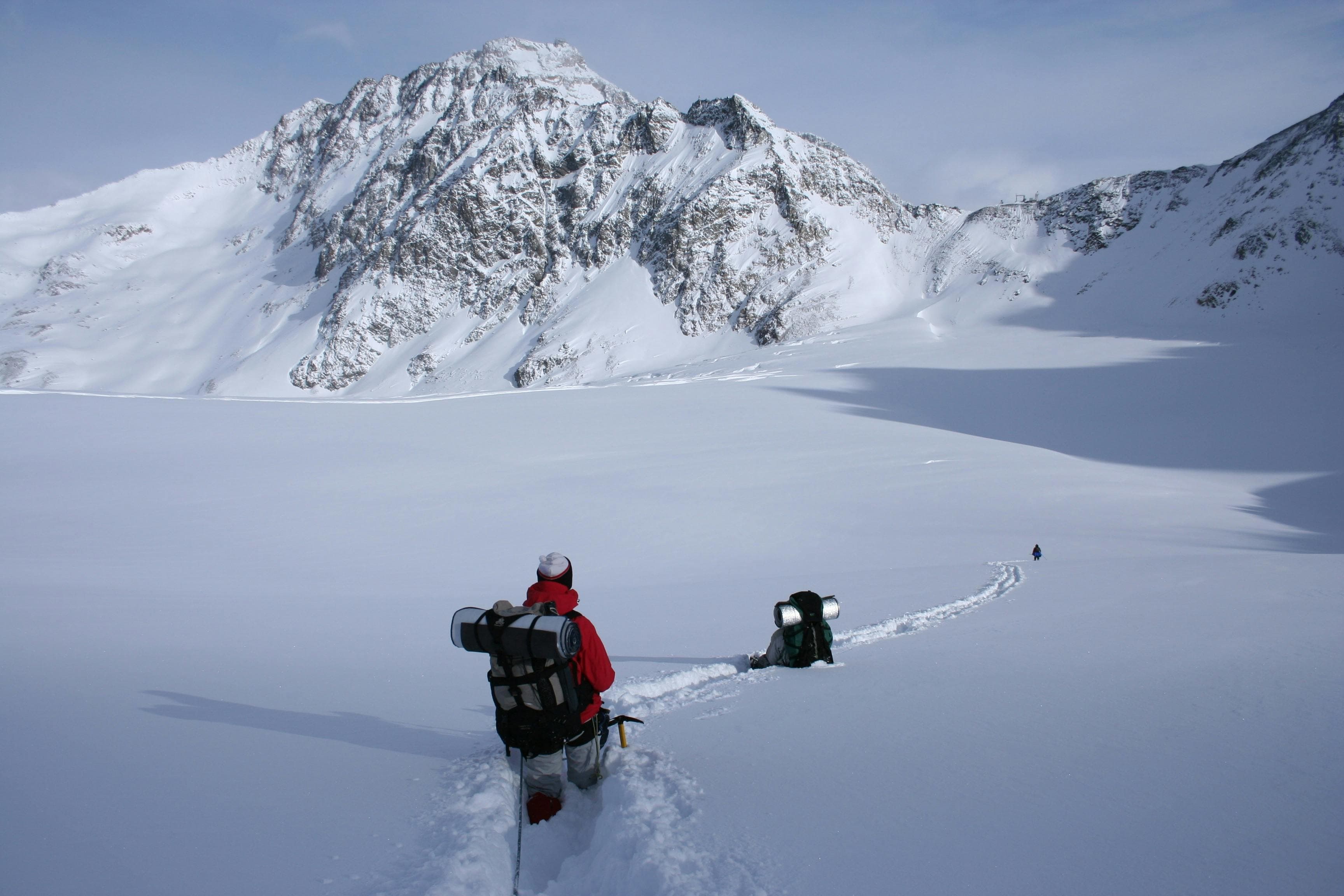
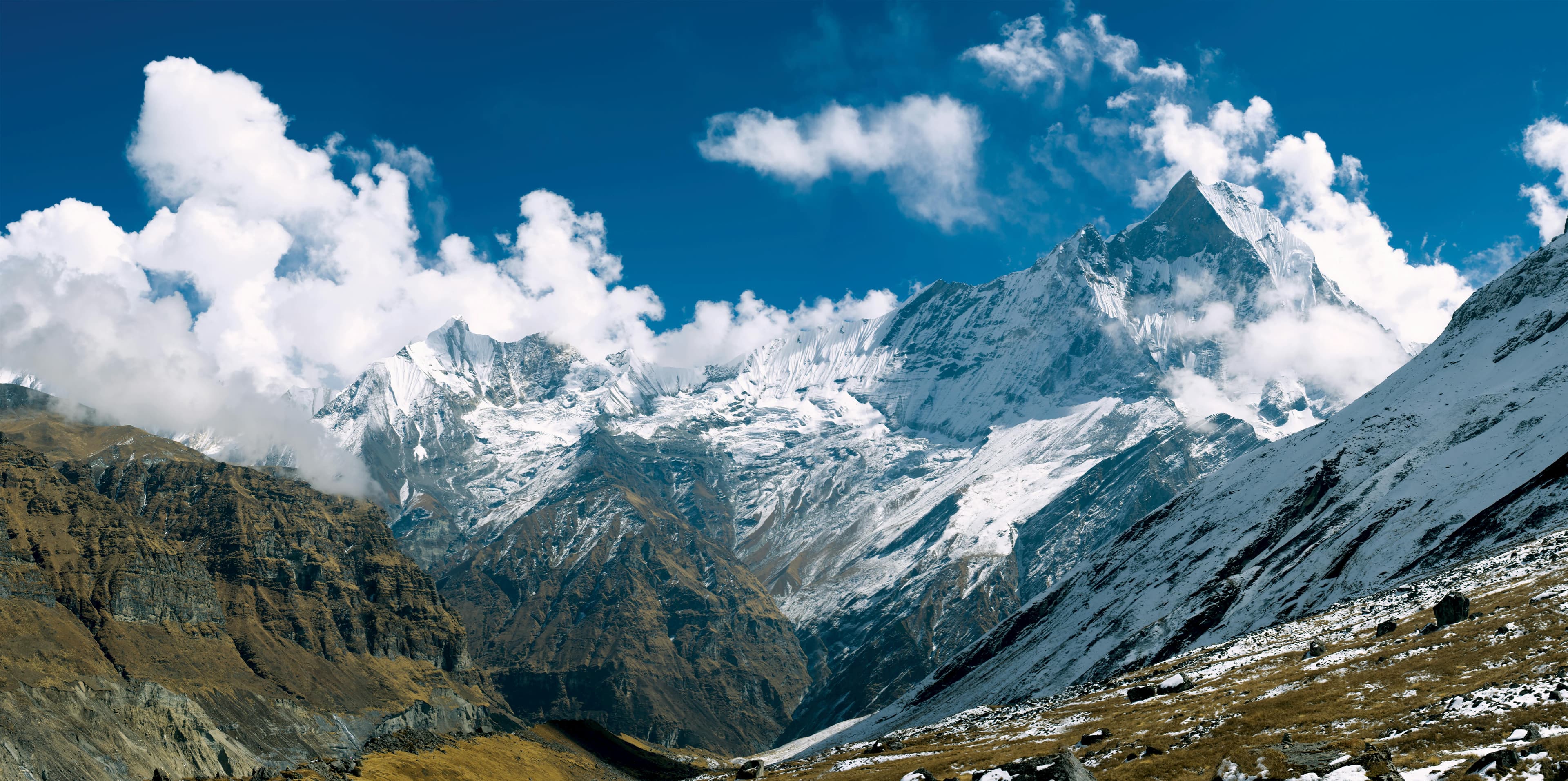
The Dhaulagiri Circuit Trek is one of Nepal's most remote and challenging high-altitude trekking adventures, circumnavigating Dhaulagiri I (8,167m), the world's seventh-highest mountain. Far beyond the country's more established trekking routes, this wilderness expedition crosses dramatic river valleys, isolated mountain settlements, and vast glacial landscapes, offering a true Himalayan adventure for experienced trekkers.
The trek begins in the lower Myagdi region, where the trail passes through traditional villages, terraced farmland, and dense rhododendron and bamboo forests. As the route gradually gains elevation, villages become fewer and the landscape transforms into rugged alpine terrain surrounded by towering Himalayan peaks. The journey passes through remarkable locations including Italian Base Camp, Dhaulagiri Base Camp, and Hidden Valley, while crossing high mountain passes such as French Col (5,360m) and Dhampus Pass (5,240m).
The remote nature of the Dhaulagiri Circuit makes it one of Nepal's most adventurous trekking routes. With limited infrastructure and several nights spent camping in high-altitude wilderness, the trek requires careful acclimatisation, strong preparation, and flexibility according to weather and trail conditions. The landscape changes dramatically throughout the journey, from lush valleys and forested hillsides to glaciers, ice-covered passes, and the immense mountain amphitheatres surrounding Dhaulagiri.
The Dhaulagiri Circuit Trek is best suited for experienced trekkers with excellent physical fitness and previous high-altitude trekking experience. The challenges are rewarded with an extraordinary journey through some of Nepal's most remote Himalayan landscapes, offering a rare combination of adventure, solitude, breathtaking mountain scenery, and an unforgettable wilderness experience.
Arrival at Tribhuwan International Airport. Our Staff member meets you and transfers you to the hotel.
Overnight at the hotel.
Morning wake-up and breakfast in the hotel
Our guide will meet you at your hotel and brief you about the upcoming trek. He will guide you through all the formalities and necessary paperwork required for the trek.
After that, we then do a sightseeing tour in Kathmandu Valley of famous UNESCO world heritage sites like Boudhanath, one of the largest Stupas in the world and Swayambhunath, a famous monkey temple. Apart from Sightseeing, we also get a TIMS card and permits for our trekking on this day. In the evening, we do initial preparation for the trek.
Overnight at the hotel.
After breakfast, we leave Kathmandu and drive to Pokhara, Nepal’s beautiful lakeside city and gateway to the Himalayas. The journey follows scenic river valleys, terraced hillsides, and rural settlements, offering a glimpse into everyday life in Nepal’s countryside.
The drive takes approximately 6 to 8 hours, depending on traffic and road conditions. Along the way, we pass several towns and enjoy views of the Trishuli River, rolling hills, and distant mountain ranges on clear days.
Upon arrival in Pokhara, we transfer to our hotel and have time to relax or explore the vibrant Lakeside area overlooking Phewa Lake. Overnight stay at a hotel.
After breakfast, we leave Pokhara and drive to Darbang (1,180 m), a bustling settlement in the Myagdi Valley and the traditional gateway to the Dhaulagiri region. The scenic drive takes approximately 4 to 5 hours, passing through terraced hillsides, riverside villages, and picturesque mountain landscapes.
Upon reaching Darbang, we begin our trek toward Dharapani (1,470 m). The trail follows the Myagdi Khola through cultivated farmland, small settlements, and forested sections, offering an enjoyable introduction to the trek and a glimpse into the daily life of local communities.
The trek takes around 3 to 4 hours before reaching Dharapani, a peaceful village surrounded by green hills and traditional farmland. Overnight stay at a teahouse.
We leave Dharapani in the morning and continue deeper into the Myagdi Valley, following a trail that blends riverside paths with gentle hillside climbs. The route passes through small Magar villages, terraced farmlands, and quiet forest sections, offering a genuine sense of rural mountain life away from main routes.
The trek takes around 5 to 6 hours, covering approximately 8 to 10 km. Along the way, we pass scattered hamlets and seasonal stopping points used by locals, while the valley gradually opens to wider views of rolling hills and distant ridgelines.
By late afternoon, we arrive at Muri (1,850 m), a beautiful ridge-top village known for its traditional stone houses, terraced fields, and sweeping mountain scenery. It is a peaceful and authentic Himalayan settlement, an ideal place to end the day’s walk. Overnight stay at teahouse.
We depart Muri in the morning, following a narrow trail that traces the ridge before easing down toward the river corridor. The path moves through terraced slopes, scattered Magar hamlets, and stretches of mixed forest, where the sound of the river gradually replaces the openness of the ridge views.
The walk takes around 5 to 6 hours, covering roughly 9 to 11 km, depending on the chosen line of the trail and ground conditions. It is a varied section, with short ascents and descents, river crossings, and quiet farming pockets where life feels steady and unchanged, shaped by the rhythm of the land.
By late afternoon, we arrive at Boghara (2,080 m), a small and remote settlement tucked into the hillside above the valley. Surrounded by forest and farmland, it offers a simple, peaceful stop with basic lodge accommodation and a strong sense of remoteness. Overnight stay at a teahouse.
We leave Boghara in the morning and enter a more remote section of the valley, where the trail alternates between riverside paths and forested ascents. The route passes through bamboo groves, landslide-prone slopes, and narrow sections carved into the hillside, gradually feeling more isolated as we move deeper into the Dhaulagiri region.
The trek takes around 6 to 7 hours, covering approximately 12 to 13 km, depending on trail conditions and river crossings. It is a varied and engaging section where terrain dictates pace more than distance, with frequent changes between open river views and enclosed forest pathways.
By late afternoon, we arrive at Dobang (2,500 m), a quiet forest settlement surrounded by steep valley walls and dense vegetation. With basic lodge facilities, it offers a simple but atmospheric stop deep in the wilderness. Overnight stay at a teahouse.
Setting out from Dobang, the trail leads us deeper into the forested heart of the Dhaulagiri valley. The route follows the Myagdi Khola through dense bamboo and rhododendron forest, where the sound of flowing water and shifting light through the trees define the rhythm of the day. This is a quieter, more isolated section, with only occasional clearings and signs of seasonal herding activity.
The trek takes around 5 to 7 hours, covering approximately 8 to 10 km, depending on trail conditions and river crossings. The terrain remains varied, with steady ascents, uneven forest paths, and sections that require careful movement, especially after rain or landslides.
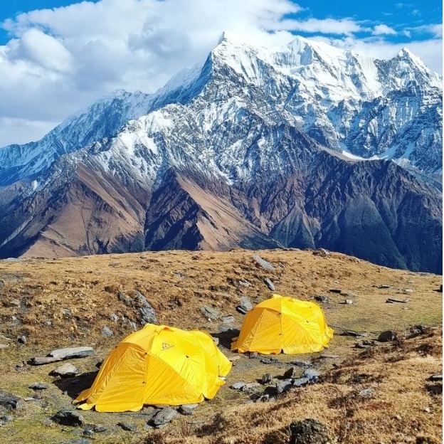
By late afternoon, we reach Sallaghari (2,820 m), a remote forest campsite surrounded by thick vegetation and bamboo groves. With no permanent settlement, it offers a simple and atmospheric stop deep in the wilderness. Overnight stay at a tented camp.
Leaving Sallaghari, the trail gradually leaves the dense forest behind and begins to open into a wider, more alpine landscape. The route follows the Myagdi Khola upstream, passing through sections of bamboo, scattered clearings, and increasingly rugged terrain where the valley walls rise more sharply on either side. This is a transitional day, where the wilderness begins to feel more raw and glacial in character.
The trek takes around 5 to 7 hours, covering approximately 7 to 9 km, depending on trail conditions and river crossings. The path includes steady ascents, occasional rocky sections, and exposed stretches where the landscape becomes more barren as we gain elevation.
By late afternoon, we reach Italian Base Camp (3,660 m), a broad glacial basin surrounded by towering peaks and hanging ice walls. The campsite offers a dramatic first close-up view of the Dhaulagiri range, marking a significant step into high-altitude terrain. Overnight stay at a tented camp.
We spend the day at Italian Base Camp (3,660 m), allowing the body to properly adjust to the higher altitude before continuing deeper into the Dhaulagiri region. This is an important rest day, though we remain active with short exploratory walks around the glacial basin to support acclimatisation.
The surrounding landscape offers striking views of Dhaulagiri’s ice walls, hanging glaciers, and surrounding peaks. Depending on conditions, we may take a short hike toward nearby viewpoints, gradually gaining and descending altitude to help the body adapt more effectively.
The remainder of the day is spent resting at camp, preparing equipment, and reviewing the route ahead with the guide team. Overnight stay at Italian Base Camp.
We leave Italian Base Camp and enter the heart of the high glacial system, where the trail climbs steadily over moraine ridges and ice-carved terrain. The route passes through a series of established high camps, including Swiss, French, and Japanese Camp, each marking stages of progression deeper into the Dhaulagiri Glacier basin.
The trek takes around 6 to 8 hours, covering approximately 9 to 11 km, depending on snow and glacier conditions. The walk is slow and demanding, with uneven ground, altitude effects, and continuous changes in terrain as we move through one of the most remote sections of the entire route.
By late afternoon, we reach Dhaulagiri Base Camp (4,700 m), set directly beneath the immense west face of Dhaulagiri I. The campsite sits in a vast amphitheatre of ice, rock, and glaciers, offering a powerful sense of scale and isolation. Surrounded by towering peaks and shifting ice formations, it is one of the most dramatic high-altitude environments in the Himalayas. Overnight stay at a tented camp.
From Yak Kharka, we begin a long and steady descent that gradually takes us out of the high alpine world and into the dry valleys of Mustang. The trail moves through open hillside paths and river corridors, passing scattered seasonal settlements and wide, wind-shaped landscapes where vegetation becomes increasingly sparse.
The trek takes around 6 to 8 hours, covering approximately 18 to 20 km, depending on trail conditions and route variations. It is a continuous downhill walk, though the distance feels substantial as the route follows the natural curves of the valley and crosses extended sections of barren terrain.
By late afternoon, we arrive at Jomsom (2,670 m), the administrative hub of the region, set along the Kali Gandaki Valley. Known for its strong winds and striking mountain backdrop, Jomsom offers a more settled environment after days in remote high-altitude terrain. Overnight stay at a teahouse.
Early in the morning, we board a short and scenic mountain flight from Jomsom to Pokhara. As the aircraft soars above the dramatic Kali Gandaki Valley, we enjoy breathtaking views of the Annapurna and Dhaulagiri ranges along with the world’s deepest gorge carved by the Kali Gandaki River. After landing in Pokhara, we transfer to our hotel and take some time to relax. In the evening, we stroll around the lively Lakeside area, enjoying the serene atmosphere by Phewa Lake. We may also visit popular attractions such as Mahendra Cave, Davis Falls, and the Peace Stupa, making the day both relaxing and memorable.
Overnight stay at a hotel.
After breakfast, we begin our scenic drive from Pokhara to Kathmandu along the picturesque Prithvi Highway. The journey takes approximately 6–8 hours, depending on road and traffic conditions. As we follow the winding road beside the Trishuli River, we pass through charming villages, terraced hillsides, and lush green landscapes, offering beautiful views throughout the drive. Upon arrival in Kathmandu, we transfer to our hotel and relax after the long but rewarding journey. In the evening, you may explore the vibrant streets of Thamel or enjoy a traditional Nepali dinner. Overnight stay at a hotel.
Alternative: You can also take a domestic flight from Pokhara to Kathmandu. The duration of the flight is about 30 Minutes. One-way flight costs around 125 USD per Person. We can make a flight reservation for you. Please let us know.
After breakfast in Kathmandu, you will have free time depending on your flight schedule. If time allows, you may take a short walk around the hotel area or do some last-minute shopping in the city.
At the appropriate time, we transfer you to Tribhuvan International Airport, Kathmandu (1,400 m) for your onward journey. This marks the end of your Dhaulagiri Circuit Trek, taking with you lasting memories of the mountains, valleys, and cultural landscapes experienced throughout the journey. We sincerely thank you for being part of this adventure and wish you safe travels home, carrying with you lasting memories of the mountains, the people, and the spirit of Nepal.