

Arrival at Tribhuwan International Airport. Our Staff member meets you and transfers you to the hotel.
Overnight at the hotel.
Off-the-Beaten-Path Treks

Trek Starting Point
Barpak

Trek Ending Point
Machhakhola

Departure From
Kathmandu

Transportation
Private Vehicle, Local Jeep

Style
Hiking and Trekking

Meal
Breakfast, Lunch, Dinner

Accommodation
Tourist standard hotel in Kathmandu, Teahouse during trek
The Rupina La Pass, Tsum Valley & Ganesh Himal Trek is one of Nepal's most rewarding wilderness expeditions, linking the remote crossing of Rupina La Pass with the culturally rich Tsum Valley and the spectacular alpine landscapes of Ganesh Himal Base Camp. Far from the country's more frequented trekking routes, this journey traverses untouched mountain terrain, isolated settlements, and centuries-old Buddhist communities, offering an exceptional combination of adventure, natural beauty, and cultural discovery.
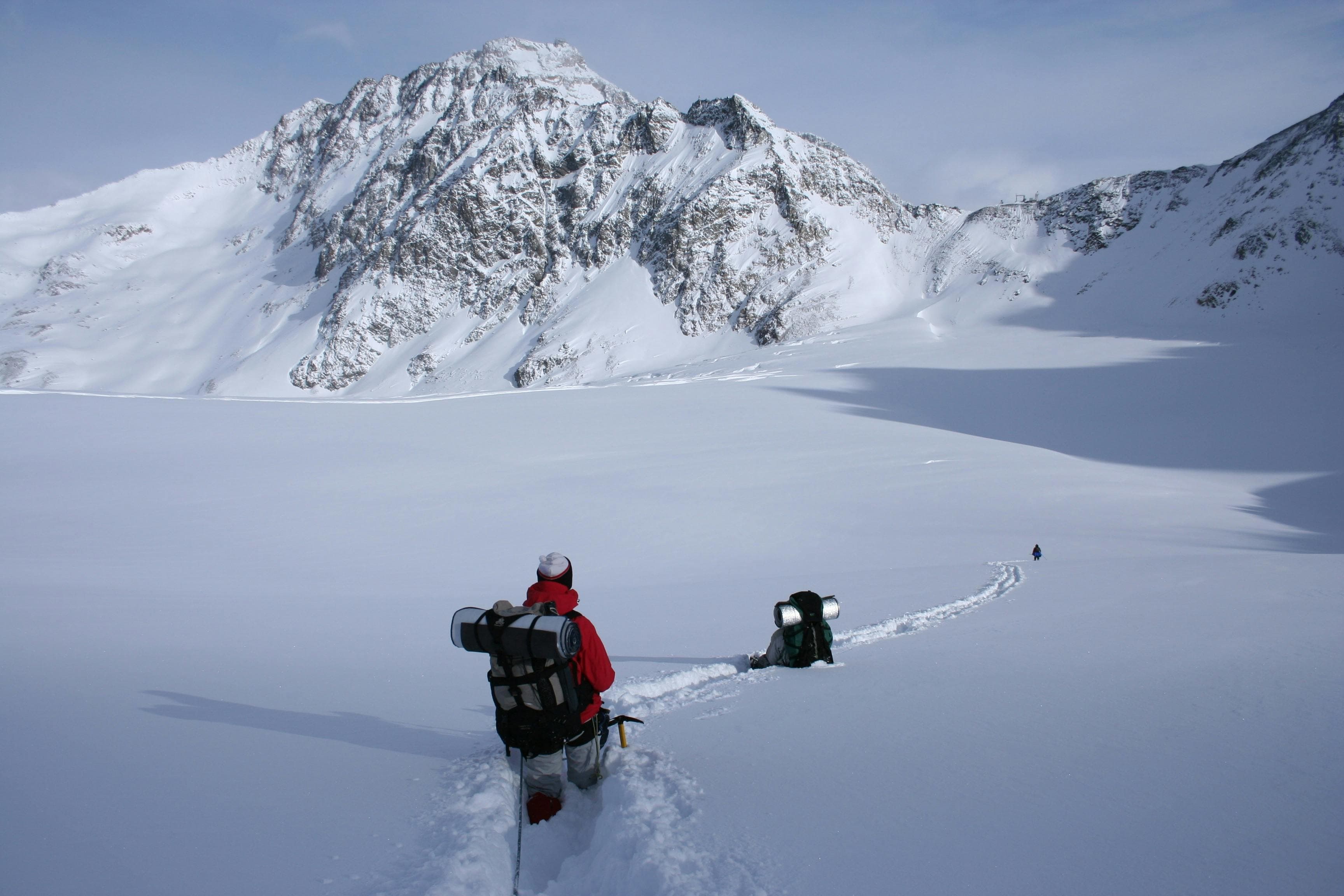
The trek begins in the hills of Gorkha, where traditional villages, terraced fields, and subtropical forests gradually give way to rugged alpine landscapes. Following little-used mountain trails, the route ascends through remote pastures and high ridgelines before reaching Rupina La Pass (4,720m). One of Nepal's lesser-known high mountain crossings, the pass rewards the effort with sweeping views of Manaslu, Ganesh Himal, Boudha Himal, and the surrounding Himalayan peaks. The sense of solitude and remoteness here is remarkable, making this section one of the most memorable highlights of the journey.
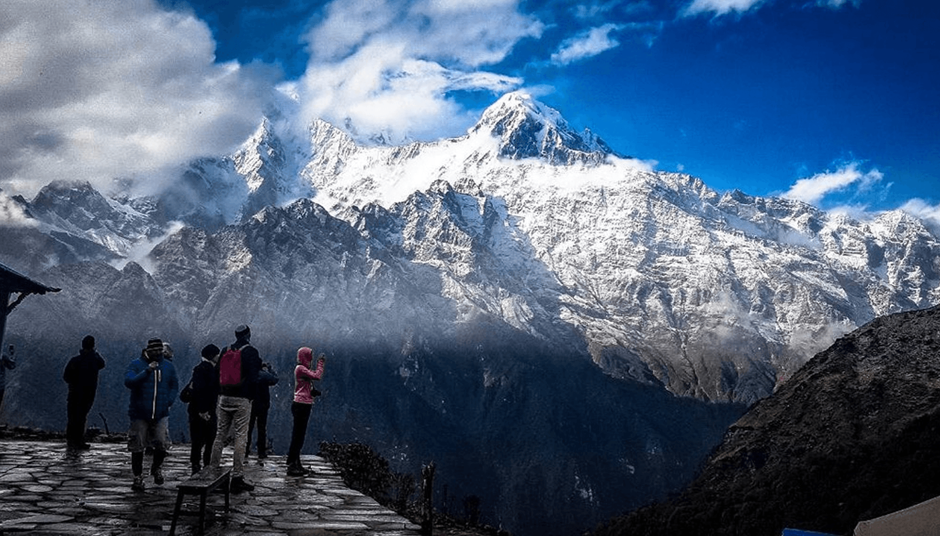
Beyond the pass, the trail descends through pristine grazing valleys and beneath the impressive slopes of Boudha Himal before entering the secluded Tsum Valley. Hidden from the outside world for centuries, Tsum remains one of the Himalaya's most culturally preserved regions, where Tibetan Buddhist traditions continue to shape everyday life. Ancient monasteries, intricately carved mani walls, prayer wheels, chortens, and traditional stone villages reflect a heritage that has been carefully maintained for generations. Walking through villages such as Chumling, Chhokang Paro, Nile, and Mu Gompa offers not only magnificent mountain scenery but also a rare opportunity to experience a living Himalayan culture that remains largely unchanged.
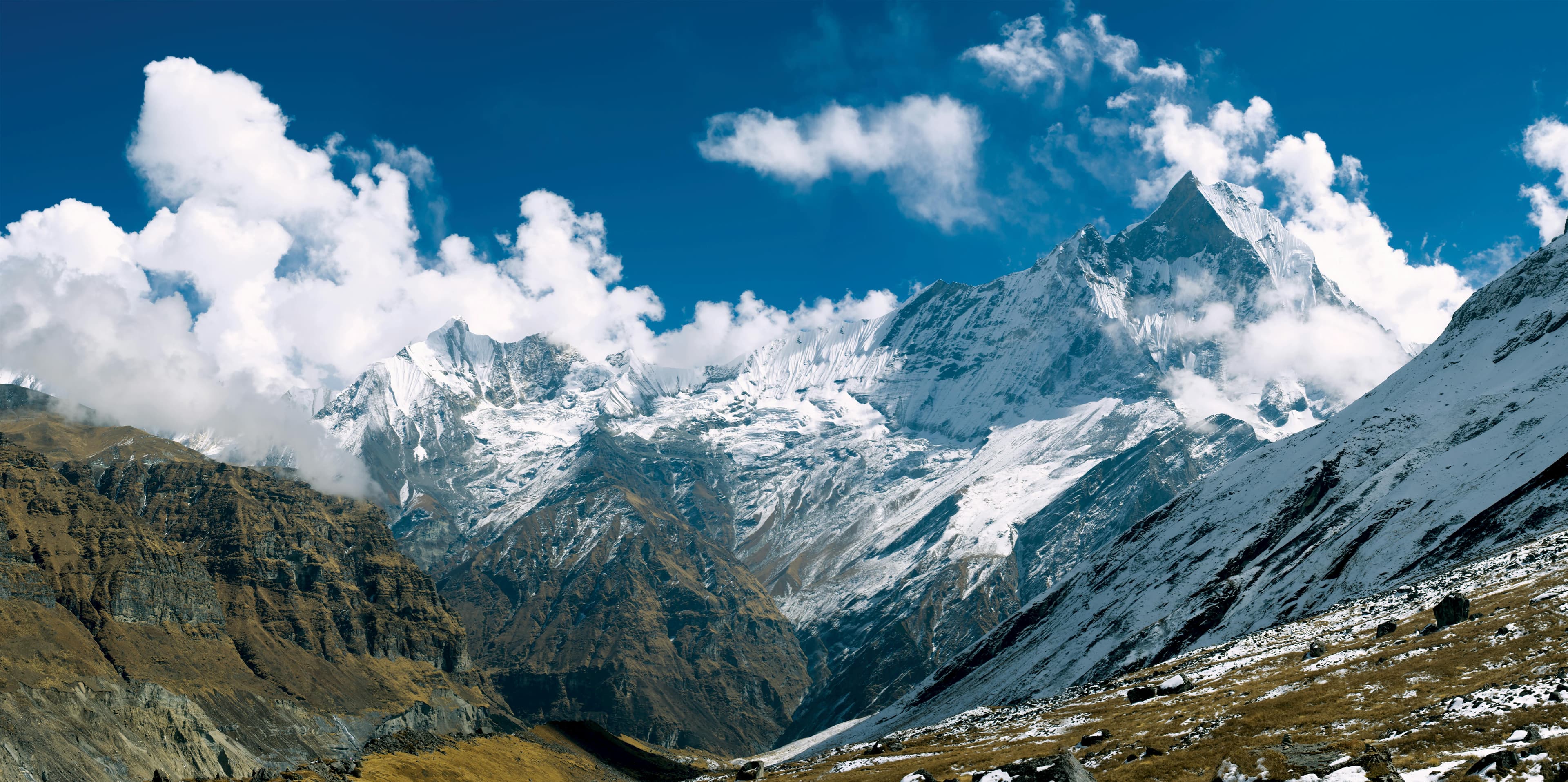
From Chhokang Paro, the trail climbs toward the peaceful monastery of Gumba Lungdang, beautifully positioned on a hillside overlooking the valley. A rewarding day excursion from the monastery leads to Ganesh Himal Base Camp, where pristine alpine meadows, glacial moraines, and dramatic mountain scenery unfold beneath the towering peaks of the Ganesh Himal range. With uninterrupted views of Ganesh Himal, Singri Himal, and the surrounding snow-covered summits, this remote side trip offers one of the most spectacular viewpoints of the trek and provides a fitting highlight to the expedition.
The return journey descends through the lower Tsum Valley before continuing via Lokpa, Jagat, and Machha Kholaalong the Budhi Gandaki corridor. Passing through dense forests, deep river gorges, suspension bridges, and traditional mountain settlements, the landscape gradually transitions from high alpine wilderness to the subtropical foothills before the drive back to Kathmandu.
Demanding in both distance and altitude, the Rupina La Pass, Tsum Valley & Ganesh Himal Trek is best suited to experienced trekkers with good physical fitness and a passion for remote Himalayan exploration. The reward is a rare journey through some of Nepal's most untouched landscapes, where challenging mountain trails, authentic cultural encounters, and breathtaking Himalayan scenery come together to create an unforgettable trekking experience.
Arrival at Tribhuwan International Airport. Our Staff member meets you and transfers you to the hotel.
Overnight at the hotel.
Morning wake-up and breakfast in the hotel
Our guide will meet you at your hotel and brief you about the upcoming trek. He will guide you through all the formalities and necessary paperwork required for the trek.
After that, we then do a sightseeing tour in Kathmandu Valley of famous UNESCO world heritage sites like Boudhanath, one of the largest Stupas in the world & Swayambhunath, a famous monkey temple. Apart from Sightseeing, we also get a TIMS card and permits for our trekking on this day. In the evening, we do initial preparation for the trek.
Overnight at the hotel.
After an early breakfast in Kathmandu, we depart for Gorkha via the Prithvi Highway, following the Trishuli River through a mix of highway towns, river valleys, and terraced hillsides. The first leg of the journey takes approximately 4–5 hours (120–130 km) to reach Mugling, where we usually pause for a short break or lunch depending on road conditions and timing.
From Mugling, we continue north toward Gorkha Bazaar. This section takes around 1.5–2 hours (40–50 km) as the road gradually ascends into the mid-hills. The scenery becomes increasingly rural and picturesque, passing through forested ridges, scattered settlements, and agricultural terraces typical of central Nepal’s hill regions.
From Gorkha Bazaar, we proceed on a more rugged mountain road toward Barpak. Although the distance is only 25–30 km, the drive takes 3–4 hours due to steep gradients, narrow sections, and uneven road conditions. We pass traditional Gurung villages and terraced landscapes shaped by both culture and resilience before arriving in Barpak (1,950m) by late afternoon. The total journey covers roughly 185 – 210 km over 8–10 hours of driving, depending on traffic and road conditions. Overnight stay at a teahouse.
After an early breakfast in Barpak, we begin our trek toward Gai Kharka (around 2,900m), gradually leaving the village behind as the trail ascends through terraced fields and traditional Gurung settlements. The initial section is a steady climb through cultivated land and forest edges, offering open views back toward Barpak and the surrounding ridgelines.
The trail then continues into denser forest of rhododendron and pine, following a mix of ridgeline paths and gradual ascents. This section is quieter and more remote, with occasional yak pastures and seasonal herder shelters along the way. The trekking pace is steady but sustained, as the altitude gain becomes more noticeable.
After approximately 5 – 6 hours of walking, depending on pace and trail conditions, we arrive at Gai Kharka (2,900m), a peaceful high pasture area used seasonally by locals. Upon arrival, we settle into camp, with time to rest and enjoy the mountain environment.
After breakfast at Gai Kharka (2,900m), we continue our ascent toward Sanrung Kharka (3,800m), gradually entering a higher and more remote alpine environment. The trail climbs steadily through open grassy slopes and seasonal yak pastures, with increasingly wide views of surrounding ridgelines and distant snow peaks.
As we gain elevation, the landscape becomes more rugged and exposed, with sparse vegetation and a noticeable drop in human activity. Occasional herder shelters may be encountered along the route, but there are no permanent settlements in this section. The trail is remote and requires a steady, well-paced ascent as we move deeper into the high Himalaya.
After approximately 5 – 6 hours of trekking, we arrive at Sanrung Kharka (3,800m), a high-altitude seasonal grazing area. We set up camp in a secluded alpine setting, surrounded by dramatic mountain scenery, with time to rest and acclimatize before continuing higher on the Rupina La route. Overnight stay at tented camp.
We set out early from Sanrung Kharka (3,800m), beginning a demanding ascent toward the high point of the trek at Rupina La Pass (4,720m). The trail climbs steadily through rugged alpine terrain, crossing rocky slopes, moraine fields, and steep scree sections. As we gain altitude, the surroundings become increasingly stark and remote, with vast Himalayan views gradually opening up.
From the summit of Rupina La (4,720m), we take a short rest to absorb the sweeping panoramas of snow-covered peaks and deep valleys on either side of the pass. After a brief pause, we begin the long descent toward the north, carefully navigating loose rock and glacially carved terrain.
After approximately 8 – 10 hours of trekking in total, we reach Boudha Himal Base Camp (3,540m), a secluded campsite set beneath the impressive Boudha Himal range. On arrival, we establish camp and rest in this remote and dramatic high-mountain setting.
We leave Boudha Himal Base Camp (3,540m) after breakfast and begin a steady descent into a more defined valley landscape beneath the Boudha Himal range. The trail initially traverses rocky moraine and alpine terrain, with careful sections over glacial debris before gradually easing as we lose elevation.
As we continue downward, the surroundings become progressively greener, with patches of vegetation reappearing and the valley opening out. The route remains remote throughout, with no permanent settlements along the way, though occasional seasonal herder shelters may be seen depending on the time of year. In some sections, the trail may involve short undulations and natural river crossings depending on the chosen line.
After approximately 5 – 7 hours of trekking, we arrive at Zhong Kharka (around 3,000m), a seasonal high-altitude grazing area used by local herders for livestock during favorable months. Upon arrival, we set up camp and rest in this peaceful alpine valley, surrounded by quiet high-hill scenery. Overnight stay at a camp.
Departing from Jhong Kharka (around 3,000m) after breakfast, we begin a steady descent along a remote valley trail. The route follows open hillside terrain at first, offering intermittent views of surrounding ridgelines and distant snow-capped peaks before gradually entering more forested sections.
As we continue, the trail winds through dense pine and rhododendron forest, with occasional clearings and seasonal grazing areas used by local herders. The route remains largely uninhabited, maintaining a strong sense of wilderness throughout the journey, with brief glimpses of distant mountains where the landscape opens up.
After approximately 5 – 6 hours of trekking, we arrive at Nyak (2,340m), a small hillside settlement. Depending on weather and visibility, partial mountain views may still be visible from open areas near the village. Upon arrival, we check into a local teahouse and settle in for an overnight stay in this quiet mountain community.
Leaving Nyak (2,340m) after breakfast, we begin a gradual descent toward Lokpa, following a well-defined trail that winds through forested hillsides and terraced slopes. The initial section features gentle undulations, with occasional openings offering glimpses of surrounding ridgelines and distant mountain views.
As we continue, the path becomes more enclosed, passing through dense pine and rhododendron forest with stretches of traditional stone-paved trail typical of the mid-hills. The route remains relatively remote in sections, though small seasonal shelters and scattered hamlets start to appear as we approach more inhabited areas.
After approximately 4 – 5 hours of trekking, we reach Lokpa (2,240m), a small but important settlement on the route toward the Tsum Valley and Manaslu region. Upon arrival, we check into a local teahouse and settle in for an overnight stay in this quiet hillside village.
Setting off from Lokpa (2,240m) after breakfast, we enter the lower section of the Tsum Valley region. The trail initially descends through forested terrain before crossing a suspension bridge over the Syar Khola (also spelled Siyar Khola), a key river of the valley. From here, the route begins a steady and sometimes undulating climb along steep, narrow hillsides.
As we ascend, the path winds through dense pine and rhododendron forest, with occasional small clearings and seasonal shelters used by local herders and trekkers. One notable waypoint along this section is Ghumlong (approx. 2,130m), a small riverside settlement that serves as a common resting point before the final climb toward Chumling. The area remains remote and culturally preserved, with limited habitation along the trail.
After approximately 5 – 6 hours of trekking, we arrive at Chumling (2,385m), a traditional Tibetan-influenced village set above the Syar Khola valley. Upon arrival, we check into a local teahouse and rest overnight in this peaceful mountain settlement.
We leave Chumling (2,385m) after breakfast and begin a steady, well-paced ascent into the upper section of Tsum Valley. The trail climbs gradually through a mix of cultivated terraces, stone-built houses, and scattered settlements, with the valley slowly opening up as we gain elevation.
Along the way, we pass through small villages and culturally significant hamlets, with Rainjam (around 3,100m) serving as a key midway point and natural rest stop before the final climb. The character of the landscape changes noticeably here, shifting from lush mid-hills to a more arid, high-altitude environment, with increasingly clear views of Ganesh Himal and surrounding ranges on clear days.
After approximately 5 – 6 hours of trekking, we arrive at Chhokang Paro (3,540m), one of the principal settlements of Upper Tsum Valley. Set on a broad plateau with traditional Tibetan-style houses and open valley views, it offers a strong sense of local culture and high Himalayan life. Upon arrival, we check into a local teahouse and rest overnight in this peaceful mountain village.
We set off from Chhokang Paro (3,540m) after breakfast, continuing our gradual ascent into the remote upper section of Tsum Valley. The trail follows an open, windswept alpine valley with gentle gradients, where the settlements become fewer and the landscape takes on a more rugged, high-altitude character.
Along the way, we pass through small hamlets and culturally significant landmarks, including Lamagaon (around 3,520m) and the revered Milarepa Cave area, which may be visited depending on time and interest. These sites are important centers of local Buddhist tradition and offer a deeper understanding of the spiritual heritage of the valley. As we progress, the terrain becomes increasingly barren, with expansive views of the surrounding Himalayan ranges.
After approximately 4 – 5 hours of trekking, we arrive at Nile (4,200m), the last permanent settlement in Upper Tsum Valley near the Tibetan border. Upon arrival, we check into a local teahouse and rest overnight in this remote high mountain village.
From Nile (4,200m), we set out after an early breakfast and begin a steady climb toward Mu Gompa, the most important monastic center in Upper Tsum Valley. The trail rises through a stark, high-altitude alpine environment, where the landscape is open, dry, and strongly influenced by the Tibetan plateau. The route is quiet and remote, with wide Himalayan views and minimal signs of settlement.
After approximately 2 – 3 hours of trekking, we arrive at Mu Gompa (around 3,700m), a historic Buddhist monastery located in a dramatic and isolated setting close to the Tibetan border. We take time to explore the monastery complex and its surroundings, experiencing the calm and spiritual atmosphere of this high mountain sanctuary.
We then retrace our steps back to Nile before continuing the descent through the upper valley. The trail gradually winds back through familiar terrain, passing open alpine stretches and scattered settlements as we lose elevation. After approximately 7 – 8 hours of total trekking for the day, we return to Chhokang Paro (3,540 m), where we check into a local teahouse and rest overnight in the heart of Tsum Valley.
We set out from Chhokang Paro (3,540m) and begin a steady ascent toward Gumba Lungdang, one of the most remote and spiritually significant monastery areas in the Tsum Valley region. The trail initially crosses open alpine terrain with gentle gradients, gradually gaining elevation as the valley becomes narrower and more rugged.
As we continue, we pass through Domje, an important settlement and trail junction in the upper Tsum Valley located along the Syar Khola. This small village serves as a key passing point on the route, with surrounding terraced fields, traditional stone houses, and strong Tibetan Buddhist cultural influence.
Beyond Domje, the trail continues through high pastures and seasonal grazing areas with very limited habitation. The route becomes increasingly remote, with a strong sense of wilderness throughout the journey. On clear days, expansive views of the surrounding Himalayan ranges open up as we climb higher into the upper valley system.
After approximately 6 – 7 hours of trekking, we arrive at Gumba Lungdang (4,580m), a secluded monastery settlement set in a dramatic high-altitude landscape beneath towering peaks. Upon arrival, we visit the monastery and settle into a basic monastery lodge for an overnight stay in this peaceful and spiritually rich environment.
We leave Gumba Lungdang (4,580m) early in the morning and begin a gradual descent toward the upper valley trails leading in the direction of Ganesh Himal Base Camp. The route initially follows remote alpine terrain, passing through open slopes and seasonal grazing areas with wide views of the surrounding ridgelines.
As we continue, the trail becomes more rugged and less defined, traversing high pastures, rocky sections, and occasional glacial-fed streams. The landscape is completely remote, with no permanent settlements along this route, offering a true wilderness experience in the Ganesh Himal region. On clear days, we are rewarded with outstanding views of Ganesh Himal and surrounding peaks as we move deeper into the high mountains.
After approximately 6 – 8 hours of trekking (round trip depending on route conditions), we reach Ganesh Himal Base Camp (around 4,200m). We spend time at the base of the mountain, enjoying the dramatic scenery before retracing our steps back to Gumba Lungdang for an overnight stay in the monastery area.
Departing from Gumba Lungdang (4,580m) after breakfast, we begin a long and steady descent back toward the lower Tsum Valley. The trail retraces sections of the upper route through remote alpine terrain, where wide Himalayan views gradually transition into greener hills and more defined valley landscapes as we lose elevation.
As we continue, we pass through Domje, an important settlement and junction along the Syar Khola. This serves as a key rest point in the upper valley, where trails connect between the higher monastery region and the main Tsum Valley route. Beyond Domje, the descent becomes more pronounced, leading through forested slopes, scattered hamlets, and terraced hillsides.
After approximately 7 – 8 hours of trekking, we reach Lokpa (2,240m), marking the exit point of the Tsum Valley region. Upon arrival, we check into a local teahouse and rest overnight in this peaceful village surrounded by forested terrain.
Leaving Lokpa (2,240m) after breakfast, we begin our descent out of the Tsum Valley corridor toward the lower Budhi Gandaki region. The trail initially drops steeply through forested hillsides, following narrow paths carved into the slopes, with sections that can be uneven and require careful footing.
As we continue, the route follows a mix of forest trails and river-side sections, with occasional suspension bridges crossing tributaries of the Budhi Gandaki River. The landscape gradually becomes warmer and more cultivated as we lose elevation, with small settlements and terraced fields becoming more frequent along the way.
After approximately 6 – 7 hours of trekking, we arrive at Jagat (1,340m), a traditional stone-paved village that serves as an entry point to the Manaslu Conservation Area. Upon arrival, we check into a local teahouse and rest overnight in this historic riverside settlement.
We depart Jagat (1,340m) after breakfast and continue descending along the Budhi Gandaki valley toward Machha Khola. The trail alternates between stone-paved sections, forest paths, and narrow cliffside tracks, maintaining a consistent downhill route as we gradually enter the warmer lower valley.
En route, we cross several suspension bridges over the Budhi Gandaki River and pass through traditional settlements such as Salleri and Sirdibas, where local mountain communities continue their daily routines along the trekking corridor. The scenery remains rich and varied, with waterfalls cascading from steep cliffs, terraced fields, and deep river gorges accompanying the walk.
After approximately 5 – 6 hours of trekking, we reach Machha Khola (870m), a riverside village named after the “Fish River.” Upon arrival, we check into a local teahouse and settle in for the night in this vibrant settlement along the valley.
The journey from Machha Khola (870m) back to Kathmandu begins after breakfast, following the Budhi Gandaki valley road through a gradually changing landscape. The drive starts on a rough mountain track and slowly improves as we pass through Arughat and connect with the Prithvi Highway at Dhading Besi or Malekhu, depending on road and traffic conditions.
From the highway, the route follows the Trishuli River corridor, passing through busy roadside towns, terraced hillsides, and river valleys. This final stretch offers a scenic transition from the lower hills to the outskirts of the Kathmandu Valley, with travel time influenced by traffic and road conditions.
After approximately 8 – 10 hours of driving, we arrive in Kathmandu (1,440m), marking the end of the journey. Upon arrival, we transfer to the hotel and conclude the trip.
Today marks the final day of your journey in Nepal and the conclusion of your trekking adventure. Depending on your flight schedule, you will be transferred from your hotel to Tribhuvan International Airport for your onward international departure.
This is a moment to reflect on the remarkable journey through the Himalayas, from remote mountain trails and traditional villages to diverse cultural landscapes and high-altitude wilderness. The experiences shared along the way form lasting memories of a truly authentic Himalayan adventure.
We wish you safe travels and a pleasant journey ahead.