

Arrival at Tribhuwan International Airport. Our Staff member meets you and transfers you to the hotel.
Overnight at the hotel.
Rolwaling Region

Trek Starting Point
Jagat

Trek Ending Point
Lukla

Departure From
Kathmandu

Transportation
Private Vehicle, Local Jeep, Domestic flight

Style
Hiking and Trekking

Meal
Breakfast, Lunch, Dinner

Accommodation
Tourist standard hotel in Kathmandu, Teahouse during trek
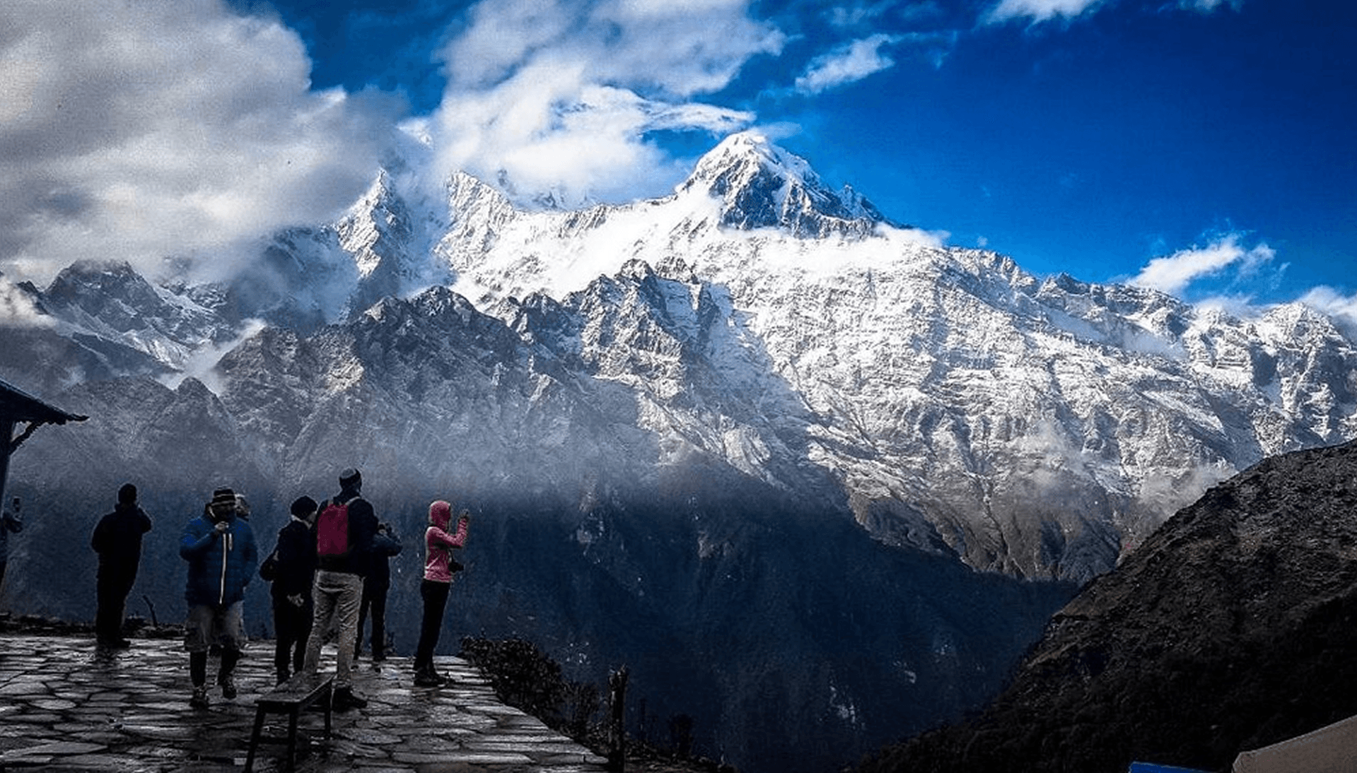
The Rolwaling Tashi Lapcha Pass Trek is one of Nepal's most spectacular and demanding high-altitude adventures, combining remote Himalayan wilderness, traditional Sherpa culture, glacial landscapes, and a challenging crossing of the Tashi Lapcha Pass (5,755 m). Located between the secluded Rolwaling Valley and the world-famous Khumbu region, this trek offers a rare opportunity to explore one of Nepal's most untouched mountain corridors.
The journey begins in the peaceful Rolwaling Valley, a remote Himalayan region known for its dramatic scenery, ancient settlements, and strong Sherpa heritage. The trail follows the Rolwaling River through terraced hillsides, dense forests, and traditional villages such as Bed and Na before entering the high alpine landscape. As the elevation increases, the valley opens into a rugged world of glaciers, moraines, and towering Himalayan peaks.
One of the major highlights of the trek is reaching Tsho Rolpa Lake (4,580 m), one of Nepal's largest glacial lakes. Surrounded by rocky peaks and impressive mountain scenery, this turquoise lake reflects the raw beauty of the Rolwaling Himalayas. Beyond Tsho Rolpa, the route continues toward the dramatic Trakarding Glacier, where trekkers encounter a remote glacial environment of ice, moraine fields, and breathtaking high-altitude landscapes beneath some of the region's highest peaks.
The ultimate challenge of the trek is crossing the Tashi Lapcha Pass (5,755 m), a remote mountain pass connecting Rolwaling Valley with the Khumbu region. The crossing involves steep ascents, glacier travel, and demanding terrain, but rewards experienced trekkers with incredible views of Himalayan peaks including Gauri Shankar, Melungtse, and surrounding summits. After crossing the pass, the trail descends toward the Khumbu region, creating a remarkable transition from a quiet wilderness valley to the legendary Everest landscape.
The Rolwaling Tashi Lapcha Pass Trek is designed for experienced trekkers seeking a true Himalayan adventure away from crowded routes. With its combination of Sherpa culture, Tsho Rolpa Lake, Trakarding Glacier, remote mountain trails, and one of Nepal's most challenging high passes, this trek offers an unforgettable journey through one of the Himalayas' most extraordinary hidden valleys.
Arrival at Tribhuwan International Airport. Our Staff member meets you and transfers you to the hotel.
Overnight at the hotel.
After breakfast at the hotel, our guide will meet you at the hotel and provide a briefing about the upcoming trek, including the itinerary, safety information, and important preparations. He will also assist you with all the necessary trekking formalities and paperwork.
After the briefing, we will go on a sightseeing tour around the Kathmandu Valley, visiting famous UNESCO World Heritage Sites such as Boudhanath Stupa, one of the largest Buddhist stupas in the world, and Swayambhunath Stupa, also known as the Monkey Temple. On this day, we will also arrange the TIMS card and other required permits for the trek.In the evening, you will have time to prepare your trekking gear and make the final arrangements for the journey ahead. Overnight at the hotel.
Today, we begin our journey with breakfast in Kathmandu before departing for a scenic drive to Jagat (1,150 m) via Dolakha. After an early morning meal, we leave the busy capital behind and gradually enter the peaceful hills and valleys of eastern Nepal. Jagat is a quiet riverside settlement and an important stop along the route toward the Rolwaling region and nearby Himalayan trekking areas.
The drive takes approximately 9 – 11 hours and covers about 240 – 260 km, depending on road and weather conditions.
Leaving Kathmandu, we follow the Arniko Highway eastward before turning north toward Dolakha. The route passes through rolling green hills, terraced farmland, traditional villages, and bustling roadside towns. Along the way, travelers enjoy views of rivers, forested slopes, and distant Himalayan landscapes.
As we continue beyond Dolakha Bazaar, the road becomes narrower and more rugged, winding through remote mountain terrain and alongside deep river gorges. The journey offers dramatic scenery with waterfalls, suspension bridges, rocky cliffs, and occasional glimpses of snow-capped peaks in the distance.
Finally, we arrive at Jagat, a small mountain settlement located along the Tama Koshi River. Surrounded by steep hills and natural beauty, Jagat serves as a gateway toward the Rolwaling Valley and several remote Himalayan trekking routes. Overnight stay at a local guesthouse or teahouse in Jagat.
From Jagat (approx. 1,300 m / 4,265 ft), we begin our ascent along the Rolwaling River toward Simigaon (2,050 m / 6,726 ft), gradually leaving the lower hills and entering the more rugged Rolwaling Valley.
The trek takes approximately 5 – 6 hours and covers around 12 – 14 km (7.5 – 8.7 miles), depending on pace and trail conditions.
The trail initially winds through terraced fields, small villages, and patches of forest. As we ascend, pine, rhododendron, and mixed hardwood forests become denser, and the valley narrows with steep hills rising on both sides. The trail follows the Rolwaling River, crossing small streams and occasional rocky sections that require careful footing.
The scenery gradually changes from cultivated lower hills to more alpine terrain, with towering cliffs and ridges framing the valley. Although the ascent is steady, it is not technically difficult, but the sustained uphill requires moderate endurance.
Finally, we arrive at Simigaon, a peaceful riverside settlement that serves as a gateway to the upper Rolwaling Valley.
Overnight stay at a teahouse or lodge in Simigaon.
From Simigaon (2,050 m / 6,726 ft), we begin our ascent toward Dongang (2,800 m / 9,186 ft), entering the higher alpine zone of the Rolwaling Valley.
The trek takes approximately 4 – 5 hours and covers around 10 – 12 km (6–7.5 miles), depending on trail conditions and pace.
The trail gradually climbs through mixed forests of pine, rhododendron, and hardwoods, with occasional terraced fields and seasonal herding shelters along the way. The path follows the valley, winding along streams and rocky sections.
As we gain altitude, the landscape opens to spectacular views of the surrounding mountains, cliffs, and ridges. The trail becomes steeper in sections, requiring steady footing and moderate effort.
Finally, we arrive at Dongang, a small alpine settlement that serves as a gateway to the higher Rolwaling Valley and a stopover before continuing toward Beding or other high-altitude points.
Overnight stay at a teahouse or lodge in Dongang.
Today, we continue our trek from Dongang (2,800 m / 9,186 ft) to Beding (3,690 m / 12,106 ft), gradually ascending into the higher alpine landscapes of the Rolwaling Valley. Beding is the largest Sherpa settlement in the region and an important acclimatization stop surrounded by dramatic Himalayan scenery.
The trek takes approximately 5 – 6 hours and covers around 9 – 11 km (5.5 – 6.8 miles), depending on trail conditions and walking pace.
After breakfast, the trail follows the Rolwaling River through forests of pine, juniper, and rhododendron before opening into wider alpine terrain. Along the way, we pass waterfalls, yak grazing areas, mani stones, and small seasonal settlements, with increasingly impressive views of the surrounding snow-capped peaks and the Gaurishankar range.
Finally, we arrive at Beding, a traditional Sherpa village known for its monastery, stone houses, and beautiful mountain setting.
Overnight stay at a teahouse.
Today is an acclimatization day in Beding, allowing the body to adjust to the higher altitude before continuing further into the Rolwaling Valley. Proper rest and gradual activity help reduce the risk of altitude sickness and ensure a safer ascent ahead.
In the morning, we may take a short hike around Beding or ascend a nearby ridge for better acclimatization. These optional walks offer excellent views of the surrounding peaks, glaciers, and the dramatic Rolwaling Valley, while keeping the body active at altitude. The rest of the day is free to relax, explore the village, and experience the traditional Sherpa lifestyle.
Beding is the largest settlement in the region, known for its ancient monastery, stone-built houses, and strong Buddhist culture. You can spend time interacting with locals or simply enjoy the peaceful mountain environment.
Overnight stay at a local teahouse in Beding.
Today, we trek from Beding to Na (4,085 m / 13,409 ft), ascending deeper into the upper Rolwaling Valley. This short but steady climb allows us to adjust to higher altitude while enjoying spectacular alpine scenery.
The trek takes approximately 3 – 4 hours and covers around 4.5 – 5 km (2.8 – 3.1 miles).
After leaving Beding, the trail winds through open yak pastures, rocky paths, and glacial valleys, with sparse vegetation and panoramic views of surrounding snow-capped peaks. Along the way, we pass seasonal herding shelters and small streams fed by the glaciers above.
We arrive at Na, a remote seasonal settlement set in a vast glacial valley beneath towering Himalayan mountains, serving as a key stop before reaching Tsho Rolpa.
Overnight stay at a teahouse.
After an early morning breakfast in Na Village (4,180 m / 13,714 ft), we begin our trek towards Tsho Rolpa Lake (4,580 m / 15,026 ft), following a scenic alpine trail through the upper Rolwaling Valley. The route gradually ascends through open yak pastures, glacial-fed streams, and rising moraine landscapes. As we move higher, vegetation slowly fades and the terrain becomes increasingly rugged and barren, while panoramic views of towering Himalayan peaks such as Tengi Ragi Tau, Ramdung Go, and the Rolwaling range begin to dominate the skyline.
After approximately 4 – 6 hours of trekking covering 7 – 10 km (4.3 – 6.2 miles), we arrive at the spectacular Tsho Rolpa Lake, one of Nepal’s largest glacial lakes. The turquoise waters, fed directly by the Trakarding Glacier, sit beneath massive icefalls and dramatic moraines, creating one of the most striking high-altitude landscapes in the region. The afternoon is spent exploring the lakeshore, taking photographs, and acclimatizing while enjoying the calm yet powerful glacial environment.
We stay overnight at Tsho Rolpa in a tented camp, allowing time to experience the changing alpine light over the lake.
After breakfast at Tsho Rolpa Lake (4,580 m / 15,026 ft), we continue our ascent towards the Trakarding Glacier approach zone (approx. 4,800 – 4,900 m / 15,748 – 16,076 ft), entering a more remote and fully glaciated section of the Rolwaling Valley. The trail initially follows the northern edge of Tsho Rolpa before climbing steadily over rocky moraine ridges formed by the retreating glacier, with increasingly rugged and exposed alpine terrain.
The trek takes approximately 4 – 6 hours and covers around 4 – 6 km (2.5 – 3.7 miles), depending on conditions, snow cover, and group pace. The route becomes more demanding with loose scree, glacial debris, and occasional icy patches, requiring steady and careful movement in high altitude conditions.
We eventually reach the Trakarding Glacier (4,900 m / 16,076 ft), a vast and shifting ice landscape that marks the entry into true expedition terrain towards Tashi Lapcha Pass. The surroundings are raw and dramatic, with sweeping views of peaks such as Dolma Khang, Takargo, and Rolwaling Kang, offering a powerful sense of isolation and high-Himalayan wilderness. Overnight stay at a tented camp.
The trek from Trakarding Glacier to Tashi Lapcha Phedi (5,200 m) continues deeper into the high alpine expedition zone of the Rolwaling Himal, moving through fully glaciated and remote terrain beneath towering peaks.
The journey takes approximately 4 – 6 hours and covers around 3 – 5 km (1.9 – 3.1 miles), depending heavily on glacier conditions, snow cover, and route selection. The trail involves walking over shifting ice, moraine ridges, and crevassed glacier sections, requiring careful navigation and steady pacing in a truly high-altitude environment.
From the Trakarding Glacier, the route gradually ascends across the broken ice fields of the glacier system, with dramatic views of surrounding peaks such as Dolma Khang, Takargo, and the Rolwaling Himal range. As we gain elevation, the landscape becomes increasingly stark and exposed, with strong winds and a profound sense of isolation typical of high Himalayan expedition routes.
We eventually reach Tashi Lapcha Phedi, a remote high camp area situated beneath the Tashi Lapcha Pass, serving as the final staging point before crossing into the Khumbu region. Overnight stay is at a tented high camp in a glacial wilderness setting.
The trek from Tashi Lapcha Phedi (approx. 5,100–5,300 m / 16,732–17,388 ft) begins early in the morning as we ascend toward Tashi Lapcha Pass (5,755 m / 18,881 ft), one of the highest and most dramatic crossings in the Rolwaling–Khumbu region. The route climbs over glaciated terrain, snow slopes, and exposed alpine ridges, requiring steady pacing and careful movement in a true high-altitude expedition environment.
From the top of Tashi Lapcha Pass, we are rewarded with a breathtaking 360-degree Himalayan panorama. On the Rolwaling side, dramatic peaks such as Gauri Shankar, Melungtse, and the surrounding Rolwaling Himal rangedominate the skyline, while on the opposite side the view opens into the Khumbu region with distant sights of Everest, Lhotse, Makalu, and Cho Oyu visible on clear days. Below us lie vast glaciers, deep valleys, and endless layers of snow-covered ridges stretching in both directions, creating one of the most spectacular viewpoints in the Himalayas.
After spending time at the pass for photography and rest, we begin a long and technical descent toward the Khumbu side, traversing snowfields, moraines, and rocky glacial terrain before reaching Ngole (approx. 5,110 m / 16,765 ft). The full crossing takes approximately 8 – 10 hours and covers around 6 – 8 km (3.7 – 5.0 miles), depending on snow and weather conditions.
We eventually arrive at Ngole, a high alpine campsite in the upper Khumbu region, marking the completion of this challenging Himalayan pass crossing. Overnight stay at a tented camp.
After breakfast at Ngole (approx. 5,110 m / 16,765 ft), we descend into the upper Khumbu region towards Thyangbo (4,350 m / 14,270 ft). The trail gradually drops through rocky alpine terrain, glacial moraines, and open high-altitude valleys, with increasingly wider views of the surrounding Himalayan peaks including Thamserku, Kangtega, and distant Everest region ranges.
The trek takes approximately 5 – 6 hours and covers around 7 – 9 km (4.3 – 5.6 miles), depending on conditions and pace. As we descend, the landscape slowly transitions from harsh glacial wilderness into softer alpine meadows and yak grazing pastures, with occasional seasonal settlements along the route.
We eventually reach Thyangbo, a high-altitude grazing area used by local herders, surrounded by dramatic mountain scenery and peaceful open valleys. Overnight stay is at a tented camp or seasonal teahouse depending on itinerary arrangement.
After breakfast at Thyangbo, we begin a steady descent towards the traditional Sherpa village of Thame (3,800 m / 12,467 ft) in the upper Bhote Koshi valley. The trail gradually drops through open alpine pastures, yak grazing fields, and wide mountain slopes, with increasingly greener landscapes as we lose altitude. Along the way, we are rewarded with excellent views of surrounding peaks including Thamserku, Kusum Kanguru, and the surrounding Khumbu ranges.
The trek takes approximately 4 – 6 hours and covers around 6 – 8 km (3.7 – 5.0 miles), depending on pace and trail conditions. Compared to the previous high-pass sections, this is a more relaxed and scenic descent, following a well-defined trail that connects remote high-altitude grazing areas with permanent settlements.
We eventually arrive at Thame, a historic Sherpa village known for its ancient monastery, strong mountaineering heritage, and peaceful Himalayan setting along the Bhote Koshi River. Overnight stay is in a comfortable teahouse lodge, marking a return to established villages after the remote high mountain crossing.
From Thame, we set off on our trek toward the bustling Sherpa hub of Namche Bazaar (3,440 m / 11,286 ft), descending gradually along the valley and crossing the Dudh Koshi River.
The trek covers approximately 9 – 11 km (9.3 – 10.5 miles) and takes around 4 – 5 hours, depending on pace and trail conditions.
We begin by leaving the village, walking through terraced fields, pine forests, and traditional Sherpa settlements. The trail follows the Dudh Koshi River, with several suspension bridges providing spectacular views of the river gorge below.
As we approach Namche, the trail climbs gradually, preparing us for the final ascent into the town. Along the way, we pass through small settlements, chortens, and mani walls, catching glimpses of local Sherpa culture.
We arrive at Namche Bazaar, the lively “capital of the Khumbu,” with bustling markets, teahouses, and stunning views of Thamserku, Kwangde, and other surrounding peaks. This is the perfect place to rest, resupply, and celebrate completing our high-altitude journey through the Rolwaling and Khumbu regions.
Overnight stay at a guesthouse in Namche Bazaar.
Following breakfast at Namche Bazaar (3,440 m / 11,286 ft), we begin our final trekking day towards Lukla (2,860 m / 9,383 ft), descending through the scenic Khumbu Valley. The trail initially drops steeply to the Dudh Koshi River and then continues through pine forests, suspension bridges, and traditional Sherpa settlements such as Monjo, Jorsalle, and Phakding, offering a gradual transition from high alpine landscapes to the lower Himalayan foothills.
The trek takes approximately 6 – 7 hours and covers around 16 – 18 km (10 – 11.2 miles), depending on pace and trail conditions. The route is generally downhill but includes several short ascents and undulating sections, especially between river crossings, making it a varied and full trekking day.
Along the way, we pass through sections of Sagarmatha National Park, prayer stone walls (mani stones), monasteries, and riverside villages, with constant views of surrounding peaks gradually giving way to greener landscapes. The final section involves a gentle climb into Lukla, the gateway to the Everest region.
We arrive at Lukla, marking the completion of the trekking journey, where we either spend the night in a teahouse or prepare for the return flight depending on the itinerary.
After completing the Rolwaling Valley and Tashi Lapcha Pass trek, we reach Lukla, marking the end of our high-altitude Himalayan adventure. From the remote glaciers of Rolwaling to the dramatic crossing of Tashi Lapcha Pass (5,755 m / 18,881 ft) and descent into the Khumbu Valley, the journey concludes in the heart of the Everest region.
After final preparations, we board our scenic flight from Lukla to Kathmandu (30 – 40 minutes), enjoying panoramic aerial views of the Himalayas one last time. Upon arrival at Tribhuvan International Airport (1,400 m / 4,593 ft), our expedition officially comes to an end.
Overnight stay at a hotel in Kathmandu.
Today marks the completion of the Rolwaling Tashi Lapcha Pass Trek. Depending on the flight schedule, you will be transferred from your hotel in Kathmandu to Tribhuvan International Airport for your onward departure.
As you leave Nepal, we hope you take home unforgettable memories of the remote Rolwaling Valley, the challenging Tashi Lapcha Pass, spectacular glacial landscapes, and the warm hospitality of the Himalayan communities. Thank you for joining us on this incredible journey, and we look forward to welcoming you again for more trekking adventures in Nepal.